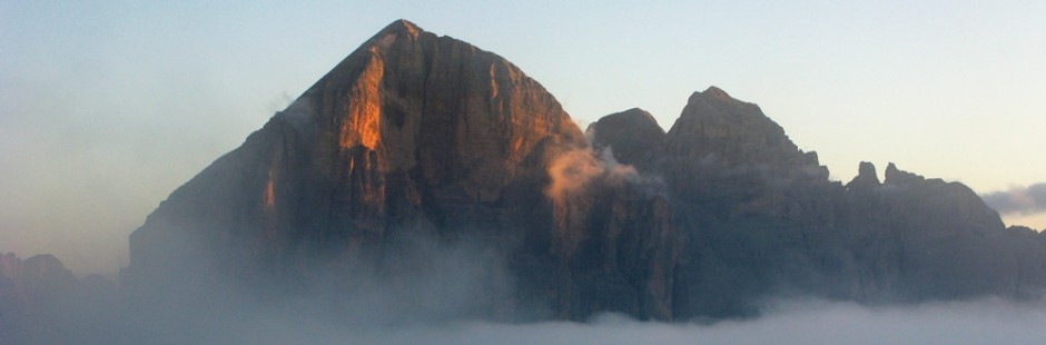
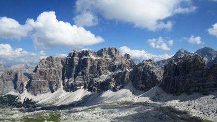
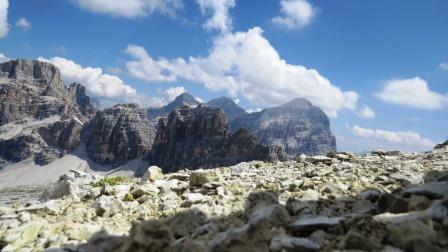
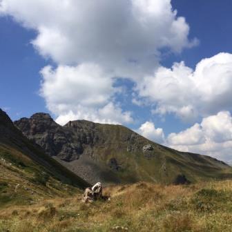
 FALZAREGO – LAGAZUOI – COL GALLINA – SASS DE STRIA – VAL PAROLA – SETTSASS – COL DI LANA
 Le gite qui proposte sono di diverso livello: le passeggiate sono per lo più su sentiero ed alla portata di tutti, pur essendo necessario graduare le forze e le proprie capacità. Interessano i dintorni di Passo Falzarego e dunque sia il Lagazuoi, con le gite che da qui si dipartono, sia i monti limitrofi (dal Col Gallina al Sass de Stria) sia le aree poco oltre il Passo e cioè i monti della Val Parola, come i Settsass ed il Col di Lana.
The trips offered here are of different levels: the walks are mostly on track and within the reach of all, while it is necessary to size the forces and capabilities. Affecting around Falzarego and therefore both the Lagazuoi, with trips that depart from here, and the nearby mountains (Col Gallina, Sass de Stria) and areas just beyond the pass (Val Parola, Settsass, Col di Lana)
§ § §
Area: Falzarego – Giro del Col dei Bos ed Ospitaletto [intera giornata – per tutti – circa tre/quattro ore di cammino]
Percorso:
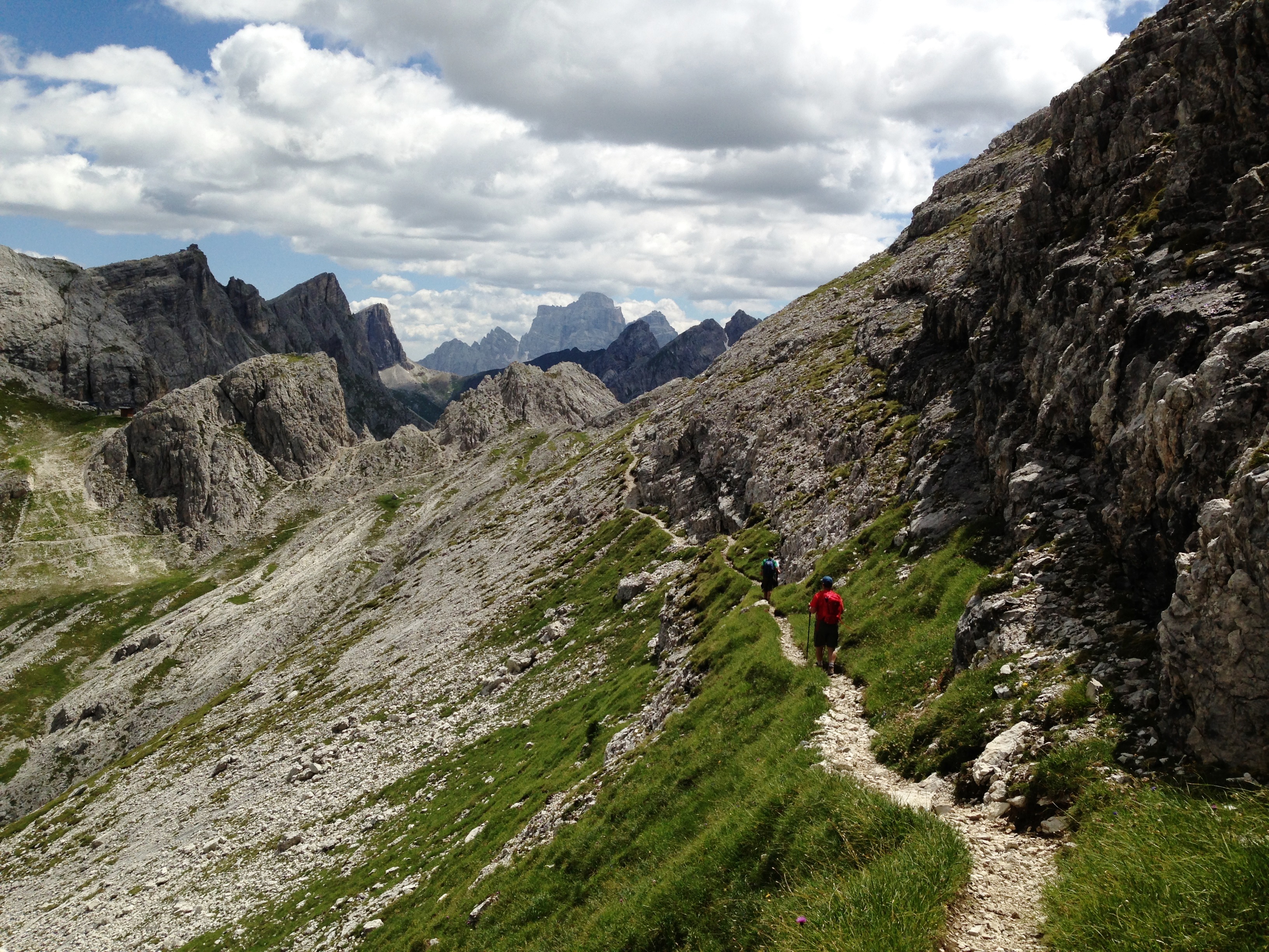
– dal Passo Falzarego (salita in funivia) al Rif. Lagazuoi; – si scende fino alla forcella Lagazuoi (sent. 20) e quindi, girando verso destra (sent. 401) alla forcella Travenanzes;
– si segue ancora il sent. 201 e, al primo bivio, si prende verso destra il sent. 402 per giungere alla forcella Col dei Bos (400 m. dislivello in discesa dal Lagazuoi; 1/1,5 h);
– proseguendo per il sentiero, in discesa, al termine del ghiaione il sentiero si trasforma in carrareccia che va seguita e diviene sent. 412;
– a circa 2000 s.l.m., lasciare la carrareccia e girare a verso destra sotto Col dei Bos; superato l’attacco della ferrata degli Alpini, si arriva agli ampi baraccamenti chiamati “Ospitaletto” (200 m. dislivello in discesa – 1,5 h); – si prosegue il sent. 423 e in 30 min. si giunge al Passo Falzarego.
(per il Col dei Bos si rinvia anche alla sez. Tofana)
Valutazioni: Gita bella e panoramica, adatta a tutti – interessante per i ruderi dell’ospedale militare italiano della 1° guerra mondiale [effettuata il 13.8.07; effettuata al contrario il 7.8.82].
Area: Falzarego – Around the Col dei Bos and Ospitaletto [whole day – for all – about three / four hours of walk] Path: From Falzarego (cable car ride) to Rif. Lagazuoi; – Descend to the fork Lagazuoi (sent. 20) and then, turning to the right (sent. 401) to the Forcella Travenanzes; – follow the path n. 201 and, at the first fork (=Forcella), take the right path no. 402 to reach the fork Col dei Bos (400 m. descent from Lagazuoi; 1 / 1.5 h); – Continuing the path, downhill, at the end of the scree path it becomes a cart track that should be followed and becomes sent. 412; – About 2000 above sea level, leaving the cart track and turn to the right under Col dei Bos; overcome the attack of the ferrata degli Alpini, you come to the large barracks called “Ospitaletto” (200 m. descent – 1.5 h); – Continue the path n. 423 and in 30 min. to Passo Falzarego. Ratings: beautiful and scenic trip, suitable for all – interesting ruins of a military hospital of the Italian World War 1 [made on 8/13/07; carried on the contrary the 7.8.82]
§ § §
Area: Falzarego – sentiero ferrato della Galleria del Lagazuoi (1/2 giornata – tre ore circa di cammino; occorre l’attrezzatura da ferrata e torce)
Percorso: ")
– dal Passo Falzarego salita in funivia al Rif. Lagazuoi
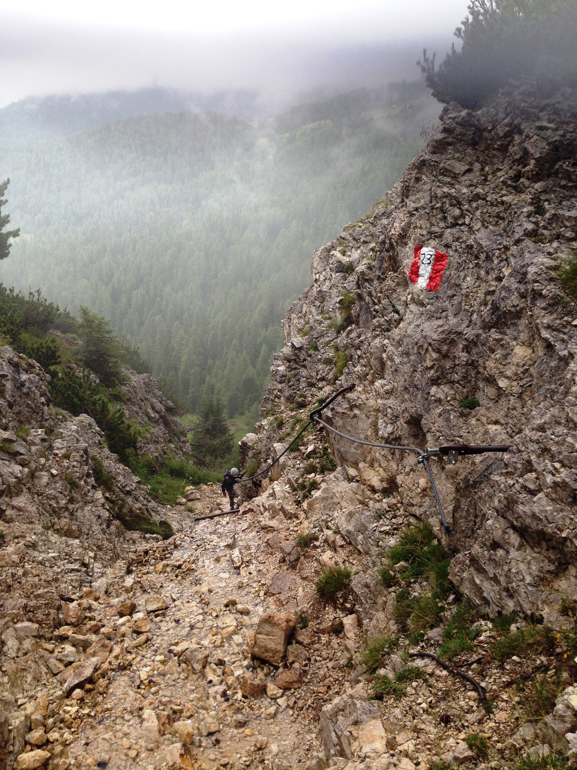
– dal Rifugio sulla destra è segnalato il sentiero ferrato della Galleria che, superato un primo tratto spettacolare e molto ben attrezzato, si sviluppa nella quasi totalità in galleria (per circa 600 m. di dislivello in discesa) fino a giungere sul sent. 402 che si prende in direzione della stazione della funivia (3 h).
Valutazioni: Il sentiero ferrato si sviluppa –come detto- quasi interamente in galleria, cosicchè si necessita di attrezzatura e lampade; assenza di claustrofobia (pur se ogni tanto vi sono aperture) e buone gambe poiché la discesa con gradini può affaticare – La parte iniziale implica assenza di vertigini, per la sua spettacolarità sulla valle, pur se si percorre in estrema sicurezza – La particolarità del percorso è costituito proprio dalle gallerie che nella 1° guerra mondiale sono state costruite dagli italiani con una famosa ed ardita operazione bellica che ha portato alla conquista della cima; sono dunque di grande interesse – La gita –se fatta con una certa accortezza – non presenta difficoltà tecniche particolari ed è dunque per tutti e di soddisfazione (più volte abbiamo portato bimbi; es. di 2 anni sulle spalle; di 4 per mano e assicurato; di 7 da solo, assicurato) [effettuata il 22.8.86; 19.8.01]
From Falzarego cable car ride to the ref. Lagazuoi – from the Refuge on the right is reported the beaten trail of the Gallery that exceeded a first stretch spectacular and very well equipped, it develops almost entirely in the tunnel (about 600 m. of descent) until reaching the path 402 that takes towards the station of the cable car (3 h). Ratings: The beaten trail develops -as said- almost entirely in the tunnel, so you need equipment and lamps; absence of claustrophobia (although occasionally there are openings) and good legs since the descent with steps can fatigue – The initial part implies the absence of dizziness, for its spectacularity of the valley, even if it runs in extreme safety – The peculiarity of the route it is constituted precisely by the galleries that the 1st World War were built by the Italians with a famous and daring military operation that led to the conquest of the summit; are therefore of great interest – The trip-if done with some forethought – has no particular technical difficulties and is therefore for all of satisfaction (many times we brought children; ex. 2 years behind him; 4 hands and assured ; 7 alone, assured) [made on 8/22/86; 19.8.01]
§ § §
Area Falzarego: sentiero dei Kaiserjager [= salita al Piccolo Lagazuoi, dal Passo Falzarego; due/tre ore; sentiero ferrato; opportuno set da ferrata]
percorso:")
–dal Passo Falzarego (dove si può lasciare l’automobile) ovvero dal Forte tra i Sass (alla base del Sass de Stria, poco oltre il Falzarego, verso la Val Parola, dove pure si può lasciare l’automobile), diparte il ripido sentiero che sale (superando circa 200 m. di dislivello) sul ghiaione sotto il Lagazuoi, e porta alla base del suo spigolo sinistro;
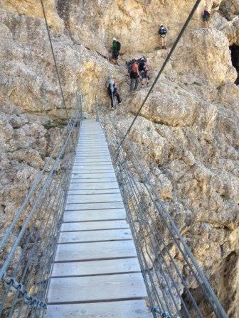
-si passa poi per un camino attrezzato con scalini, si supera un ponte sospeso, si passa una piccola parete; il tutto attrezzato con corda fissa;")
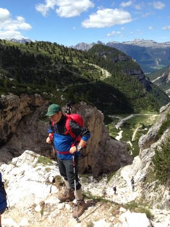
-il sentiero prosegue tra rocce e ghiaie, ripido (altri 400 m. di dislivello) e con panorama splendido, fino al Piccolo Lagazuoi, che si raggiunge con altro passaggio di sentiero attrezzato. La vetta si conquista con soddisfazione.
-si raggiunge da qui in pochi minuti e rimanendo in quota il Rifugio Lagazuoi. Da qui si scende o con funivia o per altra via (si rinvia alla gita che precede).
Valutazioni: salita estremamente panoramica, non difficile ma con circa 600 m. di dislivello; necessita passo fermo [effettuato il 18.8.13].
From Passo Falzarego (where you can leave your car) or from the “Fort between Sass” (at the base of Sass de Stria, just beyond the Falzarego towards Val Parola, where you can also leave the car), branches off the steep path rising (exceeding 200 m. in altitude) on the scree below the Lagazuoi, and leads to the base of his left edge; -you then goes to a chimney equipped with steps, cross a suspension bridge, you pass a small wall; all equipped with rope fissail path continues through rocks and gravel, steep (another 400 m. in altitude) and with splendid panorama, until Piccolo Lagazuoi, which is reached with another passage equipped path. The summit is conquered with satisfaction. -you reached from here within minutes and staying at altitude Rifugio Lagazuoi. From here it descends or cable car or by other means (please see tour before). Ratings: climb extremely panoramic, not hard but with about 600 m. in altitude; It needs firm step [made on 08.18.13]
§ § §
Area Falzarego Rif. Scotoni – Capanna Alpina [intera giornata in Alta Badia – nella sua opzione base, è gita per tutti]
Percorso:
– dal Passo Falzarego, si sale con la funivia al Rif. Lagazuoi – si scende poi fino alla forcella Lagazuoi (sent. 20 – 200 m. di dislivello in discesa);
– da qui due possibilità (una più breve di circa tre ore complessive; una più lunga di circa cinque ore complessive):
a) si prosegue per il sent. 20 (=A.V. n. 1) e, poggiando verso destra, si percorre l’ampio anfiteatro del Lagazuoi Grande;
b) girando verso destra (sent. 401) si giunge alla forcella Travenanzes; si prende poi il sent. 20b che costeggia il Lagazuoi Grande dalla parte della Val Travenanzes, superando la forcella Gasser Depot ed arrivando alla forcella Granda, ove è il bivacco Dalla Chiesa (e l’attacco della ferrata Tomaselli) – si prosegue poi oltre la forcella e ci si immette sul sent. 20 nell’anfiteatro del Lagazuoi Grande
 –da qui torna tracciato comune: si prosegue sul sent. 20, gradatamente scendendo e giungendo fino al lago de Lagacio; quindi, dopo un’ultima parte scoscesa, si giunge su un bel prato al Rif. Scotoni (550 m. di dislivello in discesa complessivi);
– dal Rifugio Scotoni, sempre per sent. 20, ripido ma comodo nella prima parte, si giunge al Rif. Capanna Alpina (300 m. di dislivello); da qui si prosegue per sentiero 11 (anche con bus navetta), fino alla statale che sale sino al passo Falzarego.
Valutazioni: la gita a) è assimilabile a quella che si fa d’inverno con gli sci; c’è un dislivello complessivo di 1.000 metri inn discesa; si trova da mangiare, e bene, in entrambi i rifugi; è tutta in discesa e dunque per alcuni attenzione alle ginocchia …; la gita b) consente di giungere al bivacco ed all’attacco della ferrata Tomaselli, una delle più impegnative delle Dolomiti, su cima Fanis Sud – le passeggiate poi si congiungono e lo scenario è bellissimo ed è di grande soddisfazione – Come accennato prima, per il ritorno si può prendere la jeep da Capanna Alpina (verificare comunque preventivamente perché sono servizi di concessione stagionale) [effettuate: i) 11.8.93; 17.8.14; ii) 7.8.82].
Falzarego Ref. Scotoni – Capanna Alpina whole day in Alta Badia – in its basic option is trip for all] Path: – From Falzarego, climb by cable car to the Rif. Lagazuoi – you descend to the col Lagazuoi (sent. 20 to 200 m. of descent); – From here two possibilities (one shorter than about three hours in total; one longer than about five hours in total): a) continue along the path n. 20 (AV = n. 1) and, leaning to the right, go along the large amphitheater of Lagazuoi Grande; b) turning to the right (sent. 401) you come to the fork (=Forcella) Travenanzes; then take the path n. 20b that runs along the side of the Lagazuoi Grande, Val Travenanzes, surpassing the fork Gasser Depot and coming to fork Granda, where is the bivacco Dalla Chiesa (and the start of ferrata Tomaselli) – then continue over the fork and turn into the sent. 20 in the amphitheater of Lagazuoi Grande -from here traced back common: continue on the felt. 20, gradually going down and coming up to the lake de Lagacio; then, after a last steep part, it comes on a beautiful lawn at the Rif. Scotoni (550 m.) From Rifugio Scotoni, always felt. 20, a steep but easy in the first part, get to the Rif. Capanna Alpina (300 m. In altitude); from here continue to trail 11 (bus shuttle), to the state road up to the Passo Falzarego. Ratings: tours a) it is similar to what is done in the winter on skis; there is a gradient of 1,000 meters downhill inn; It is to eat, and well, in both shelters; It is all downhill and then for some attention to your knees …; the trip b) allows you to reach the bivouac and the attack of the ferrata Tomaselli, one of the most challenging of the Dolomites, on top Fanis South – walks then come together and the scenery is beautiful and it is very satisfying – As mentioned before, the return you can take the jeep from Capanna Alpina (always check in advance because they are seasonal services concession) [performed: i) 8.11.93; 08/17/14; ii) 07/08/82]
§ § §
Area Falzarego / Tofane – val Travenanzes (intera giornata – circa sei/sette ore)
Percorso:
L’attacco alla Valle può essere duplice:
 i) Salita alla forcella Col dei Bos dalla strada per il Falzarego all’altezza del Cason de Rozes (sent. 402 – 1,5 h) – giunti alla foorcella dove si gusta un panorama su Fanis unico, si inizia la discesa per il Cason (=Malga) Travenanzes (sent. 404 – 1,5 h);
ii) dal passo Falzarego con la funivia al Rif. Lagazuoi – sent. 20 per forc. Lagazuoi (200 m. di dislivello in discesa) e quindi sent. 401 per forcella Travenanzes – discesa per sent. 401 fino al Cason Travenanzes (2 h)
– da qui i sentieri si uniscono e rimane il sent. 401 che va seguito per tutta la val Travenanzes – verso Ponte Alto e fino a Pian de Loa con arrivo al parco della Val di Fanes (4 h – tutto il sent. 401).
Valutazioni: La Travenanzes per i suoi colori e per il rio che vi scorre, per i suoi panorami tra le Tofane e Fanes è imperdibile – Certo è piuttosto lunga pur se sostanzialmente in discesa – va organizzato l’arrivo, distante dalla partenza (effettuata 8.8.88; 11.8.95).
Path: i) Climb to Fork Col dei Bos from the road to Falzarego at the Cason de Rozes (sent. 402 to 1.5 h ) – At the Fork (=Forcella) where enjoying a unique view of Fanis; start the descent to the Cason (= Malga ) Travenanzes (sent. 404 to 1.5h); – ii) from Falzarego by cable car to Rif . Lagazuoi – sent. 20 Forcella Lagazuoi (200 m. of descent ) and then path 401 Fork Travenanzes – downhill path (=sent). 401 to Cason Travenanzes ( 2 h ) – From this point the paths are combined; go on sent. 401 that must be followed throughout the Travenanzes valley – towards High Bridge (=Ponte Alto) and up to Pian de Loa, arriving at the park of the Val di Fanes ( 4 h – everything felt . 401 ) – Ratings : The Travenanzes for its colors and for the river that flows, for its views of the Tofane and Fanes is a must – Sure is pretty long although basically downhill – should be organized for the arrival , that is from the start ( made 8.8 .88; 8/11/95).
§ § §
Area: Falzarego – Col Gallina [intera giornata per tutti – tre ore circa di cammino]
Percorso:")
– dal Rif.Falzarego (subito dietro al Rifugio) parte il sent. 441 che sale in direzione del Col Gallina
– dopo circa 15 min. si prendano sulla destra le tracce di sentiero che sostanzialmente seguono il tracciato dello skilift e della pista da sci
– si giunge alla forcella del Col Gallina (a circa 2300 m. s.l.m.) con un panorama bellissimo verso la vale di Colle Santa Lucia (30 min.);
i) dalla forcella si scende per la stessa strada
ii) per tracce di sentiero sulle tre creste del Col Gallina; fiori e marmotte, che evidenziano come ci sia pochissimo passaggio; bel panorama in solitudine (45 min); attenzione comunque sempre agli itinerari scelti. Ancora per tracce di sentiero si raggiunge poi il sent. 441, fino al Passo Falzarego.
Valutazioni: Gita bella e panoramica, adatta a tutti bambini compresi [effettuata i) il 18.8.11; ii) 6.8.15, 7.8.21].
for everybody – 3 hours From Rif.Falzarego (immediately behind the Rifugio) starts the sent. 441 rising in the direction of Col Gallina – after about 15 min. take to the right the trails of path that basically follow the ski lift and the ski track – you reach the Col Gallina fork (about 2300 m. s.l.m.) with a beautiful panorama to the valley of Colle Santa Lucia (30 min.); the fork goes down the same way ii) trails on the Col Gallina crests, beautiful panorama (45 min), and return with the sent. 441, at Passo Falzarego. Reviews: Beautiful and panoramic tour, suitable for all children included [performed on 18.8.11; ii) 6.8.15].
°°°
Area: Falzarego – Croda Negra del Col Gallina [intera giornata per tutti – quattro ore circa di cammino; non ci sono rifugi se non quello del Falzarego]
Percorso:
– dal Rif. Falzarego (subito dietro al Rifugio) parte il sent. 441 che sale in direzione del Col Gallina
– dopo circa 20 min. si prenda sulla destra il sent. 422 che sale per la pista da sci, acquisendo quota, giungendo alla sella con postazioni militari a ca. 2300 m. slm. In precedenza il sentiero proseguiva ed aggirava la croda con possibile piccola deviazione per una galleria alpina con finestra sulla valle;attualmente vi è traccia di sentiero perraggiungere la stessa")
– giunti alla sella ci si dirige verso il monte, con un sentiero in quota; piccolo camino con brevissima e facile arrampicata;
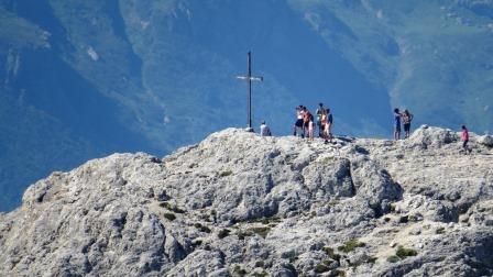
-così arivati sulle pendici della Croda il sentiero (segnato anche con ometti) in salita porta alla cima della Croda Negra del Col Gallina (m. 2.507 slm; 400 m. di dislivello dal Falzarego; 1,5/2 h complessive);")
– dalla cima si scende per sentiero ripido e breve (sent. 441) in prossimità della Forcella Averau;
– da qui si prosegue il sentiero che segue nuovamete una pista da sci con deviazione verso il bel laghetto di Limedes (1 h/1,5 h dalla cima della Croda);
-da qui, proseguendo il sent. 441, si giunge al Passo Falzarego (30 min.).
Valutazioni: Gita bella e panoramica, adatta a tutti bambini compresi – si conquista la cima con alcune parti di divertente piccola arrampicata [effettuata il 18.8.07; 11.8.13; 22.8.25].
for everybody – 4 hours – From the Rif. Falzarego (immediately behind the Rifugio) starts the sent. 441 rising in the direction of Col Gallina – after about 20 min. Take the sender to the right. 422 who climbs and is in the crown; Possible small deviation for an alpine tunnel with window on the valley; Then climbs steeply towards the mountain in a small chimney with very short climbing; You reach the path that ascends to the top of the Croda Negra of Col Gallina (400 m of altitude difference from Falzarego; 1.5 / 2 h overall) – From the top you descend by steep and short path (441) near the Averau Fork;- from here you drop for sent. 419 towards the lake of Limedes (1.5 h from the top of Croda);- here, with sent. 441, you reach Passo Falzarego (30 min.). Reviews: Beautiful and scenic ride, suitable for all children including – you can reach the top with some fun little climbing parts [performed on 18.8.07; 11.8.13].
° ° °
Area: Falzarego – Col Gallina – 5 Torri [intera giornata per tutti – quattro ore circa di cammino]
Percorso:

 – da Passo Falzarego al Rif. Col Gallina (sentiero tra prati, con dislivello minimo in discesa) – dal Rif. Col Gallina, si sale (sent. 419), passando per lago di Limedes, fino alla forcella Averau (430 m. di dislivello); – quindi si prosegue per lo stesso sentiero, in quota sotto l’Averau fino al Rif. Averau (2 h);
– ritorno: i) per lo stesso sentiero; ii) oppure discesa al Rif. Scoiattoli (200 m. di dislivello in discesa).
Valutazioni: Gita bella e panoramica, adatta a tutti – porta al comprensorio del Nuvolau / Cinque Torri (per i commenti si rinvia) – se si opta per la discesa alle Cinque Torri, bisogna lasciare preventivamente un’automobile alla base della seggiovia delle Cinque Torri [effettuate il 4.8.88; 19.8.94]
4 hours – from Passo Falzarego to Rif. Gallina (trail between meadows, with minimum downhill drop) – from Rif. Gallina, climb (419), passing through Lake Limedes, up to the Averau fork (430 m in altitude); – then continue on the same trail, high up under the Averau to the Averau Refuge (2 h); – return: I) for the same trail; Ii) or descent to Rif. Scoiattoli (200 m downhill slope). Reviews: Beautiful and panoramic, suitable for everyone – leads to the Nuvolau / Cinque Torri (for comments like If you opt for the descent to the Five Towers, you must first leave an automobile at the base of the Five Towers Chairpiece [on 4.8.88; 08/19/94]
§ § §
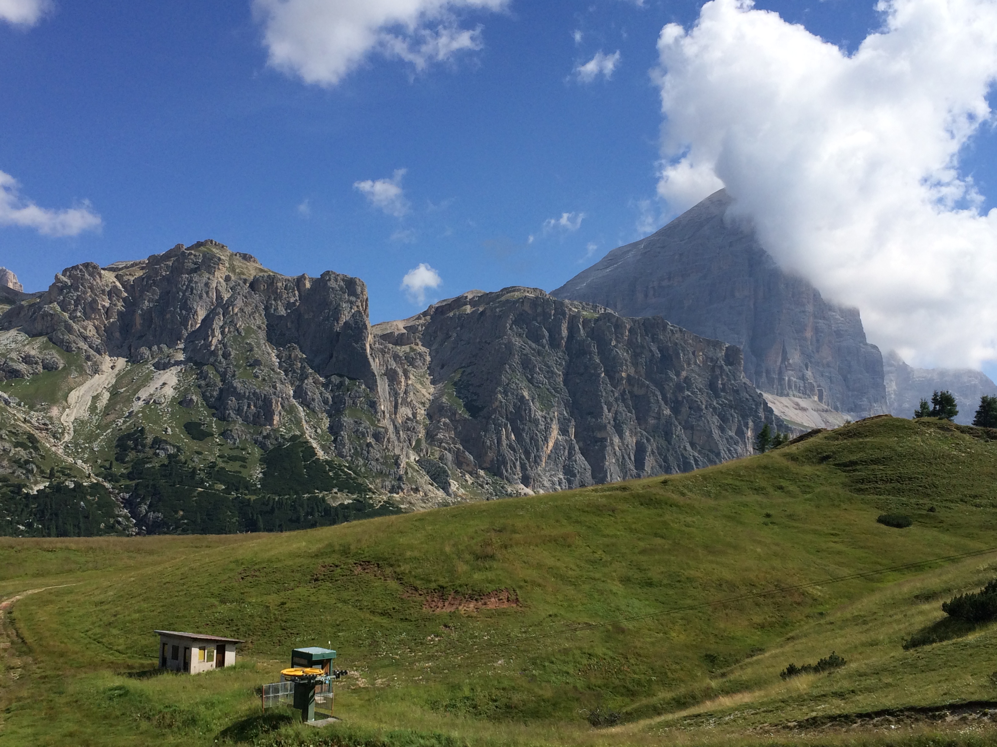
 Area: Falzarego – Sass de Stria (1/2 giornata – per tutti o bambinabile a seconda del percorso scelto –durata da una a tre ore; occorre l’attrezzatura da ferrata solo per il percorso a); occorrono torce per il percorso c)
Percorso: 4 diverse possibilità; il Sass si trova sulla sinistra salendo per la strada statale poco dopo aver superato il passo Falzarego; qui al Forte tra i Sass, si può parcheggiare l’auto (ed eventualmente vistare il Museo della Guerra che è quivi contenuto). Non ci sono rifugi, cosicchè occorre sempre avere con sé acqua e panini.
Path: 4 different possibilities; The Sass is on the left by going up the highway shortly after passing the Falzarego pass; Here at the Fort between Sass, you can park your car (and possibly see the Museum of War that is here). There are no huts, so you always have to have water with you
a) Salita alla vetta del Sass de Stria, (da m. 2183 a m. 2296) raggiungendo la cima tra trincee e roccia, con un paio di camini attrezzati con scale ritorno per la stessa via con varianti; 
(2/3h complessive a seconda della frequentazione; 150 m. di dislivello in salita).
Climb to the summit of Sass de Stria, reaching the summit between trenches and rock, with a pair of fireplaces equipped with return stairs for the same street; 2-3 hours)
b) Passeggiata in piano (m. 2183) sul sentiero 424 che costeggia la base del Sass, parallela alla strada statale – girovagare tenendosi sul versante del monte: 
è la c.d. “valle delle marmotte” (in piano; tempo dedicato a piacere);
Walk along the 424 footpath that runs along the Sass base, parallel to the state road – wandering on the mountainside: Is the c.d. “Marmots valley” (in plan, time dedicated to pleasure);
c) Passeggiata sul sentiero che costeggia la base del Sass (vedi lett. b che precede), parallela alla strada statale – dopo circa 15 min. si sale sulla destra per tracce di sentiero e ghiaione (circa 15 min.), fino alla Galleria Pengov Goiginger (m. 2244) austriaca della I guerra mondiale
") che si può percorre per intero (la galleria è buia e con poche aperture; servono le torce ben funzionanti!; bellissimi panorami dalle feritoie sulla valle; si percorre in salita (20-25 min.) giungendo infine all’aperto alla postazione Goinger (sull’anticima) e proseguendo fino alla cima che domina la valle con altre postazioni austriache della grande guerra (10 min.) che –anche perché inaspettate- si possono perlustrare giungendo alla sommità dell’anticima con un panorama a 360°(complessive due/tre ore);
che si può percorre per intero (la galleria è buia e con poche aperture; servono le torce ben funzionanti!; bellissimi panorami dalle feritoie sulla valle; si percorre in salita (20-25 min.) giungendo infine all’aperto alla postazione Goinger (sull’anticima) e proseguendo fino alla cima che domina la valle con altre postazioni austriache della grande guerra (10 min.) che –anche perché inaspettate- si possono perlustrare giungendo alla sommità dell’anticima con un panorama a 360°(complessive due/tre ore);
")
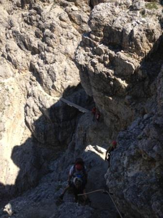
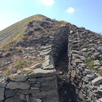
 il ritorno può essere effettuato per la stessa strada ovvero c1) dalla parte opposta cioè effettuando il giro del Sass, prendendo il sentiero che si diparte dall’anticima e che dà sulla valle verso Andraz; il sentiero scende gradatamente, attraversa un ghiaione, ha un passaggio -aiutato da corda- leggermente esposto, e giunge sotto al Forte Tra i Sass tra trincee austriache (1,30 h).

d) Nella parte meridionale del Sass de Stria (loc. Ra Locia), vi è una nota Palestra di roccia, con vie chiodate di diversi livelli da effettuarsi con guida: i) via “friend” 4°; ii) via “totem” 5b
Walk along the path that runs along the Sass base (see paragraph b above), parallel to the highway – after about 15 min. go to the right for trails to the Pengov Goinger Gallery which can be traversed in full (the gallery is dark and with few openings; well functioning torches are needed!), (20-25 min.) Finally reachout to the Goinger station (on the ancient) and continuing to the the top that dominates the valley with other Austrian Great Warships (10 min.) Which – unexpectedly – can be explored by reaching the summit of the ancient with a 360 ° panorama (two hours overall); Return can be done on the same road or c1) on the opposite side, ie by taking the round of the Sass, taking the trail that departs from the ancient one and gives the valley towards Andraz; The trail gradually descends, crosses a screech, has a steeply-swayed passage, and reaches the Forts between the Sasses between Austrian trenches (1.30 h). D) In the southern part of the Sass de Stria, there is a Rock Gym known, with nails of various levels to be guided: i) via “friend” 4 °; ii) via totem 5b
Valutazioni:")
a) Per tutti: Gita piuttosto facile da iniziarsi presto, stante la molta gente e la circostanza che alcuni passaggi “nevralgici” sono a “senso unico alternato” (recentemente sono state realizzate varianti per evitare gli incroci) e sono con scalette e con corda fissa. Per questi ultimi è necessaria un minimo di tecnica e buona forma fisica. Il sentiero –specie in discesa- si diparte in più direzioni che in alcuni casi si congiungono ed in altri no; bisogna quindi prestare attenzione poiché alcune tracce di sentiero possono essere confuse con le trincee e non portano a nulla. Gita di soddisfazione e di poco sforzo: ottima per conquistare la prima vetta [effettuata 12.8.87; 24.8.01; 7.8.04; 11.8.10; in autunnale, ben coperti, 2.11.16; anche con bimbi più volte ed il più piccolo 5 anni).
b) Bambinabile: Nella valletta la poca presenza di persone pur stando vicini alla statale, consente di ammirare da vicino le marmotte. Certo bisogna avere occhio allenato individuando prima le tane e quindi gli animali; poi in gran silenzio osservarli e rispettarli. Ottima per riempire giornate uggiose e di gioia i bimbi [effettuata 24.8.01; 7.8.04; 11.8.10]
c) Passeggiata facile e di soddisfazione ma –posta la scarsa segnaletica anche al fine dell’individuazione dell’entrata principale della galleria, segnalata con vernice rossa – un po’ avventurosa per avviarla. Nella galleria assolutamente necessarie le torce, spirito di avventura e assenza di claustrofobia; in essa fare attenzione alle varie finte uscite (che sono aperture sulla valle), proseguendo per il tracciato principale avendo fiducia che giunge ad un’uscita; il divertimento è assicurato. L’uscita dopo circa 20-25 min. di percorso in galleria stretta e in salita, spesso bagnata, premia per lo splendido panorama e il punto di osservazione più lontano che domina la valle [effettuata 23.8.07; 20.8.08; 11.8.10; 12.8.15; 16.8.17; con prolungamento c1) il 13.8.13 e 10.8.23; la parte verso Andraz è molto panoramica sul Col di lana ed oltre; a circa metà si incrocia deviazione a destra per via ferrata Fusetti sul Sass (moderatamente difficile), ed invece si prosegue sul sentiero; si giunge ad un passaggio che rimane orizzontale ma è esposto, specie per superare un dente di roccia (trattasi di pochissimi chiodi); passo sicuro; poco frequentata si incontrano camosci ma soprattutto stelle alpine e rododendri in grande quantità] 
d) la salita in palestra impone attrezzatura ma necessita della guida [effettuate con bimbi di 15, 12, 9 anni il 25.8.08].
A)For everyone: It’s easy to get started soon, given the many people and the fact that the “neuralgic” passages are “single-sided” and are with ladders and fixed ropes. For the latter, a minimum of technique and good physical fitness is required. The path – down in the descent – moves in several directions that in some cases join together and in others no; So be careful because some trace tracks can be confused with the trenches and do not lead to anything. Excitement and little effort: great to win the first summit [performed on 12.8.87; 08/24/01; 08/07/04; 08/11/10; 2.11.16; with children many times and the smallest 5 years).
B) Childbearing: In the valley, the small presence of people near the state allows you to admire the marmots closely. Of course you have to have a trained eye locating the dung and then the animals first; Then in silence observe them and respect them. Great for filling delicious and joyful days with the children [performed on 24.8.01; 08/07/04; 08/11/10]
C) Easy walking and satisfaction but also poor signaling for the purpose of identifying the main entrance of the tunnel, marked with red paint – a bit adventurous to launch it. In the gallery absolutely necessary the torches, the spirit of adventure and the absence of claustrophobia; In it be mindful of the various fake exits (which are openings on the valley), continuing for the main path with confidence coming to an exit; fun is guaranteed. The exit after about 20-25 min. Of course in a narrow and uphill tunnel, often wet, rewards for the splendid panorama and the farthest observation point overlooking the valley [performed on 23.8.07; 08/20/08; 08/11/10; 08/12/15; 08/16/17; With extension c1) on 13.8.13; 10.8.23; pay attention to a passage that remains horizontal but is exposed, especially to overcome a rock tooth (these are very few pitons); sure-footedness; Seen chamois and alpine stars in large quantities
D)The climb to the gym requires equipment but needs guidance [performed with children aged 15, 12, 9 years on 25.8.08].
§ § §
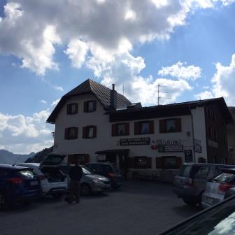
Area: Valparola / Falzarego – Settsass: dal Rifugio Valparola, dove si lascia l’automobile, partono diverse passeggiate che percorrono sentieri che danno sulla Val Badia (vedi nn. 1 e 2), ovvero aggirano il gruppo dei Settsass (vedi n. 3), ovvero percorrono sentieri che danno verso il Falzarego (vedi n. 4)
1) Monte Castello (intera giornata – per tutti – circa quattro ore di cammino)
Percorso:")
– dal Rif. Valparola sul lato dei Settsass (sent. 23 poi 24), che da verso la Val Badia fino alla cima del Monte Castello e rit. per la stessa via (4 h in totale)
") Valutazioni: Gita di media fatica e di soddisfazione – adatta a tutti – poco frequentata – postazioni di guerra austriache [effettuata 9.8.06; viste marmotte – stelle alpine]
Valutazioni: Gita di media fatica e di soddisfazione – adatta a tutti – poco frequentata – postazioni di guerra austriache [effettuata 9.8.06; viste marmotte – stelle alpine]
° ° °
2) Armentarola (intera giornata – per tutti – circa tre ore di cammino)
Percorso: dal Rif. Valparola, si attraversa la strada e si prende il sent. 18 che si segue fino all’Armentarola, in Val Badia.")
Valutazioni: Gita in discesa tra prati; potrebbe prendersi il sentiero 18 più avanti, sulla sin della strada qualche km. dopo il Rifugio. Il panorama in discesa, dominato dal gruppo Fanis è stupendo. Di media fatica e di media soddisfazione; adatta a tutti; necessita di un’organizzazione con le automobili per i diversi punti di partenza e di arrivo [effettuata 14.8.87; con marmotte – stelle alpine]
° ° °
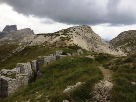
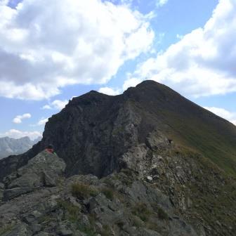
3) Giro dei Settsass (intera giornata – 5 ore)
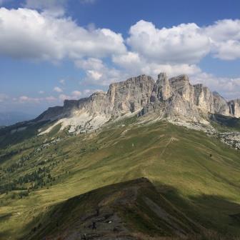
Percorso: dal Rifugio Valparola , si prende il sentiero 24 avanzando in quota (o meglio in saliscendi), su sentiero spesso non agevole e pietroso, nell’anfiteatro dei Settsass e con vista sulla Val Badia; dopo circa un’ora in cui si perde anche quota, il sentiero 24 sale decisamente (circa 150 metri di dislivello) verso la sella Pizades, dove si arriva (dopo circa 1,30) non prima di aver lasciato sulla sinistra una diramazione del sentiero (che ha lo stesso n. 24) che porta alla cima del picco Settsass (cui si può salire in circa 45 min.);
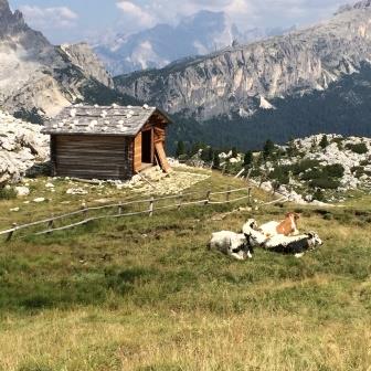
– il sentiero 24 prosegue poi sul versante che da sul Rifugio Pralongià (che si può raggiungere con comodo sentiero); il panorama sul gruppo Sella, sui passi Gardena e Sella, sul CIR … poi sulla Marmolada è maestoso; – il percorso aggira ancora il gruppo montuoso ed è un saliscendi non agevole, sempre tra rocce e sassi, che infine (h 1,30) raggiunge il Passo Sief (dove c’è un piccolo ricovero (malga) che in caso di maltempo è fondamentale
– dalla sella (= Passo Sief) parte il sentiero per punta Sief e Col di Lana (vedi n. 4 che segue)
-dalla sella il ritorno è per il sentiero 23 che costeggia il Settsass dal versante Falzarego; saliscendi più dolce su terreno boscoso (problematico in caso di pioggia), che giunge infine ad una piccola salita attrezzata con alcuni chiodi, assolutamente facile;
– si giunge così nella Valparola (o direttamente al Forte Tre Sass) dove è anche possibile ammirare trincee sotto al Sass de Stria; si sale per sentiero sino al rifugio, passando anche -ove lo si volesse- per il piccolo lago di Valparola
Valutazioni gita panoramica da effettuarsi preferibilmente con il bel tempo per il bel panorama che si gode (effettuata il 22.8.14, con tempo brutto e con difficoltà collegate alla temperatura bassa ma soprattutto al terreno bagnatissimo e scivoloso; vista marmotta in Valparola; effettuata il 24.8.21 con maggiore soddisfazione); il giro completo è di circa 13 km, con un dislivello di 565 m. (passando con i saliscendi da un minimo di 2379 m. a 2018 m.) – Non ci sono rifugi e dunque portare panini e acqua.
Tour of Settsass (full day – 5 hours) Path: Valparola from the Refuge, take the path 24 advancing at high altitude, on path often not easy, in the amphitheater of Settsass and overlooking the Val Badia; After about an hour the path 24 rooms (150 vertical meters) into the sella (= forcella = pass) Pizades, where you get (after 1.30) but not before leaving a branch of the trail on the left (which has the same n. 24 ) leading to the top of the peak Settsass (which you can get in about 45 min.); – The path 24 continues on the slope from the Pralongià (which can be reached by an easy trail); the path is a latch not easy, that finally (h 1.30) reaches the Passo Sief where there is a small shelter in case of bad weather it is crucial) -from the Passo the path to tip Sief and Col di Lana (see no. 4 below) -from the back seat is the path 23 that runs along the side Settsass from Falzarego; the path is “up and down” (problematic in case of rain), which finally comes to a small slope equipped with some nails, absolutely easy; – Thus you reach the Valparola and go up the path until the shelter, passing -if you want- for the small lake Valparola – Ratings panoramic tour to be carried out in good weather (made on 08/22/14, with bad weather and difficulties related to low temperature but above the ground very wet and slippery; view groundhog Valparola); carried out on 24.8.21 with greater satisfaction); the complete circuit is about 13 km, with a difference in height of 565 m. (passing with ups and downs from a minimum of 2379 m. to 2018 m.) – There are no shelters and therefore bring sandwiches and water.
°°°
4) Monte Sief e sentiero attrezzato al Col di Lana (intera giornata – opzione base fino a Passo Sief, per tutti, circa tre ore di cammino; le varianti intorno alle 6 ore con attrezzatura da ferrata per la seconda variante)
Mount Sief and equipped path to Col di Lana (full day – according to the Sief pass option for everyone, about three hours of walking ; variants around 6 hours with climbing gear for the second variant )
") Percorso:
Percorso:
– dal Rif. Valparola prendere il sent. 23 che costeggia i Settsass, e proseguire in quota fino a Passo Sief (1,5/2 h);
– il ritorno per lo stesso sentiero (1,5/2 h) (complessive 3 ore);
Varianti:
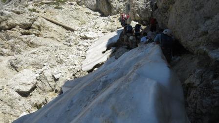
 i ) prosecuzione dal Passo Sief fino alla Cima Sief (sent. 21), dinanzi alla cima del Col di Lana, salendo (250 m) tra trincee delle linee austriache (30/45 min. a salire + 15/30 min. a scendere) (complessive 4/5 ore);
")
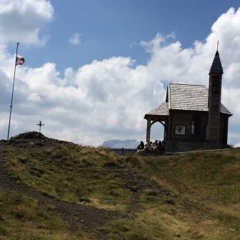
ii) ulteriore prosecuzione fino al Col di Lana; dalla Cima Sief si scende con sentiero attrezzato, facile ma con lieve esposizione, all’anticima del Col di Lana (Spiz de le Seleghe); si prosegue poi per la Cima del Col di Lana, con sentiero attrezzato per lo più consistente in ripidi scalini (45 min. a salire + 45 min. a scendere; si sale di circa 50 m. complessivamente ma si perde quota per l’anticima e si riacquista per il Col di Lana). Si giunge così al luogo della più grande battaglia della 1° guerra mondiale in zona e fronte italiano; la Cima è attrezzata con un bivacco ed una chiesetta. La discesa -se non effettuata sulla medesima strada della salita- si può effettuare per il sentiero che molto ripido (200 m) scende alla Pala da Om fino alla sella (direzione Andraz); da qui sulla sin. il sentiero Teriol Ladin porta nuovamente risalendo al Passo Sief (complessive 6 ore circa).
") Valutazioni: Gita bella, molto panoramica, che diviene più emozionante e magnifica (ed anche più faticosa) verso la fine, per le vestigia della grande battaglia; la salita ripida alla Cima Sief, fronte austriaco, è tra le trincee; la discesa dal Sief e la salita al Col di Lana è altrettanto emozionante – c’è da leggere delle gesta dei soldati, eroi della Grande guerra, che ha visto in questo luogo la battaglia più importante – per il Col di Lana è opportuna attrezzatura, per maggior sicurezza pur se il sentiero attrezzato è facile – splendido panorama in vetta, ove c’è una chiesa in ricordo dei caduti [effettuata il 17.8.92; con variante i), il 24.8.08; con variante ii) il 10.8.15]
Valutazioni: Gita bella, molto panoramica, che diviene più emozionante e magnifica (ed anche più faticosa) verso la fine, per le vestigia della grande battaglia; la salita ripida alla Cima Sief, fronte austriaco, è tra le trincee; la discesa dal Sief e la salita al Col di Lana è altrettanto emozionante – c’è da leggere delle gesta dei soldati, eroi della Grande guerra, che ha visto in questo luogo la battaglia più importante – per il Col di Lana è opportuna attrezzatura, per maggior sicurezza pur se il sentiero attrezzato è facile – splendido panorama in vetta, ove c’è una chiesa in ricordo dei caduti [effettuata il 17.8.92; con variante i), il 24.8.08; con variante ii) il 10.8.15]
From Ref. Valparola take the felt n. 23 that runs along the Settsass, and continue at altitude up to the Sief pass ( 1.5 / 2 h ); – The return by the same route ( 1.5 / 2 h ) ( total 3 hours); – variants: i) continuing from Sief pass to the top of Mount Sief (sent. 21 ), before the summit of the Col di Lana, walking ( 250 m ) from the trenches of the Austrian lines ( 30/45 min . to rise + 15/30 min . down again at Sief pass) ( total 4/5 hours); ii ) further prosecution to the Col di Lana ; from the top of Mount Sief it descends with equipped path , but easy with mild exposure , as the “anti cima” del Col di Lana ( the Spiz de Seleghe ) ; then along the Cima del Col di Lana , with equipped path mostly consisting of steep steps ( 45 min . to rise + 45 min . to decrease, it climbs of about 50 m . in total but lost share to the smaller peak and regains the Col di Lana ) . This leads to the site of the largest battle of the 1st World War in the area and the Italian front ; Cima is equipped with a campfire and a small church . The down -if not carried out on the same road- can be made for the trail is very steep ( 200 m ) down the shovel Om to the pass ( direction Andraz ) ; from here on the right . the path Teriol Ladin again by going back to Step Sief ( total 6 hours ) – Ratings : beautiful , very scenic , which becomes more exciting and beautiful (and most exhausting ) towards the end , for the remains of the great battle ; the steep climb to the top of Mount Sief , the Austrian front , is one of the trenches ; the descent from Sief and the climb to the Col di Lana is just as exciting – there is to read of the exploits of soldiers , heroes of the Great War , which saw in this place the most important battle – Is necessary appropriate equipment , for safety even if the equipped path is easy – wonderful view at the top , where there is a church in memory of the fallen [ made on 8/17/92 ; with the variant ) , the 24/08/08 ; with variant ii) 10/08/15 ]