ABRUZZO
A) GRAN SASSO (da Prati di Tivo e da Campo Imperatore) e M.San Franco;
GRAN SASSO
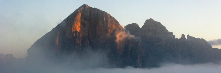
Il Gran Sasso è una montagna maestosa che, con i suoi due picchi (Corno Grande e Corno Piccolo), domina l’Abruzzo, in Italia centrale; la sommità si raggiunge o da Campo Imperatore (salita da Assergi –uscita della A24-) o da Prati di Tivo (salita verso Pietracamela, uscita San Gabriele Colledara della A24); luoghi belli sia d’inverno sia d’estate, rimasti ancora ad uno stato molto naturale perché si trovano nel Parco Nazionale del Gran Sasso e dei Monti della Laga. Le gite partono dai (A) Prati di Tivo o (B) da Campo Imperatore. Di seguito viene descritta anche altra gita (C) al Monte San Franco (Passo delle Capannelle).
The Gran Sasso is a majestic mountain which, with its two peaks (Corno Grande and Corno Piccolo), dominates the Abruzzo, in central Italy; the summit is reached or from Campo Imperatore (uphill from Assergi -output of A24- ) or from Prati di Tivo (ascent to Pietracamela, exit San Gabriele Colledara of the A24); beautiful places both in winter and in summer , were still at a very natural because they are located in the National Park of Gran Sasso and Monti della Laga .
§ § §
A) Area: Prati di Tivo –
1-Alla “Madonnina” dalla Laghetta (gita per tutti – due ore circa di cammino; in giornata anche da Roma) – trip for all – about two hours walk; also in the day from Rome
Percorso: – a Prati di Tivo, Piazzale Amorocchi, si prende la strada a sinistra in salita per 3 km. fino a “La laghetta”– piccolo laghetto dove alla sera vengono ad abbeverarsi cavalli bradi (circa m. 1750 slm); qui si lascia l’auto;

– per sent. SG una breve salita (5 min.) porta al grande crocifisso a picco sulla valle verso Teramo; panorama bellissimo;")
-si prosegue poi salendo sempre in cresta, fino all’Albergo Deruto (cioè ad un rudere di rifugio; 1896 slm; 40 min) e poi fino alla sella, all’arrivo dell’ovovia (2028 slm; 15 min.) ed alla Madonnina (alla sella dal 6.7.13 si può salire direttamente da Piazzale Amorocchi, con l’ovovia); da qui il ritorno per la stessa strada (45 min.).

Valutazione: Passeggiata su prati e con magnifico panorama (dislivello in salita di 280 m. circa): davanti il Gran Sasso (Corno Grande e Piccolo) e a sinistra salendo a picco sulla Valle verso Teramo ed il mare – Non si giunge ad alcun rifugio, quindi portarsi acqua e panini [effettuata 30.6.13].
Path: – Prati di Tivo , Piazzale Amorocchi , take the road left uphill for 3 km. up to ” The Laghetta ” – small pond where the evening come to drink wild horses (about m . 1750 above sea level) ; Here you leave your car ; – take SG for a short climb (5 min) Leads to the large crucifix overlooking the valley towards Teramo ; beautiful view; then continue climbing along the ridge, to the Hotel Deruto (i.e. to ruins of refuge; 1896 asl; 40 min) and then to the saddle, on arrival of cable car (2028 asl; 15 min.) and at the Madonnina (6.7.13 from the saddle you can go directly from Piazzale Amorocchi , with the cable car); hence the return by the same route (45 min).
Rating: Walk on lawns and magnificent panorama (difference in height of 280 m. Approximately): in front of the Gran Sasso (Corno Grande and Piccolo) left and climbing to the peak of the Valley towards Teramo and the sea – not you come to any shelter, so bring water and sandwiches [carried 06/30/13 ] .
°°°
Area: Prati di Tivo
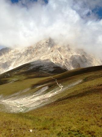
2-salita al Rif. Carlo Franchetti [gita per tutti – due ore circa di cammino – in giornata, anche da Roma].trip for all – about two hours walk; also in the day from Rome
Percorso:
– a Prati di Tivo, Piazzale Amorocchi si lascia l’auto e -se si vuole- si prende la cabinovia che porta fino alla sella, ove è la “Madonnina” dalla Laghetta (metri 2.042);
– a questo punto si prende verso destra e si sale per il sent. 3; si entra nella valle delle Cornacchie al centro del catino del Gran Sasso; il sentiero è sassoso anche con massi e con un breve passaggio con corda di sicurezza; la salita è panoramica fino al Rifugio (a 2.433 m. s.l.m.);
– ritorno per lo stesso sentiero fino alla cabinovia che si può prendere anche per la discesa (c’è naturalmente il sentiero fino alla base).
Valutazione: Escursione panoramica e di soddisfazione nel catino del Gran Sasso, tra il Corno Grande e il Corno Piccolo, che si può svolgere in tempo relativamente breve (1 ora / 1,15 ora in salita; 45 min./1 h in discesa; dislivello di circa 400 metri, da farsi in salita ed in discesa). L’arrivo al rifugio Franchetti, del CAI di Roma, premia e consente ristoro. Da qui partono ascensioni sulle cime vicine [effettuata 20.7.14].
Path – Prati di Tivo, Piazzale Amorocchi you leave your car and if you want take the cable car that leads to the pass, where is the ” Madonna” by Laghetta (2,042 m.); – At this point you take to the right and climb to the felt . 3 ; you enter the valley of the Crows at the center of the basin of the Gran Sasso; the trail is rocky with boulders and a short passage with safety rope; the climb is panoramic to the Refuge Carlo Franchetti (2,433 m); – Return to the same path to the cable car that you can take for the descent (of course there is the path to the base)
Rating: Panoramic excursion and satisfaction in the basin of the Gran Sasso, between the Big Horn (= Corno Grande) and the Little Horn (= Corno Piccolo), who can play in relatively short time ( 1 hour / 1.15 hours uphill ; 45 min . / 1 h downhill ; altitude of about 400 meters , to be uphill and downhill ). The arrival at the shelter Franchetti , CAI Rome , rewards and allows options. From here climbs on nearby peaks [carried 07/20/14 ] .
°°°
Area: Prati di Tivo
3 – Alle “Cascate del rio Arno” (gita bambinabile – un’ ora ed un quarto circa di cammino; in giornata anche da Roma).
Percorso: – a Prati di Tivo, Piazzale Amorocchi, si prende la strada a destra e si prosegue per circa 100 m., dopo gli impianti, dove si lascia l’auto;
") -si sale per il sentiero 2V che entra in un bel bosco di faggi; dopo una breve salita si scende con sentiero a mezza costa per le Coste di San Giovanni; quindi con breve salita si giunge alle cascate del rio Arno (che si trovano poco oltre il bivio che le indica …), che si ammirano da un belvedere (35 min. dalla partenza); poco oltre (10 min.) in salita fino ad un altopiano, dove sono le sorgenti del rio Arno; il ritorno per la stessa strada (40 min.)
-si sale per il sentiero 2V che entra in un bel bosco di faggi; dopo una breve salita si scende con sentiero a mezza costa per le Coste di San Giovanni; quindi con breve salita si giunge alle cascate del rio Arno (che si trovano poco oltre il bivio che le indica …), che si ammirano da un belvedere (35 min. dalla partenza); poco oltre (10 min.) in salita fino ad un altopiano, dove sono le sorgenti del rio Arno; il ritorno per la stessa strada (40 min.)
Valutazione: Passeggiata sostanzialmente in quota con bella faggeta e cascata, senza punti di ristoro [effettuata 6.7.13].
Path: – Prati di Tivo, Piazzale Amorocchi, take the road to the right and continue for about 100 m – After the plants , where you leave your car ; -you salt 2V for the trail that enters in a beautiful forest of beech trees ; after a short climb you go down with path half for the Coasts of St. John ; then with short climb leads to the waterfalls of the river Arno (located just past the junction that indicates … ) , that can be seen from a viewpoint ( 35 min . from the start) ; a little further ( 10 min . ) climb up to a plateau , where are the sources of the river Arno ; the return by the same route (40 min . )
Rating : Walk substantially in proportion with beautiful beech forest and waterfall , without refreshment [ carried 6.7.13 ]
§ § §
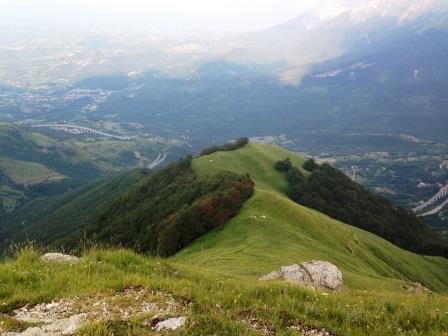
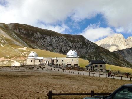
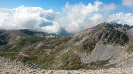
(B) Area: Campo Imperatore – si giunge a Campo Imperatore (uscita Assergi A24) o con la funivia (di cui bisogna controlare sempre apertura ed orari) la cui stazione di partenza è poco distante dall’uscita dell’autostrada o con la strada (25 km) panoramica di montagna (in inverno spesso chiusa), che attraverso un incontaninato paesaggio di pascoli montani di alta quota (con laghetti, cavalli bradi, mucche, pecore …), ci trasporta in un mondo ancora dal sapore antico. A Campo Impetatore poi si domina la vallata aquilana e si è sotto il Corno Grande. Interessante l’Osservatorio astronomico e il giardino botanico (www.giardinocampoimperatore.it) conservato faticosamente e che merita una sosta, poichè sono conservate specie appenniche anche rare come le stelle alpine locali.
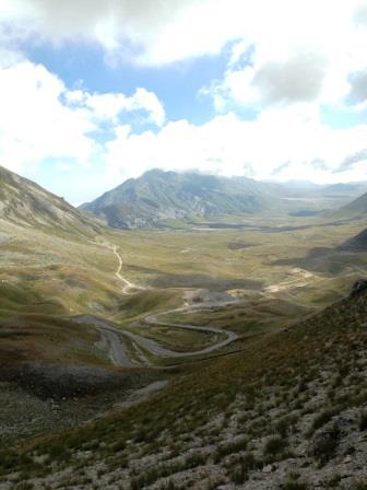
Reach Campo Imperatore (exit Assergi A24) or by cable car (which you have to control always opening and times) whose departure station is not far from the highway or by the scenic mountain road (25 km; often closed in winter ), which through a wild landscape of mountain pastures at high altitudes ( with ponds , wild horses , cows , sheep … ), takes us into a world still antique flavor. A Field Impetatore then dominates the valley of Aquila: and you are under the Big Horn. Interesting Astronomical Observatory and the Botanical Garden (www.giardinocampoimperatore.it ) painstakingly preserved and worth a stop , as they are preserved, even rare species of the Apennine edelweiss local
1) Monte Prena – Via dei laghetti e via Brancadoro (gita per esperti – 5 ore di cammino).
Percorso: – Raggiunta l’altipiano di Campo Imperatore, vicino al bivio per Santo Stefano di Sessanio, si prende una via sterrata (per Monte Prena e Monte Infornace); ci si inoltra per un buon tratto superando dei casali, il fontanile S. Lorenzo e, poco oltre, si lascia l’auto;
-si prosegue per “La canala” (fiume di ghiaia) e si raggiunge la presa dell’acquedotto (a circa 1810 m s.l.m., dopo poco meno di 100 m. di dislivello) dove “inizia” la “via dei laghetti” che sale per un canalone con paretine e numerosi passaggi di II e III grado, passando vicino a molti piccoli laghetti dalle limpide acque, fino a raggiungere una forcella dove ci si ricongiunge con la via Brancadoro; la parte in salita è finita, e per ghiaie si superano le ultime rocce e si raggiunge la vetta, con una grande croce.
Per la discesa, due opzioni:
a) per sentieri 7° e 7; si continua sulla cresta verso il Monte Camicia per scendere fino a Vado di Ferruccio (2245 m., targa); dopo aver attraversato tutto l’anfiteatro, per la Fornaca si giunge alla macchina.
b) per il sentiero Brancadoro, che si raggiunge dopo aver ripercorso l’ultima parte del sentiero appena fatto in salita; quindi cengia esposta, poi placca impegnativa, ed infine un camino non esposto; tratti però impegnativi con corda; si giunge poi all’automobile riprendendo il sentiero originario (effettuata luglio 1993).
Valutazioni: gita panoramica e molto gradevole; tuttavia impegnativa fisicamente e tecnicamente anche per la quasi totale assenza di appigli artificiali; necessaria quindi attrezzatura da montagna e una corda. Senza punti di ristoro; dunque portare acqua e vivande.
Path: – After reaching the plateau of Campo Imperatore, near the junction to Santo Stefano di Sessanio, you take a dirt road (for Monte Prena and Monte Infornace); you forward for some distance beyond the houses, the fountain S. Lorenzo and , shortly afterwards, leaving the car ; -it goes to ” La chute ” (river gravel) and reach the outlet of the aqueduct ( at about 1810 m above sea level , after less than 100 m . in altitude) where ” starts ” the “way of the lakes ” that salt for a gully with small walls and numerous passages of II and III degree, passing by many small lakes from the clear waters , until you reach a fork where you join up with the way Brancadoro; the uphill part is over, and you exceed the latest gravels and rocks you reach the summit , with a large cross. For the descent, two options : a) for paths 7 and 7 ; you continue on the ridge to Mount Shirt to drop to Vado di Ferruccio (2245 m; plate); after going through all the amphitheater, for Fornaca you reach the machine. b) the path Brancadoro, which is reached after having retraced the last part of the path just done uphill; then exposed ledge, then plaque challenging, and finally a fireplace is not exposed ; Whether however challenging with rope ; Then we come to the car taking up the original path (carried in July 1993).
Ratings: panoramic tour and very pleasant ; however technically demanding physically and also for the nearly total absence of artificial holds ; necessary therefore mountain equipment and a rope . Without refreshment; So bring water and food
2) Monte Aquila e Rif. Duca degli Abruzzi (gita per tutti; 3 ore di cammino; sosta in Rifugio, ma opportuno pranzo al sacco) trip for all; 3 hours walk, stop in Refuge, but should be packed lunch
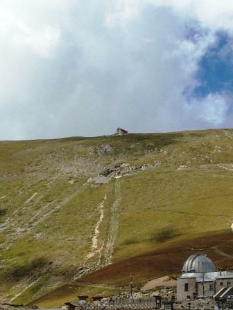
Percorso: giunti a Campo Imperatore, si lascia l’auto al parcheggio e si prende il sentiero n. 2 che sale ripido verso il Rif. Duca degli Abruzzi;
-dopo circa 10 min. si gira a destra per il sentiero n. 3 che sale gradatamente prima e con uno strppo finale alla sella di Monte Aquila (35 min.; 200 metri di dislivello)
-si segue poi verso destra il crinale del Monte Aquila (sentiero n. 4), deviando a destra verso la cima (sentiero 4A) e salendo anche in modo ripido, fino ad un’anticima e poi alla cima, proprio su una cresta (45 min.; 180 metri di dislivello dalla sella); magifico panorama;
-la discesa fino alla sella è per lo stesso sentiero (30 min.); quindi in cresta per il sentiero n. 2 si prosegue per il Rif. Duca degli Abruzzi (30 min.);
-da qui la ripida discesa (30 min.) per il parcheggio di Campo Imperatore.
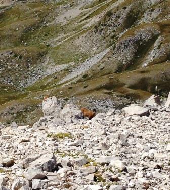
 Valutazioni: il Monte Aquila offre uno spettacolo stupendo, a 360 gradi; incontro ravvicinato con un camoscio appenninico; area piuttosto incontaminata con fiori di alta quota (più frequentato il sent. n. 2 in salita/discesa per il rifugio); (effettuata 29.8.14)
Path: arrive to Campo Imperatore and leave your car to the parking lot and take the path n . 2 that climbs steeply to the Rif. Duca degli Abruzzi; -After about 10 min. turn right on path. 3 gradually climbs before and with a final strong climb reach the saddle of Mount Eagle (35 min .; 200 vertical meters ) -you then follows the ridge to the right of Mount Eagle (path n . 4), turning right towards the top (path 4A) and also rising so steeply , until ANTICIMA and then to the top, right on a ridge (45 min; 180 vertical meters from the saddle); beautiful scene; -the descent to the saddle is the same path ( 30 min); then the ridge path no . 2 continue to Rif . Duca degli Abruzzi ( 30 min); -from here the steep descent ( 30 min) for the parking of Campo Imperatore.
Ratings: Mount Eagle offers a wonderful show , 360 degrees ; close encounter with a Apennine chamois; rather pristine area with flowers of high altitude ( the busiest sent. n . 2 in up / down to the shelter ) ; ( carried 29/08/14)
§ § §
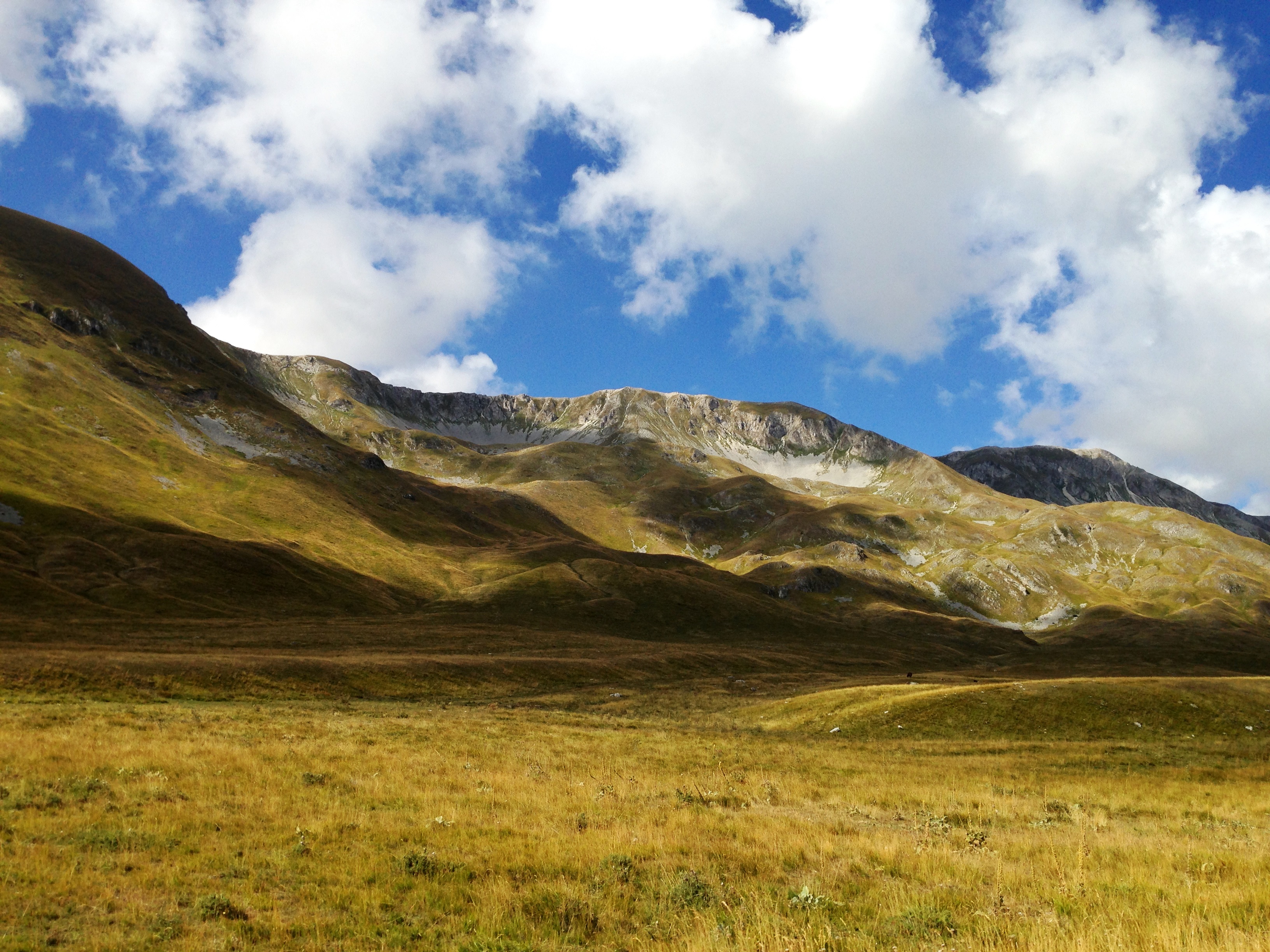
C) Area Passo delle Capannelle – Cima San Franco (gita per tutti – 5 ore di cammino – pranzo al sacco, non ci sono posti per bere e dunque portarsi acqua; in vetta possibile vento forte)
-Si raggiunge l’Aquila e si prende la strada per il lago di Campotosto; raggiunto il passo delle Capannelle (m. 1.304 s.l.m.), si prosegue per circa un km e sulla destra si apre un piccolo slargo dove può essere lasciata l’auto; si è in zona “Acqua fredda”.
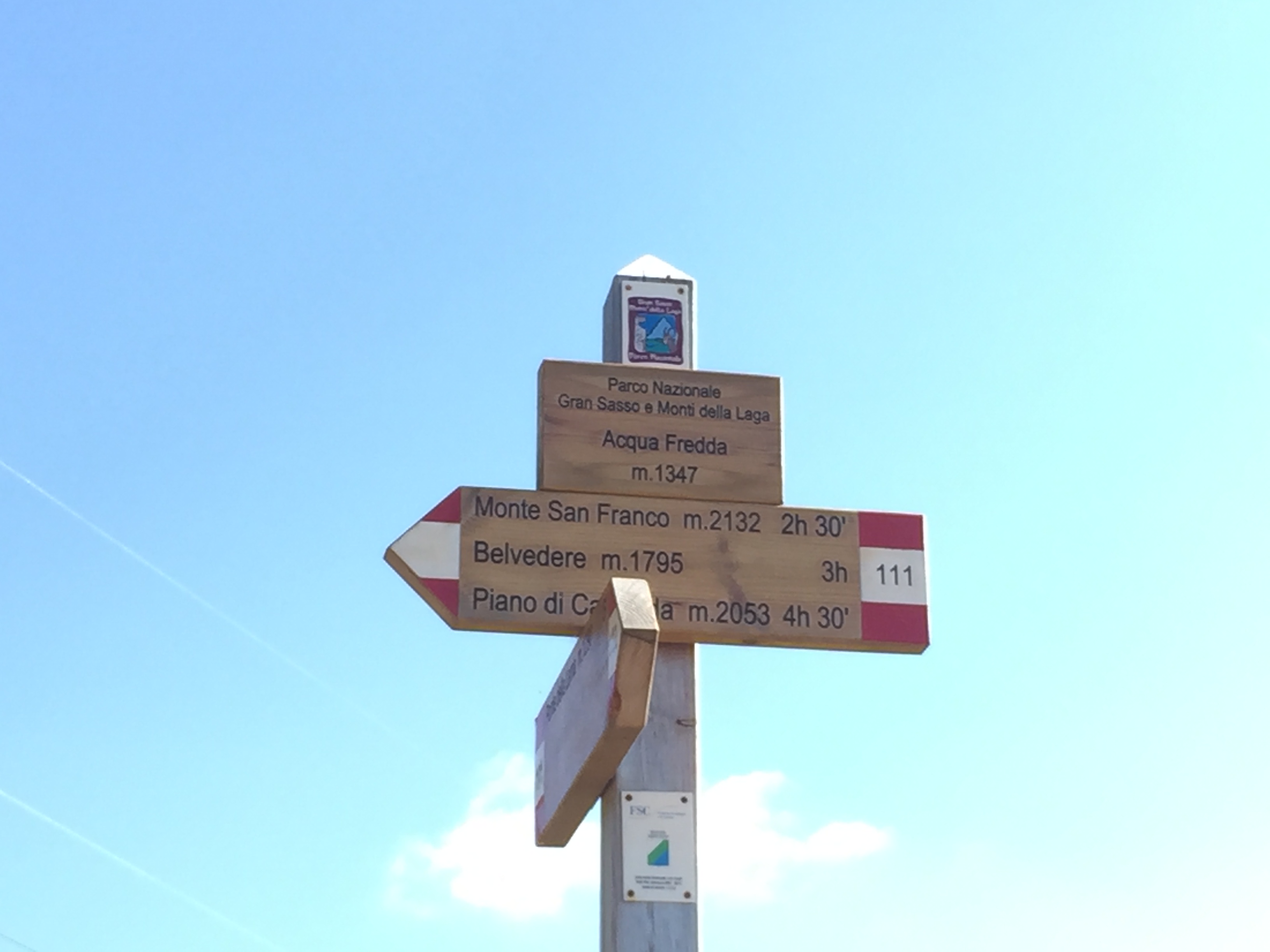
-si segue il sentiero n. 111 (n. 12 se vecchia numerazione) dalla strada ben segnato, proseguendo sullo stesso anche dopo il bivio presso Acqua fredda (m. 1.355 s.l.m.); ben segnalato. Si trova invece difficoltà al bivio successivo (si aprono due sentieri da un piccolo piazzale in curva; il sentiero è quello più a monte): attenzione comunque perchè nella prima parte il sentiero è di facile dispersione; vi sono molti ometti che aiutano.
Non ci sono poi altri bivi: si sale solamente su una cresta inclinata. Prima costeggiando un bosco di faggi; e poi per prati, seguendo per lo più ometti e segnali apposti su pali. Si prende quota nella parte centrale della salita, nel raggiungere le prime tre anticime; alla quarta anticima la pendenza cala; si giunge finalmente alla cima dove c’è una croce ed un cippo dell’IGM a 2.132 s.l.m.
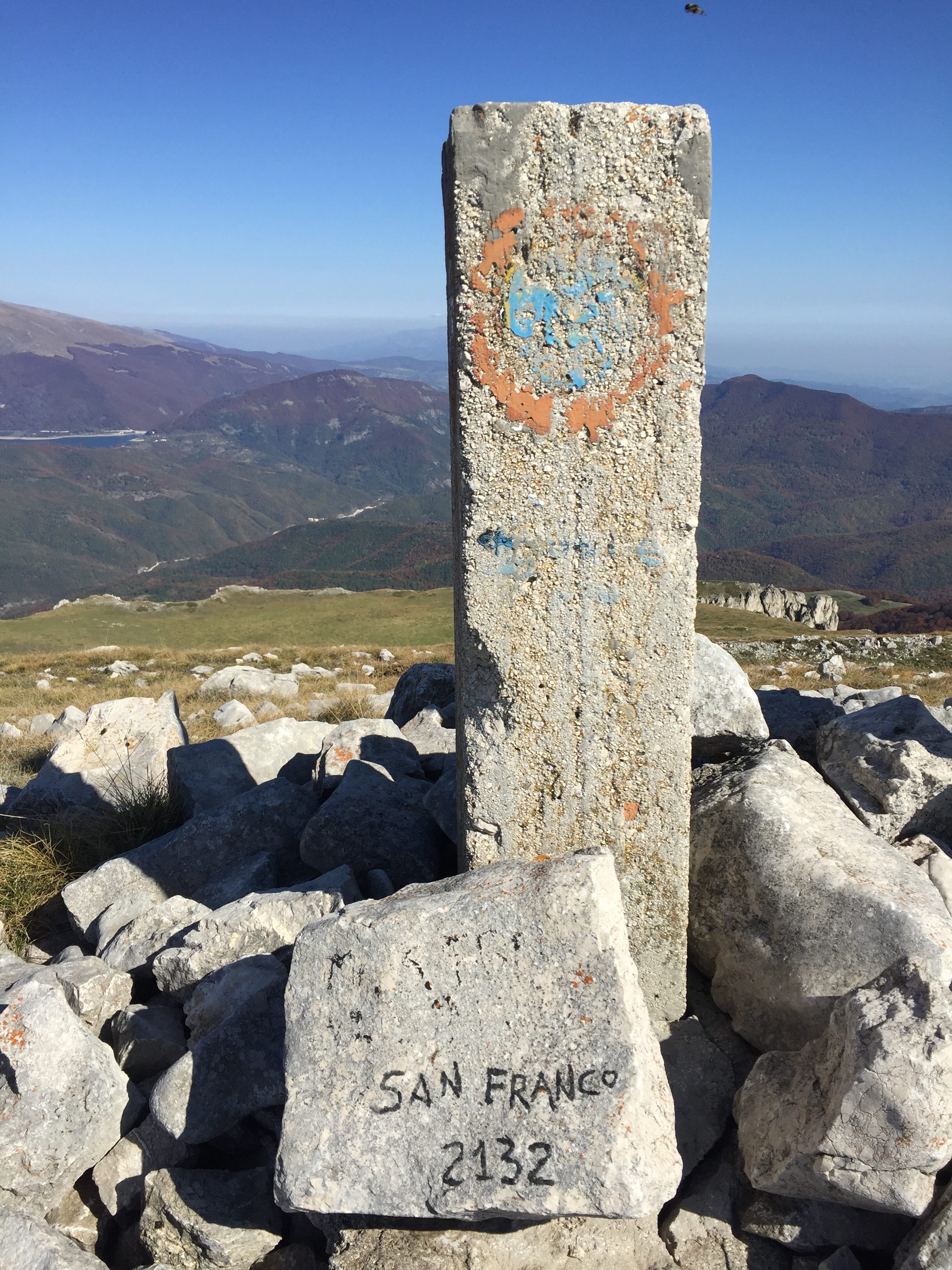
cippo di vetta dell IGM
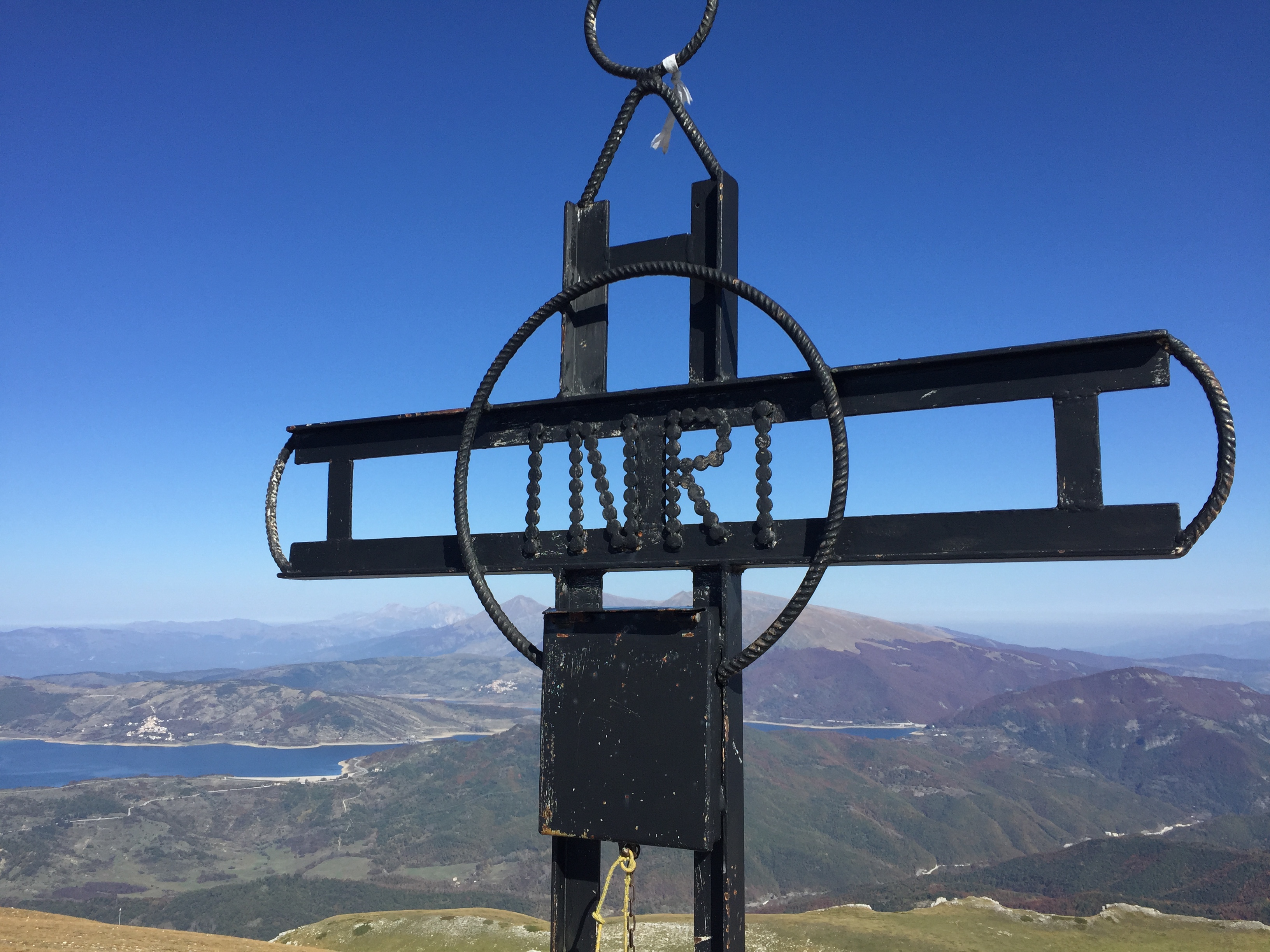
croce di vetta con lago di campotosto
Discesa per lo stesso sentiero.
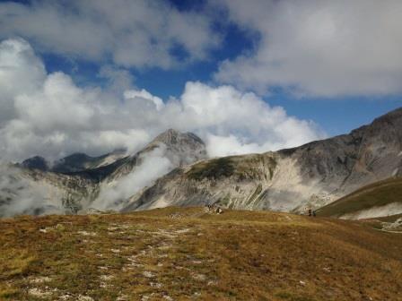
Valutazioni: bella salita su prati, impegnativa ma non troppo; salita di 2 ore e 45 min.; discesa di circa 2 ore e 30 min.. Panorama bellissimo a 360 gradi, in primo luogo sul Gran sasso, poi sul lago di Capostosto e su tutte le montagne dei dintorni (dal Velino alla Magnola, alla Laga …). Sulla cima si sono potuti ammirare anche gli avvoltoi grifoni (che nidificano in zona velino) che in un gruppo di circa trenta hanno volato superbi sopra di noi (eseguita il 13.10.18).
Area of the Capannelle Pass – Cima San Franco (excursion for all – 5 hours of walking – packed lunch, there are no places to drink and therefore bring water, in the peak possible strong wind) – Path: You reach Aquila and take the road to the lake of Campotosto; after reaching the Capannelle pass (1,304 m above sea level), continue for about one km and on the right there is a small open space where the car can be left; you are in the “Cold water” area. – Follow the path n. 111 (number 12 if old numbering) from the well-marked road, continuing on the same even after the junction at Acqua fredda (1,355 m above sea level); well reported. On the other hand, there are difficulties at the next junction (two paths open from a small curving square, the path is the one further upstream): pay attention, however, because in the first part the path is easy to scatter; there are many little people who help. Then there are no other crossroads: you only get on a sloping ridge. First along a beech forest; and then for meadows, mostly following “ometti” and signs posted on poles. You take altitude in the central part of the climb, reaching the first three antics; at the fourth ancients the slope decreases; finally we reach the top where there is a cross and a cipp of the IGM at 2,132 s.l.m. Descent by the same path. Ratings: nice climb on meadows, challenging but not too much; ascent of 2 hours and 45 min .; descent of about 2 hours and 30 minutes. Beautiful 360 degree panorama, first on the Gran Sasso, then on the Lake of Capostosto and on all the mountains in the surroundings (from the Velino to the Magnola, to the Laga …). On the top you can also admire the vultures griffins (which nest in the velino area) that in a group of about thirty have flown superb above us (performed on 13.10.18).
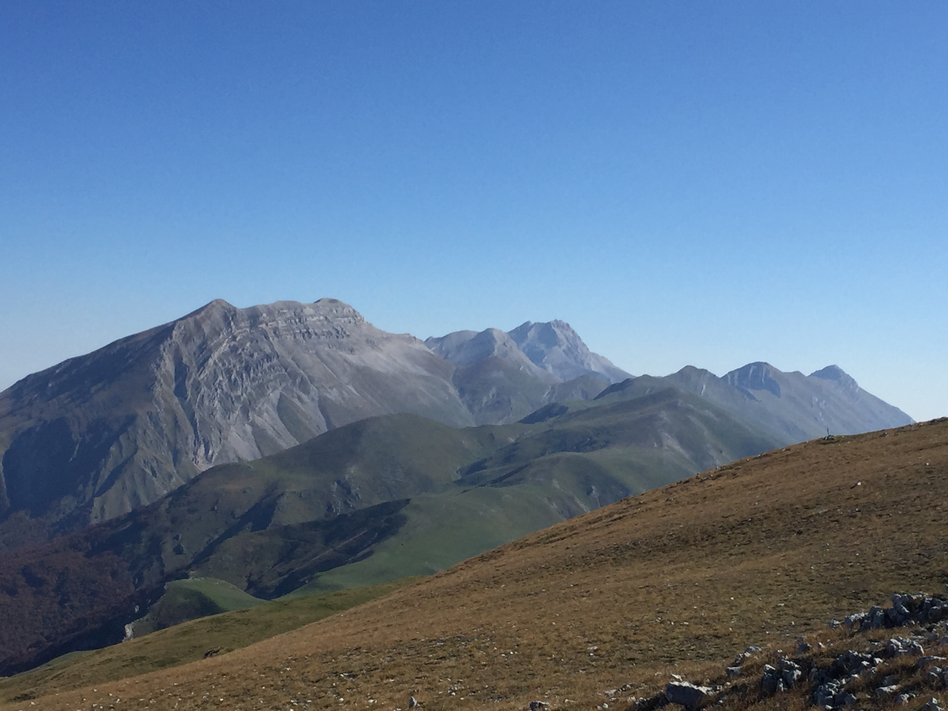
panorama dalla vetta con il Corno grande del Gran Sasso