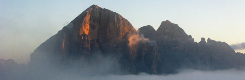
 L’Etna è il vulcano attivo più grande d’Europa; è, anzi un sistema vulcanico (non già semplicemente un “cono”), perché molti sono i crateri che non sono più attivi, su cui oggi si può camminare ma che in passato hanno eruttato. E la lava (ormai non più viva) è visibile, attraversabile, calpestabile; tutto è sassi, sabbia, cenere; silenzio interrotto dai rumori sordi (spesso anche “tuoni” un po’ inquietanti) del vulcano; nessuno intorno se non chi sale e la guida. Un luogo affascinante e misterioso; si è in montagna (anche per il clima, specie in inverno) ma si vede il mare; la gita inizia dal mare; salendo si è immersi in boschi di betulle, ma una natura via via più aspra e selvaggia; un’atmosfera surreale accompagna l’escursionista.
Etna is the largest active volcano in Europe; is indeed a volcanic system (and not simply a “cone “), because there are many craters that are no longer active, on which today you can walk but in the past have erupted. And the lava (no longer alive) is visible, crossed, walkable; everything is stones, sand, ash; silence broken by the muffled sounds ( often ” thunder ” a bit ‘ disturbing) of the volcano; no one around except those salt and driving. A fascinating and mysterious; you are in the mountains (also for the climate, especially in winter) but you can see the sea. The tour starts from the sea; climbing (walking) you are immersed in birch woods, but nature more and more rough and wild; a surreal atmosphere accompanies the hiker.
§ § §
Area: versante est dell’Etna (paesi di Milo e di Fornazzo – Rif. Citelli)
Percorso: Rifugio Citelli (1.736 m.) – Sentiero Serracozzo (con la Grotta) e Serra delle Concazze – Cresta Valle del Bove (2.250 m.) (gita per tutti; intera giornata con soste “didattiche”; 3 ore circa)
 -Si giunge al rifugio Citelli (dopo aver superato Zafferana, Milo e Fornazzo, seguendo una strada di 14 km. che incontra –e l’attarversa con alcuni tornanti- anche una grandissima colata lavica), dove si lascia l’automobile in ampio parcheggio;
– dal rifugio, dopo breve tratto a piedi scendendo sulla strada asfaltata, si imbocca sulla sinistra il sentiero n. 15.1 e si entra in un bosco di betulle, che sale verso la Serra delle Concazze;

-superati i ruderi di un antico ovile in pietra, ci si dirige in quota verso il Vallone Serracozzo; cambia il panorama: il bosco si dirada e su terreno nero e sassoso compaiono cactus tondeggianti. Il sentiero (che diviene poi n. 723) è segnato su sassi, ed anche con pali; attenzione però alla nebbia che spesso compare improvvisa e confonde il cammino.
")
") Nel Vallone si apre l’ingresso della Grotta di Serracozzo creata dalla colata lavica del 1971
Nel Vallone si apre l’ingresso della Grotta di Serracozzo creata dalla colata lavica del 1971 (quota 1.830 m.); nella grotta di scorrimento lavico si entra e si percorre comodamente (con torcia) tratto del cunicolo lavico;
-da qui si procede fino in fondo al vallone e si sale il ciglio della Serra fino ai 2.000 m., giungendo alla cresta che domina la Valle del Bove; si sale poi ancora fino ai 2.250 m. (sosta “panino”);
– si piega quindi sulla destra in discesa, fino a imboccare un canalone di soffice sabbia (un “sabbione”) che scende di 200 metri (si è sotto il Piz Deneri). La discesa è come quella che si fa in un ghiaione (anzi più comoda, perché la sabbia è più morbida); da farsi correndo e divertendosi. Il ghiaione è nero, interrotto da grandi “sfere” spinose, i cactus che soli crescono in quel luogo inospitale e che trattengono la sabbia lavica (abbiamo incontrato anche uno scheletro di capra…).


-da qui il sentiero continua a scendere e quindi torna a passare in mezzo al bosco; a quota 1.800 m. si congiunge con il sentiero della salita (poco prima dell’ovile); in dieci minuti si ritorna al Rifugio Citelli.
-non si può lasciare l’area se non si visitano i 6 crateri ormai spenti, teatro di un’eruzione alcuni anni fa; riprendendo l’automobile e scendendo sulla strada per un chilometro, circa, sulla sinistra comodo sentiero che consente un tour dei crateri (15 min. per salire su ciascuno di essi). 
Valutazioni: escursione effettuata il 16 novembre 2013, ed il vulcano era in attività. La notte precednte e successiva, trascorsa a Santa Maria alla Scala (proprio sotto ad Acireale), nella casa offerta dall’amico Piero, è caratterizzata dal rumore della risacca; poi una mattinata splendida, in un paesino che sembrava un quadro, solo con pochi pescatori.
Ci raccoglie la guida “Pippo” e ci conduce in macchina [l’accompagnamento delle guide è fortemente consigliato sia per il tempo sia per il sentiero sia per l’illustrazione anche naturalistica; a tal fine si suggerisce www.escursioneetna.it] – la strada (da Zafferana in poi) è coperta dalla sabbia vulcanica di pochi giorni prima e bisogna guidare con prudenza. Già dal Rifugio Cipelli si sente il respiro / brontolio / urlo del vulcano; come tuoni lontani e poi vicini e sempre più forti, circa ogni minuto …. E dell’intera giornata il tempo è stato ritmato dalla sua rumorosa presenza poiché si preparava per l’eruzione esplosiva del pomeriggio (siamo scesi giusto in tempo ….) di seguito ecco le foto serali e notturne (tratte dal sito web dell’INVG: www.ct.invg.it) – [Durata: 1.30/2 a salire (ma può durare di più se si visita la grotta e si è accompagnati da guida che illustra l’ambiente) e 1 h a scendere – dislivello in salita 580 m; l’escursione ai 6 crateri è a parte come tempistica – va ovviamente portata acqua e panini –
-Reach the Refuge Citelli (after passing town of Zafferana, Milo and Fornazzo, following a road of 14 km. that meets and cross a huge lava flow ), where you leave the car in large parking; – From the Refuge, after short walk down the paved road, turn left on the path n. 15.1 and you get into a birch forest, going up to the Serra of Concazze – passed the ruins of an ancient stone sheepfold, we head up towards the Vallone Serracozzo; change the view: the forest thins and black soil and rocky cactus appear rounded. The path (which then becomes no. 723) is marked on the stones, and also with poles; but attention to the fog that often appears suddenly and confuses the cammino. Nel Vallone is the entrance of the cave Serracozzo created by the lava flow of 1971 (altitude 1,830 m); in the cave of lava flow entering and walk comfortably (with torch) stretch of lava tunnel then bends to the right downhill, until you get into a gully of soft sand (a ” sandy soil”) that descends 200 meters (it is under the Piz Deneri). The descent is like that which is done in a scree (indeed more convenient, because the sand is softer); to do running and having fun. The scree is black, interrupted by big “balls” thorny cacti that grow only in that inhospitable place and that hold the lava sand (we also met a skeleton goat … -from here the trail continues to fall and then go back to in the woods, at an altitude of 1,800 m . it joins with the path of the climb (just before the sheepfold); in ten minutes you will return to Rifugio Citelli. -no one can leave the area if you do not visit the 6 extinct craters, the scene of an eruption a few years ago ; recovering the car and going on the road for a mile or so, the left easy path that allows a tour of the craters (15 min. to get on each of them).
Ratings: hike effected November 16, 2013 , and the volcano was active. The night before and later spent in Santa Maria alla Scala (right below Acireale), the house offered by hour friend Piero, is characterized by the sound of the surf ; then a beautiful morning, in a village that looked like a painting, with only a few fishermen. We collect the guide ” Pippo ” and leads us in the car [the accompaniment of the guides is strongly recommended both for time and for the path is for illustration also naturalistic ; to this end, it is suggested www.escursioneetna.it] – the road ( from Zafferana onwards) is covered by volcanic sand a few days before and we must drive carefully. Already from Rifugio Cipelli feels the breath / growl / scream of the volcano ; like distant thunder and then close and getting stronger , about every minute … . And the day the weather was punctuated by his noisy presence as he prepared for the explosive eruption of the afternoon ( we went down just in time …. ) below here are the pictures the evening and night ( taken from the website of ‘ InvG : www.ct.invg.it ) – [Duration : 1.30 / 2 to go up ( but can last longer if you visit the cave and it is accompanied by a guide that illustrates the environment) and one has come down – ascent 580 m ; the hike to the crater 6 is apart as timing – is obviously brought water and sandwiches]
")
; noi non avevamo attrezzatura per una foto del genere")