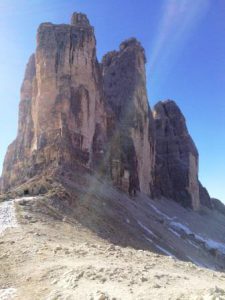
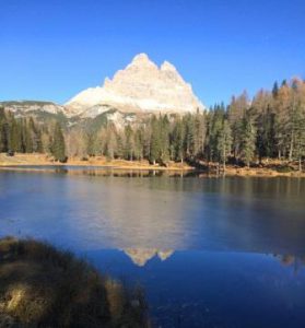
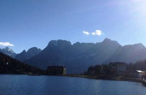
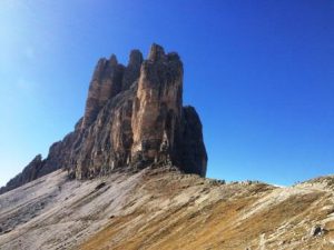
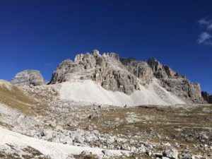
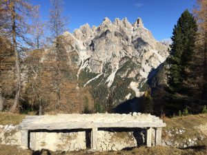
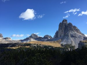
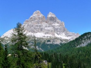
 Le magnifiche Tre Cime di Lavaredo, simbolo delle Dolomiti, patrimonio dell’umanità.
The magnificent Three Peaks, symbol of the Dolomites , a world heritage site
§ § §
Area: Tre Cime di Lavaredo – Giro delle Tre Cime [intera giornata – per tutti – quattro ore di cammino] whole day for everybody – four hours walk
Percorso:
– si giunge in macchina al lago di Misurina;
-si prosegue e si prende la strada apposita; si supera il lago di Antorno (m. 1.889, s.l.m.);
-poco dopo si paga il pedaggio, e con l’automobile si prosegue per una magifica strada fino al parcheggio, presso il Rif. Auronzo (m. 2.320);
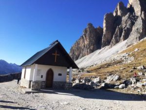
-si prende a questo punto a piedi il sent. 101, molto comodo, praticamente pianeggiante, che raggiunge una chiesetta a ricordo dei caduti della Grande Guerra;
-sulla sinistra del sentiero, poco prima della chiesetta (circa 300 m.), un grande masso cela un’orma di dinosauro (anzi due);
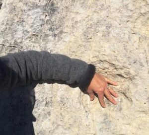
[orma di circa 30 cm. di dinosauro tridattilo, carnivoro, bipede, genere Eubrontes (“Dolomiti, atolli e lagune” di M.Wachtler, 2002)]
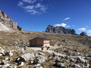
– in circa 30 min. dal Rif. Auronzo, si giunge al Rif. Lavaredo (m. 2.344, s.l.m.);
-da qui ci si può spingere sulla destra, passeggiando su tracce di sentiero sui prati che guardano verso la Croda de Toni
-oppure si sale verso la Forcella Lavaredo, proprio sotto le Tre Cime (10. min; m. 2454 s.l.m.); quindi si prosegue sui ghiaioni del Monte Paterno, in un anfitetatro e, restando sostanzialmente in quota si giunge –sempre per il sent. 101- al Rif. Locatelli (45 min.; m. 2.438 s.l.m.);
-si prende poi il sent. 105 [parte dell’Alta Via n. 4] che costeggia l’altro lato delle Tre Cime ed in uno splendido scenario, dopo oltre due ore, porta al Rif. Auronzo.
Valutazioni: Il Giro delle Tre Cime è magnifico ed adatto a tutti, unico specie nella parte finale, dove non c’è molta gente; un panorama mozzafiato, in una delle icone delle Dolomiti World Eritage. L’aspetto negativo è invece quello della grandissima affluenza nella parte tra Auronzo e Lavaredo; la gita è quindi sconsigliata nei periodi di festività ed invece suggerita fuori stagione [effettuata da ultimo il 3.11.17, fino alla Forcella Lavaredo; i rifugi erano chiusi].
Path:- Arrive by car to Misurina lake; continue and take the road appropriate; you exceed the lake Antorno and you pay the toll, going up to the parking under the Rif. Auronzo;-it takes at this point path n. 101, very comfortable, almost flat, that in about 30 min. leads to Ref. Lavaredo;- it continues to skirt the Three Peaks and reach for -always sent. 101, and always fairly level in about 45 min., the Rif. Locatelli;-it takes then path n. 105 [part of the Alta Via n. 4] that runs along the other side of the Three Peaks and beautiful scenery, after more than two hours, leads to Rif. Auronzo.
Ratings: The Tour of the Three Peaks is magnificent and suitable for all , the only species in the final part , where there is not a lot of people ; the downside is that instead of the great turnout at the between Auronzo and Lavaredo.
° ° °
Area: Tre Cime di Lavaredo – Paterno [intera giornata – quattro/cinque ore di cammino] whole day – four / five hours walk
Percorso:
-si giunge in macchina al lago di Misurina; si prosegue e si prende la strada apposita; si supera il lago di Antorno (m. 1.889, s.l.m.); poco dopo si paga il pedaggio, e con l’automobile si prosegue per una magnifica strada fino al parcheggio, presso il Rif. Auronzo (m. 2.320), dove si lascia la macchina;
-si prende a questo punto il sent. 101 (si veda la gita sopra descritta ove si descrive la chiesetta e le orme di dinosauro), molto comodo, praticamente pianeggiante, che in circa 30 min. porta al Rif. Lavaredo (m. 2.344, s.l.m.);
-si sale quindi alla Forcella Lavaredo, proprio sotto le Tre Cime (10. min; m. 2454 s.l.m.); quindi si prosegue sui ghiaioni del Monte Paterno, verso il Rifugio Locatelli;
-dopo circa 15 min. inizia la gita che si diversifica da quella sopra descritta: sulla destra del sentiero 101 ne parte altro che sale verso il Monte Paterno che va preso;
– il sentiero sale verso la cima del Monte (per circa 300 m. di dislivello) e, tra cengie e gallerie di guerra, porta anch’esso al Rif. Locatelli;
– da qui: o si torna per il sentiero 101 verso il Rif. Lavaredo e quindi il Rif. Auronzo Auronzo, o si prosegue con il giro delle Tre Cime sopra descritto.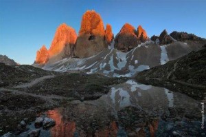
Valutazioni: Una bella variante sul Paterno, luogo di grandi battaglie, da effettuarsi anche con l’ausilio di set da ferrata.
Path: Arrive by car to Misurina lake; continue and take the road dedicated to the Three Peaks; you exceed the lake Antorno and you pay the toll, going to the parking lot under the Rif . Auronzo; – At this point you take the path n. 101, very comfortable, almost flat, that in about 30 min. leads to Ref . Lavaredo; – Continue to skirt the Three Peaks and after about 15 min. on the right you take the path towards the Monte Paterno; – The trail climbs to the summit (about 300 m. in altitude) and, between ledges and tunnels, leading to the Rif . Locatelli ; – From here the path back up all’Auronzo (path n. 101) – Ratings: A nice variation on Paterno, a place of great battles, to be carried out with the aid of via ferrata s
°°°
Croda dell’Arghena da Malga Rimbianco – tre ore e mezza -per tutti la prima parte; poi per più sicuri ed esperti; potrebbe essere necessario il set da ferrata – non ci sono rifugi nè acqua, solo la malga in partenza ed in arrivo (non consigliato nel periodo più frequentato di agosto, per la difficoltà di giungere all’imbocco della strada, per le molte auto che salgono alle Tee Cime).
– Si giunge in automobile fino alla strada per le Tre Cime; si supera il lago di Antorno (m. 1.889, s.l.m.); poco prima del pedaggio, si prende sulla sinistra una strada sterrata che porta alla Malga Rimbianco; qui si lascia l’automobile.
– dalla Malga (m. 1.844 s.l.m.) si accede a piedi alla strada asfaltata per le Tre Cime; si prende questa strada sulla sinistra a salire ma dopo circa dieci metri la si lascia e si prende un sentiero nel bosco, ancora sulla sinistra;
-si sale in maniera regolare nel bosco su comodo sentiero; acquistata quota, si incontra un bivio per il Col de Medo; si prosegue invece verso sinistra fino alla forcella de l’Arghena (m. 2.087 s.l.m.; 45 min. dalla Malga); trincee; il panorama si apre;
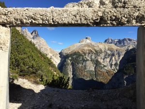
– si prosegue verso sinistra (sentiero su prato segnato da bastoni) lungo il sentiero che sale sulla costa, alternando tratti rocciosi, fino ad una postazione di guerra con una bella vista sui Tre Scarperi;
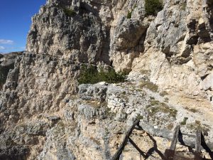
-continuare verso sinistra in salita, fino a raggiungere un ulteriore forcella ove c’è un bivio: i) a sinistra si giunge su una costa esposta con una corda fissa; ha un passaggio esposto dietro un vecchio ponte abbandonato (la fune è molla ed apparentemente non molto sicura); ii) a destra si sale per una breve salita a quattro mani di circa 8 metri; si raggiunge così la cima della Croda in pochi minuti (2.262 s.l.m.; 45 min. circa dalla forcella de l’Arghena); splendido panorama a 360 ° sulle Tre Cime, sul Cristallo, a Misurina … e oltre.
Discesa per lo stesso sentiero.
Valutazioni: bella passeggiata poco frequentata, alla scoperta di postazioni della grande guerra e di panorami magnifici (effettuata il 21.10.18)
safer and more experienced; you may need the via ferrata set – there are no shelters or water, only the departing and arriving hut. – You arrive by car up to the road to the Tre Cime; just before the toll on the left a dirt road leads to the Malga Rimbianco; here you leave the car. – from Malga (1,844 m above sea level), it is possible to reach the paved road on foot for the Tre Cime; take this road on the left to go up but after about ten meters you leave it and take a path in the woods on the left; – you ascend in a regular way in the woods on an easy path; purchased altitude, there is a junction for the Col de Medo; continue instead to the left up to the fork of the Arghena (m 2.087 s.l.m.); trenches; the panorama opens; – Continue to the left (path marked by sticks) along the path that goes up the coast, alternating rocky slopes, up to a position with a nice view of the Tre Scarperi; continue until you reach a further fork. A junction: i) to the left leads to a coast exposed with a fixed rope with a passage behind an old abandoned bridge (the spring rope was apparently not very safe; has advised against the passage); ii) to the right you go up a very short four-hand climb of about 8 meters, and then you reach the summit of the Croda that can be reached in a few minutes (2.262 m.l.m.); splendid 360 ° panorama to the Tre Cime, Cristallo, Misurina … and beyond. Descent by the same path – Evaluations: beautiful walk not very frequented, to discover the post of the great war and magnificent panoramas (carried out on 21.10.18)
°°°
Malga Rimbianco – Val de Rimbianco – Val della Rienza – passeggiata per tutti; due ore circa; nel bosco; si giunge ad un ristorante sulla strada per Dobbiaco
-Si giunge in automobile fino alla strada per le Tre Cime; si supera il lago di Antorno (m. 1.889, s.l.m.); poco prima del pedaggio, si prende sulla sinistra una strada sterrata che porta alla Malga Rimbianco; qui, al primo dei due parcheggi, si lascia l’automobile.
– poco prima della Malga (m. 1.844 s.l.m.), dal parcheggio, si diparte il sentiero n. 108 che scende dolcemente nel bosco tra il Monte Piana, da un lato, e la Croda dell’Arghena e il Sasso Gemello dall’altro, per la Val de Rimbianco; il sentiero segue il rio de Rimbianco;
– nella parte finale della valle, il sentiero sale leggermente e diventa un pochino più scosceso; poi scende nella valle della Rienza (1 ora);
-si attraversa la Rienza e si scende poi su sentiero (n. 102) ampio verso il Tre Cime Block (poco dopo il lago di Landro; 45 min. m. 1.400 s.l.m.) [effettuata il 24.8.19]
Passeggiata poco frequentata, natura incontaminata.
You arrive by car up to the road to the Tre Cime; go past the Antorno lake (1,889 m, s.l.m.); just before the toll, take a dirt road on the left that leads to the Malga Rimbianco; here, at the first of the two parking lots, you leave the car.- just before the Malga (1,844 m asl), the path n. 108 which leaves gently in the woods between Monte Piana, on one side, and Croda dell’Arghena and Sasso Gemello on the other, for Val de Rimbianco; the trail follows the Rimbianco stream;- in the final part of the valley, the path rises slightly and becomes a little bit more steep; then leaves in the Rienza valley (1 hour); – cross the Rienza and then find yourself on the path (n. 102) wide towards the Tre Cime Block (shortly after the Landro lake; 45 min. 1,400 m. l.m.) [inserted on 24.8.19]

