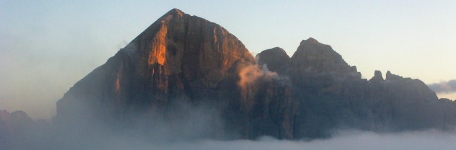
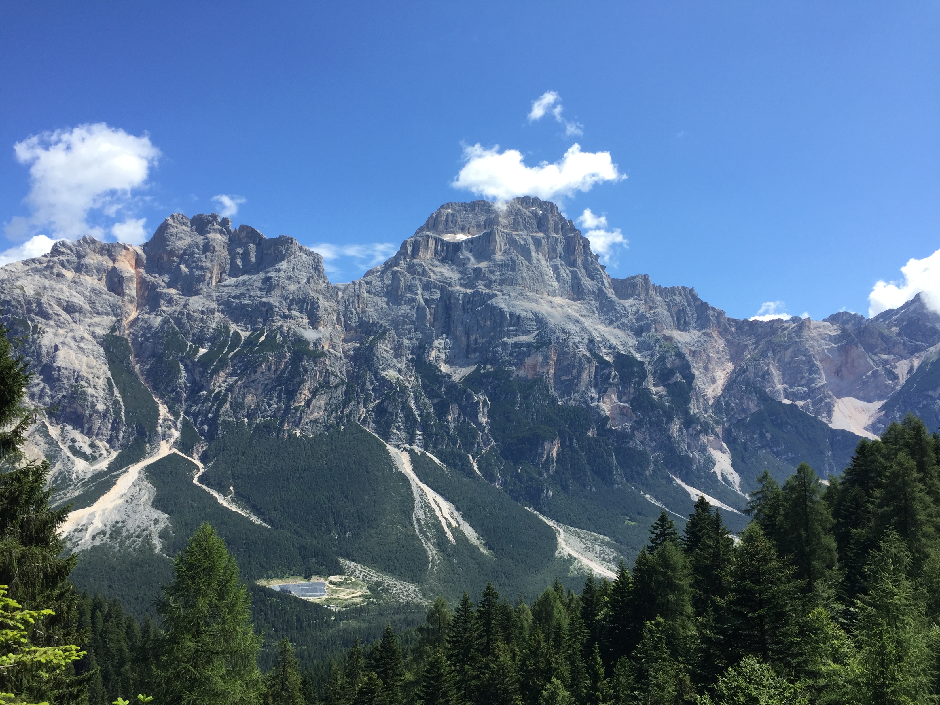
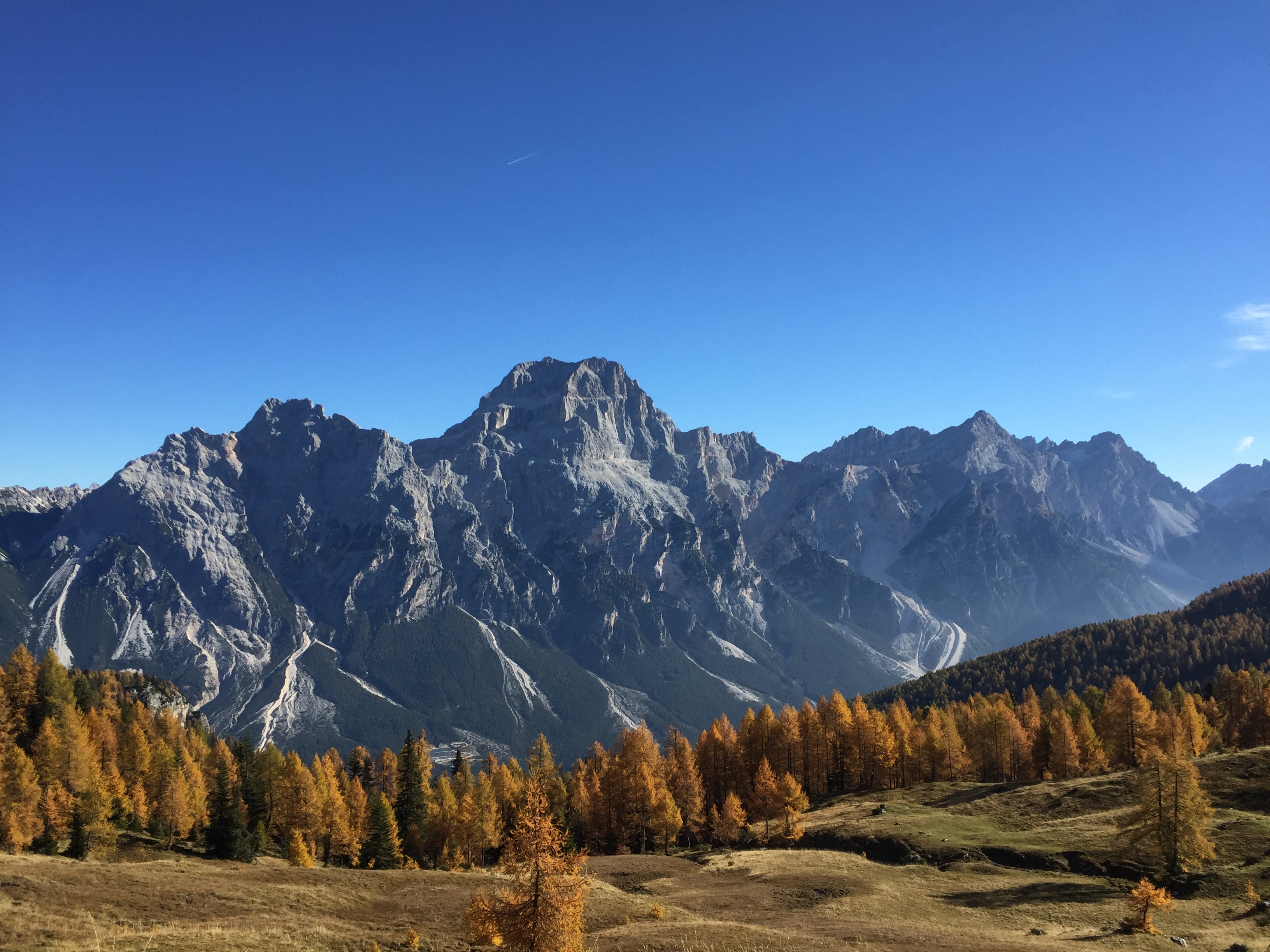
 La Croda da Lago è uno dei monti imperdibili dell’area Ampezzana e le sue gite sono per tutti. Nella zona sono anche compresi il Becco di Mezzodì, i Lastoni di Formin, il Becco d’Ajal, le cui gite sono per più esperti. La Croda da Lago per la sua collocazione geografica ha delle connessioni con le aree del Passo Giau e di Pocol. Meno battuta è l’area delle Rocchette, che precedono la Croda venendo da San Vito
Croda da Lago is one of the mountains of the area d’Amepzzo and his trips are for everyone. In the area are also including il Becco di Mezzodì , the Lastoni Formin , the Becco d’Ajal , whose trips are for more experienced. Croda da Lago for its geographical location has connections with the areas of the Passo Giau and Pocol.
§ § §
Area: Croda da Lago: Pianozes – Malga Federa e Gores de Federa – (prosecuzione per Croda da Lago) [gita per tutti – i tempi variano a seconda delle opzioni seguite: da 30 min. a cinque ore]
Percorso:
– si giunge in automobile a Campo di Sotto; si segue la segnaletica per il Lago di Pianozes; si prosegue superando il bivio per il Lago fino ad un primo grande parcheggio sulla destra (che si individua per la segnaletica stradale), ove partono anche le jeep per la salita ai rifugi, oppure, proseguendo, fino ad un secondo più piccolo parcheggio; da qui si prosegue a piedi (o in taxi-jeep)
– si segue quindi il sent. 432, tutto carrozzabile, che può essere seguito più o meno a lungo, così da effettuare una gita più o meno faticosa a seconda dell’obbiettivo finale; il ritorno è comunque per lo stesso sentiero:
i) dal bivio prima del parcheggio seguendo il sent. 432, con poca fatica e con circa 15 min., si giunge al Rif. Pianozes (m. 1.181 s.l.m.) che si affaccia sul Lago omonimo;
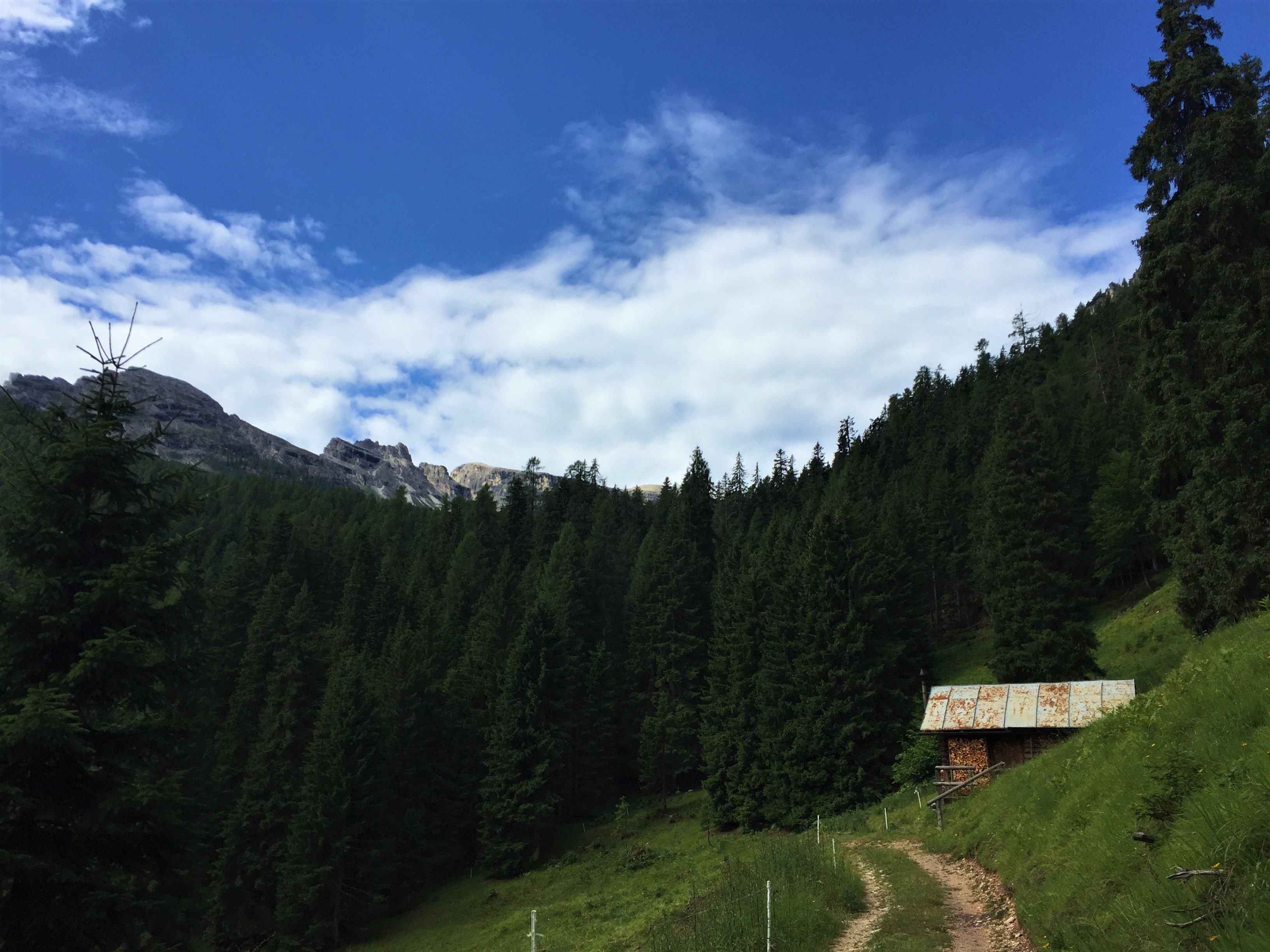
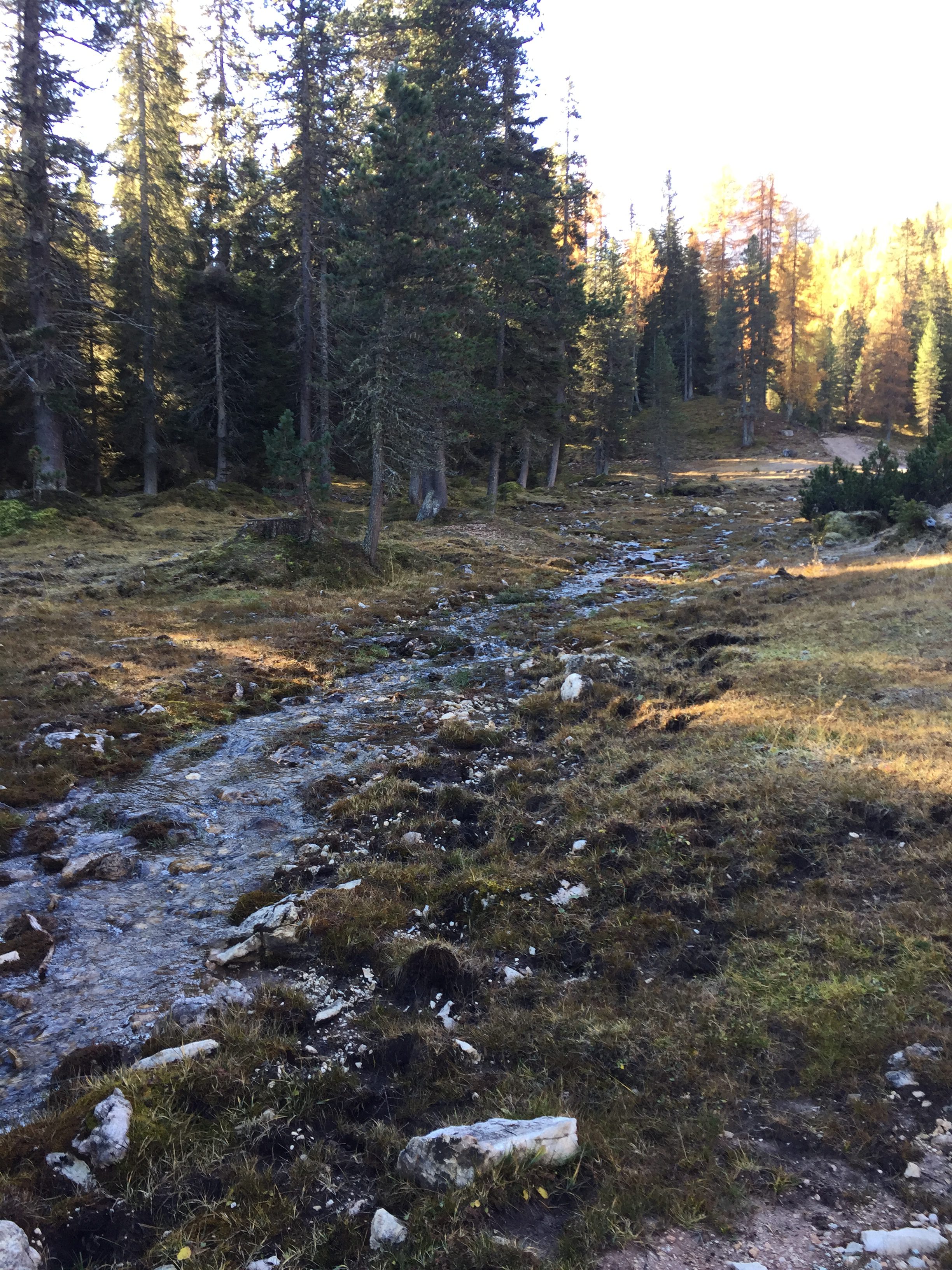
ii) proseguendo il sent. 432 (tutto asfaltato e carrozzabile, ma nel bel bosco) dal Rif. Pianozes, si giunge a Ponte Federa (m. 1.603 s.l.m. – 1,5 h; 450 m. di dislivello) dove si può fare un pic nic, nel bosco e con il rio de Federa accanto;
iii -a) proseguendo ancora per lo stesso sentiero asfaltato si giunge alla Malga Federa (m. 1.816 s.l.m. – altri 30/45 min. e 200 m. di dislivello), la prima vera meta per una gita, un rifugio dove si può mangiare e bere godendo il panorama del Becco di Mezzodì, su prati di alta quota;

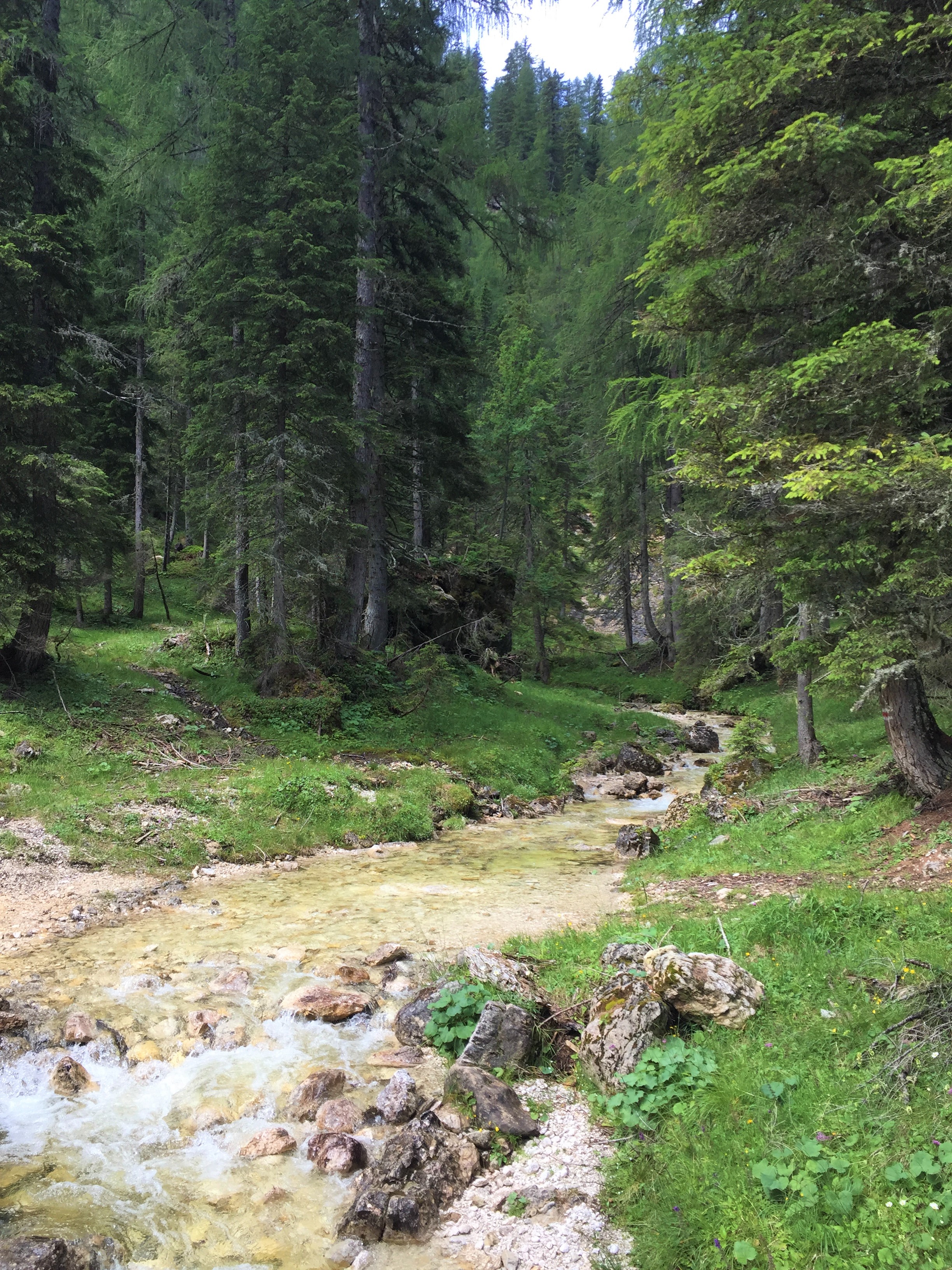
iii – b) dal ponte Federa, e sempre per raggiungere la Malga, si può prendere, sulla destra, un sentiero nel bosco, denominato Gores de Federa; una salita di circa 45 min. che entra in forre, attraversa con più ponticelli il rio, supera tante cascate … molto piacevole e di soddisfazione.
iii-c) nell’agosto 2020 il sentiero delle Grotes de Federa è stato prolungato nella parte bassa; e dal sentiero asfaltato, ben prima del Ponte de Federa ed in più punti si può entrare nel bosco (da Bariza in cu; m. 1280 slm oppure dal Pian de legname m. 15117 slm) prendendo (sempre salendo) sentieri sulla sinistra.
Il sentiero delle Gores presenta anche una variante facoltativa attrezzata (bivio “sentiero facile” o “sentiero attrezzato”); che necessita di una sicura presa e di attrezzatura adeguata; si passa a pochi metri dal rio, tenendosi su alcuni scalini fissi (ed altri appigli da trovare) per una ventina di metri di piacevoli passaggi; si necessita di passo sicuro e di entrambe le mani per tenersi.
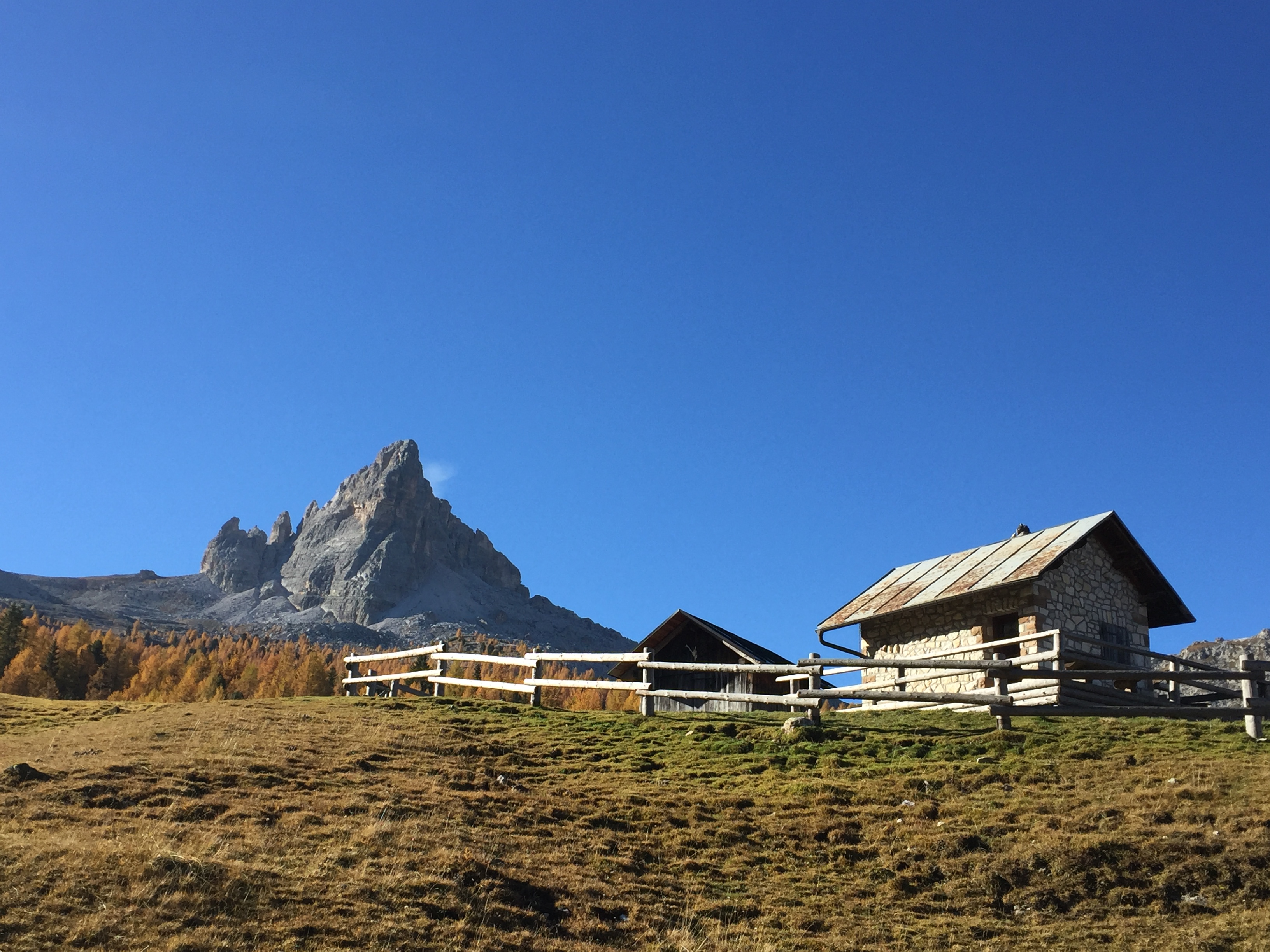
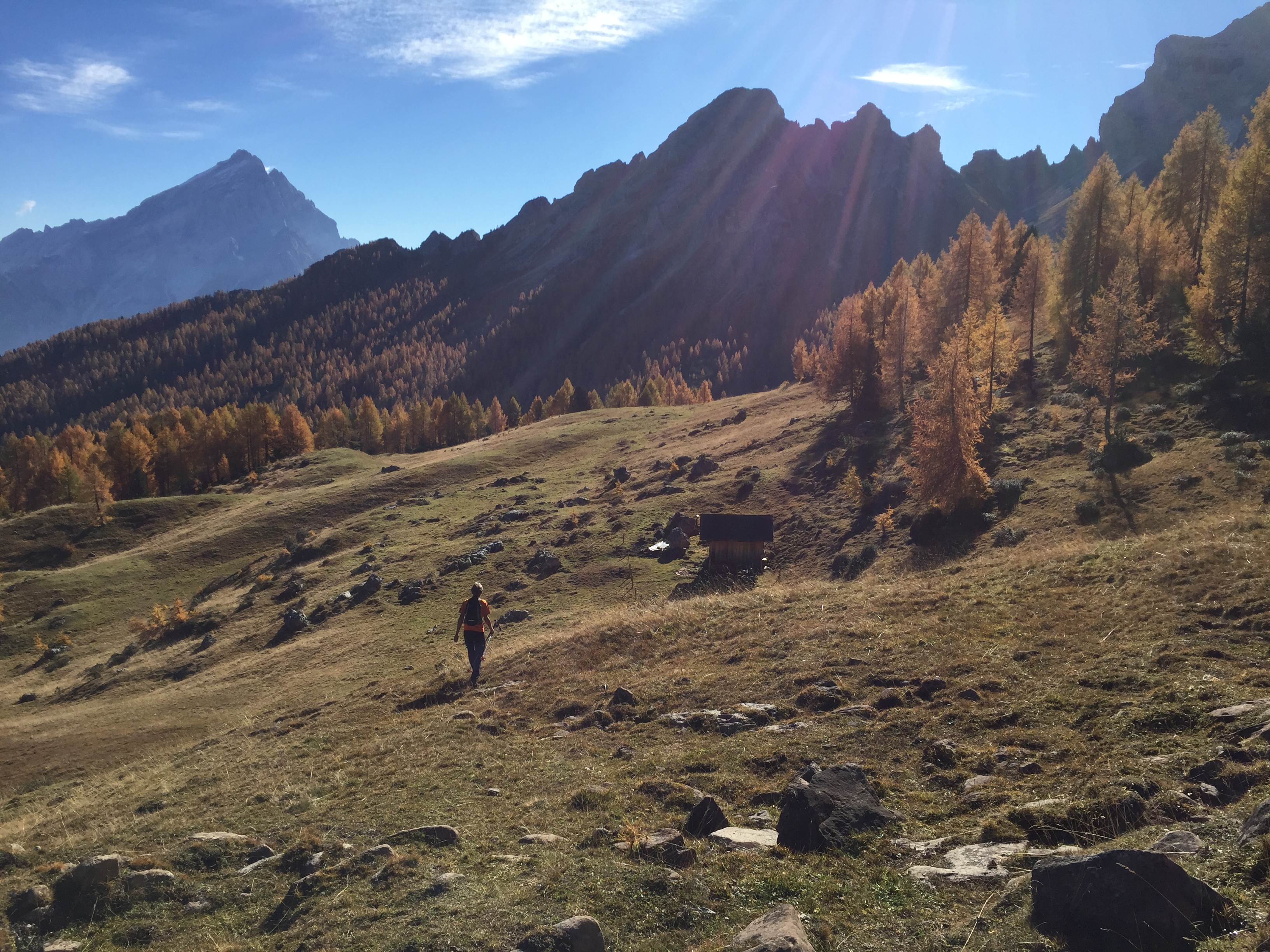
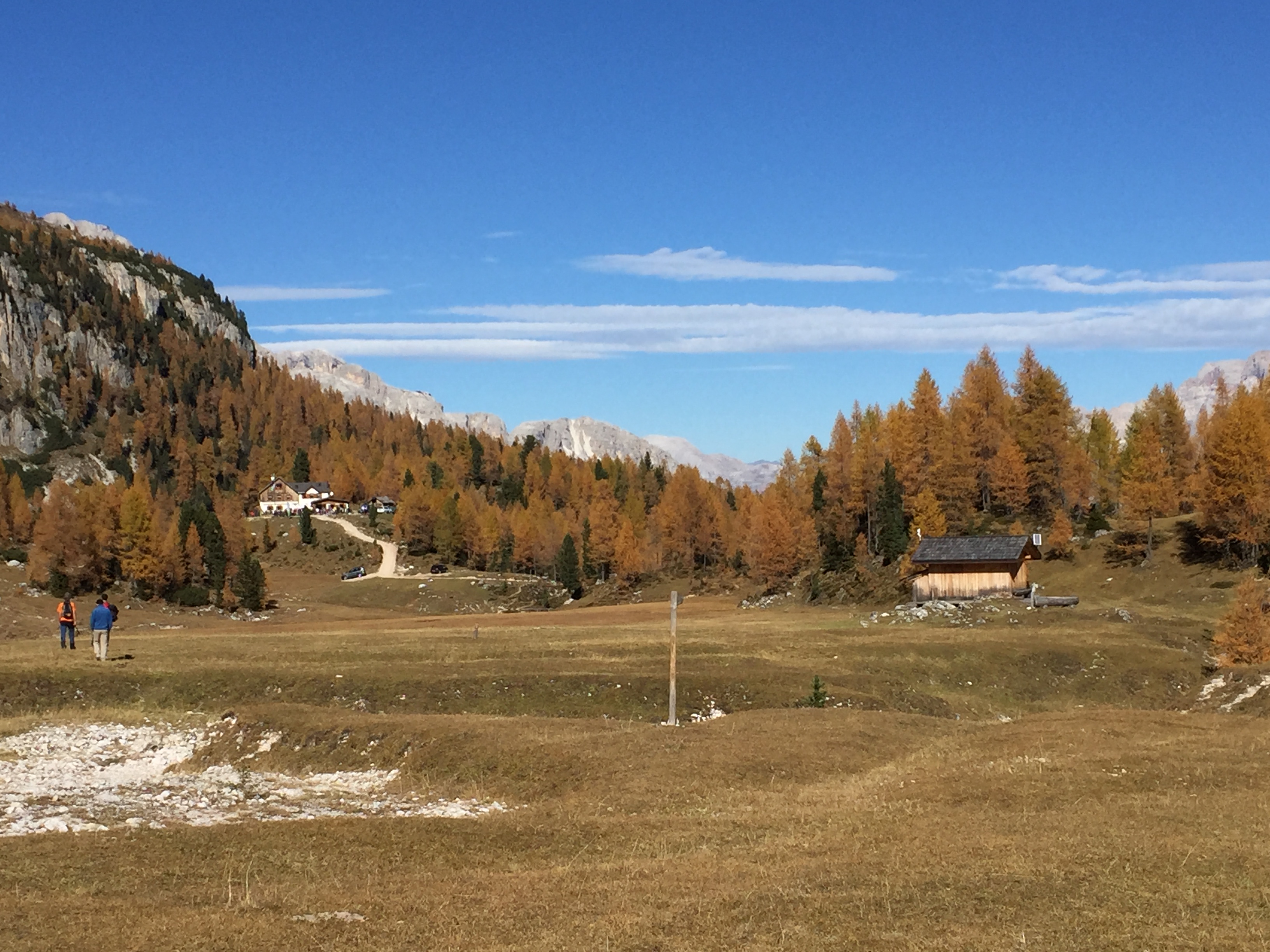
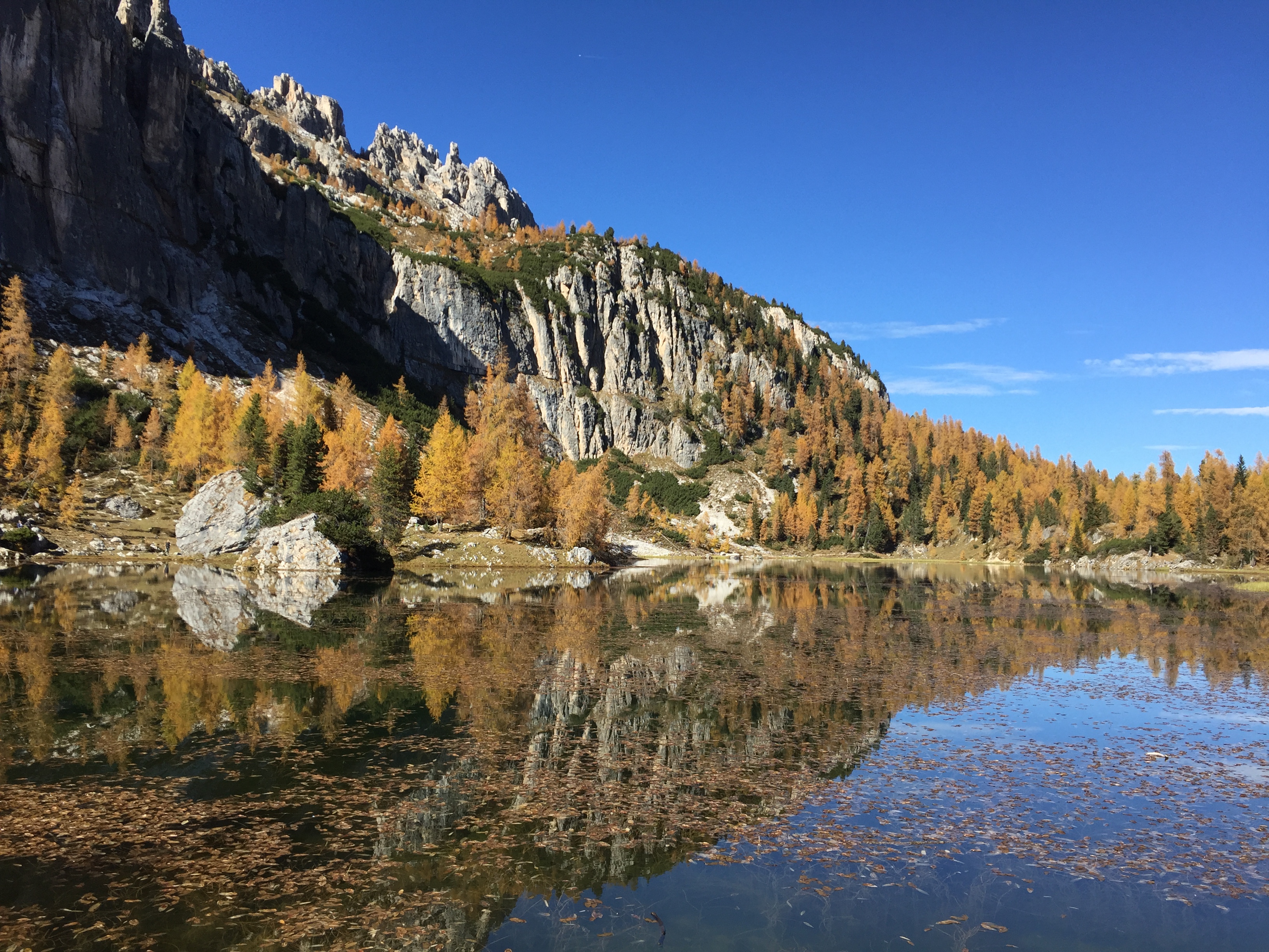
iv) dalla Malga Federa si prosegue ancora il sent. 432 e si giunge fino alla Croda da Lago, Rif. Palmieri che si affaccia sul Lago da Lago o Federa (m. 2.046 s.l.m – 1 h, altri 200 m. di dislivello).
Valutazioni: Passeggiata tranquilla e rilassante, che diventa via via, a seconda delle opzioni, un po’ più impegnativa – i) al Lago Pianozes ci si può fermare a pescare (con divertimento dei bimbi), rimanendo anche in attesa di altri componenti del gruppo che volessero proseguire la passeggiata; ; – ii) – iii -a ) la prosecuzione del sentiero alla malga Federa su strada carrozzabile, porta alla malga su prati e un buon conforto [effettuata il 13.8.13]; – iii b) la salita nel bosco, in mezzo ad una natura ancora incontaminata con tanta acqua, cascate, e piccoli canyons è molto bella; adatta a tutti [effettuata il 10.8.19]; iii – c) piacevole ma la breve variante per esperti necessita di un minimo di capacità di arrampicata (effettuata 21.8.20); c1) effettuata tutta in discesa da Malga Federa con la variante attrezzata il 23.8.25 (2,15 h di percorso); iv) l’arrivo al Lago da Lago (o Federa) ed al Rif. Palmieri offre una vista magnifica e rappresenta una delle mete più classiche dell’area, in effetti da non perdere [effettuata l’11.8.06] – E’ zona dove piove facilmente se il maltempo viene dalla valle.
Is reached by car in Campo di Sotto;Follow the signs for Lake Pianozes; continue past the junction for the lake until you reach a first large parking lot on the right (which is identified by the road signs), where jeeps also depart for the climb to the refuges, or continue until you reach a second, smaller parking lot; from here, continue on foot.– Follows then sent. 432 , all the carriage , which can be followed more or less long , so to make a trip more or less laborious depending on the final lens ; the return is still the same path : i) following path . 432 , with little effort and with about 15 min . , Get to the Rif . Pianozes overlooking the lake of the same name ; ii ) continuing sent. 432 (all paved and road to the jeep , but in the beautiful forest ) from Ref . Pianozes , you reach Ponte Federa ( 1.5 h ; 450 m . In altitude ) where you can have a picnic in the woods and the river de Federa next ; iii -a) still continuing along the same path you come to the Malga Federa ( other 30/45 min . and 200 m . in altitude) , the first true destination for a day trip , a haven where you can eat and drink while enjoying the view of the spout noon, on the lawns of high altitude iii -b rom the Federa bridge, and still to reach the Malga, it is now possible to take, on the right, a path in the woods, called Gores de Federa; a climb of about 45 min. that enters the gorges, crosses the rio through 5 small bridges, passes many waterfalls … very pleasant and satisfying.; iii-c) in August 2020 the path of the Grotes de Federa was extended in the lower part; therefore it starts from Pian de legname and goes – on the left going up the main path – into the woods. Well arranged, with steps that allow you to overcome parts in altitude leads to the path. 432 just before the Federa bridge. The path has an optional equipped variant, which requires a safe grip and adequate equipment; you pass a few meters from the river, keeping to some fixed steps (and other holds to be found) for about twenty meters of pleasant passages; iv) continue still sent. 432 and you come up to the Croda da Lago , Ref . Palmieri overlooking the lake by lake or pillowcase ( 1 h , a further 200 m . Altitude) is reached by car in Campo di Sotto , and park at the trailhead for Lake Pianozes (which is identified for road signs).
Ratings: Walk quiet and relaxing , which becomes gradually , depending on the options , a bit ‘ more challenging – i) to Lake Pianozes you can stop to fish ( with entertainment of children ) , remaining also waiting for other members of the group who want to continue the walk ; – ii) – iii -a) the continuation of the path to the Federa hut on a carriage road today mostly asphalted, leading to the hut on meadows and good comfort [carried out on 13.8.13]; – iii b) the climb in the woods, in the middle of a still uncontaminated nature with lots of water, waterfalls, and small canyons is very beautiful; suitable for everyone [performed on 10.8.19]; iii – c) pleasant but the short variant requires a minimum of climbing ability; the use of rope and harness is always recommended; (carried out 21.8.20) iv) the arrival at Lago da Lago (or Federa) and at the Palmieri Refuge offers a magnificent view and represents one of the most classic destinations in the area, in fact not to be missed [carried out on 11.8. 06] – It is an area where it rains easily if bad weather comes from the valley
§ § §
") Area: Croda da Lago (intera giornata – per tutti – quattro / cinque ore di cammino)
Area: Croda da Lago (intera giornata – per tutti – quattro / cinque ore di cammino)
Percorso:
– la partenza della gita può avere tre attacchi diversi:
i) da Ponte Ru Curto (= strada del passo Giau a 1.703 m. s.l.m.), si lascia la macchina e si percorre il sent. 437 che sale nel bel bosco (180 m. di dislivello), fino ad incrociare il sent. 434, che si prende continuando a salire (all’arrivo in Croda, complessivi 380 m. di dislivello e 2,5 h);
ii) da Ponte Peziè de Parù (= strada del passo Giau a 1.506 m. s.l.m.), si lascia la macchina e si percorre il sent. 434 che sale nel bel bosco (380 m. di dislivello; oltre la metà del percorso è su strada carrozzabile), fino ad incrociare il sent. 437; si prosegue per il sent. 434, continuando a salire (all’arrivo in Croda complessivi 580 m. di dislivello; 2,5 h);
iii) la partenza può anche avvenire dal lago d’Ajal (m. 1.412 s.l.m.), cui si giunge in automobile e dove si parcheggia; da qui si sale per il sent. 431 (all’arrivo in Croda complessivi 600 m. di dislivello; 3 h) e si veda gita precedente;
-si giunge così al Rif. Palmieri (m. 2.046 s.l.m.) della Croda da Lago;
-il ritorno per lo stesso sentiero.
Valutazioni: Un classico da non perdere: salita in mezzo al bosco, ed arrivo al Rifugio della Croda da Lago, proprio sul Lago da Lago, con panorama sotto la Croda e dinanzi al Becco di Mezzodì, veramente molto bello – E’ zona dove piove facilmente se il maltempo viene dalla valle [effettuata 14.8.96, da Rio Curto: 2,15 andata e 2h al ritorno].
path: – The start of the trip may have three different attacks : i) from Ponte Ru Curto ( = pass road Giau at 1,703 meters above sea level ) , you leave the car and walk along the path n . 437 rising in the beautiful forest ( 180 m . In altitude ) , until you cross the path n . 434 , who takes continuing to rise ( arrival at Croda , totaling 380 m . In altitude and 2.5 h ) ; ii ) from Ponte de Peziè Parù ( = pass road Giau at 1,506 meters above sea level ) , you leave the car and walk along the path n . 434 rooms in the beautiful forest ( 380 m . In altitude , over half of the route is on paved road ) , until you cross the path n . 437 ; continue along the path n . 434 , continuing to rise ( arrival at Croda totaling 580 m . In altitude ; 2.5 h ) ; iii ) the start can also occur from Lake Ajal , which is reached by car and where you park ; from here you climb to the felt . 431 ( arrival at Croda totaling 600 m . In altitude ; 3 h ) ; -you thus comes to Ref . Palmieri Croda da Lago ; -the return by the same route –
Ratings: A classic not to be missed : climb through the woods , and arrive at Rifugio Croda da Lago , right on Lake by Lake , with views under the Croda and before the Becco di Mezzodì , really very nice – It s area where it rains easily if the bad weather comes from the valley [ 14/08/96 performed , from Rio Curto : 2.15 round- 2h to return ] .
§ § §
Area: Giro della Croda da Lago (Becco di Mezzodì e Lastoi di Formin – intera giornata – sei / sette ore di cammino)
Percorso:
-la partenza della gita avviene dalla strada del Passo Giau e precisamente da Ponte Ru Curto (= strada del passo Giau a 1.703 m. s.l.m.), dove si lascia la macchina e si percorre il sent. 437 che sale nel bel bosco (180 m. di dislivello), fino ad incrociare il sent. 434, che si prende continuando a salire;
-si giunge così al Rif. Croda da Lago (m. 2.046 s.l.m. – altri 200 m. di dislivello; 2,15 h);
 -si prosegue poi con sent. 434, costeggiando il Lago, in quota, per giungere con comodo sentiero in moderata salita in prossimità del Becco di Mezzodì, alla Forcella Ambrizzola (m. 2.277 s.l.m. – 200 m. di dislivello in salita; 45 min.);
-da qui si prende a destra il sent. 436 (che porta al Passo Giau) per un breve tratto, lasciandolo per il sent. 435, sulla destra
-il sentiero 435 si sviluppa proprio sotto la Croda e la segue in quota; il sentiero sale (possibile deviazione a destra verso Forcella Rossa -m. 2.331 s.l.m.- che per tracce di sentiero riporta sul sentiero 434, e quindi al Palmieri) e quindi alla Forcella de Formin (m. 2.462 s.l.m.; 45 min/1 h);
-si prosegue ancora sul sentiero 435, che porta alla base dei Lastoi de Formin, sempre con a destra la Croda [alcune tracce di sentiero con ometti portano alla cima; m. 2657 s.l.m.; per chi volesse bel panorama e scorci];
-il sentiero scende, via via in modo più ripido -anche in frana- per la Val de Formin e entra nel bosco fino a ricongiungersi con il sent. 434 (1 h);
-subito dopo aver preso –sempre verso valle- il sent. 434, si giri a sin. per il 437 e si giunge comodamente così a Ponte Ru Curto (30 min.; dopo aver perso, dalla forcella Formin, circa 700 di dislivello).
Valutazioni: Una bellissima gita che porta alla Croda (un classico da non perdere), dopo la salita in mezzo al bosco, ed arrivo al Rifugio della Croda da Lago, proprio sul Lago da Lago, con panorama sotto la Croda e dinanzi al Becco di Mezzodì, veramente molto bello – Ma prosegue sotto al Becco ma soprattutto sui Lastoni di Formin, dove c’è poca gente e dove la conformazione delle rocce (un tempo fondo marino) e l’atmosfera surreale lascia di stucco – E’ zona dove piove facilmente se il maltempo viene dalla valle [effettuata 9.8.82].
path: -the start of the tour takes place from the road of the Passo Giau and precisely from Ponte Ru Curto ( = pass road Giau at 1,703 meters above sea level ) , where you leave the car and walk along the path n . 437 rising in the beautiful forest ( 180 m . In altitude ) , until you cross the path n . 434 , who takes continuing to rise ; -you thus comes to Ref . Croda da Lago ( another 200 m . in altitude ; 2.15 h ) ; -you continues with sent. 434 , along Lake in proportion to arrive near the spout south, the Forcella Ambrizzola ( 200 m . Of altitude difference ; 45 min . ) ; -from here you take the right path no . 436 ( to Passo Giau ) for a short distance , leaving it to the felt . 435 , on the right , which develops just below the Croda and follows in proportion , then climbing to the Red Fork and then to the Forcella de Formin ( 200 m . Of altitude difference dall’Ambrizzola and 1.5 / 2 h ) ; -you still continues on the path 435 , which crosses the Lastoni de Formin , always with the right Croda ( 1 h ) ; -the trail descends gradually more steep , and left the Lastoni enter the forest to rejoin the felt . 434 ( 1 h ) ; -once taking -always towards the Valle- sent. 434 , you turn right . for the 437 and you ‘ll come to Ponte Ru Curto ( 30 min .; after losing , from the fork Formin , about 700 in altitude ) .
Ratings: A beautiful trip that leads to Croda ( a classic not to be missed ) , after the climb through the woods , and arrive at Rifugio Croda da Lago , right on Lake by Lake , with views under the Croda and before the spout noon, really very nice – However, he goes under the Beak but especially on Lastoni Formin , where there is nobody and where the shape of the rocks and the atmosphere stunned – Area where it rains easily if the bad weather comes from valley [carried 08/09/82]
§ § §
Area: Giau / Croda da Lago / Lastoni di Formin (intera giornata – cinque/sei ore di cammino)
Percorso:
– si lascia una macchina a Ponte Ru Curto (= strada del Passo Giau a 1.703 m. s.l.m.), e si prosegue –con le altre macchine- per il Passo Giau, dove si parcheggia;
 – ci si dirige in direzione Croda da Lago per sent. 436;
– si giunge alla forcella de Zonia ed ancora proseguendo alla forcella de Col Piombin (m. 2.239 s.l.m.);
– si segue sempre il sent. 436, scendendo e risalendo in un anfiteatro popolato da marmotte, su ripido pendio finale sino alla forcella Giau (fin qui 1 – 1,5 h);
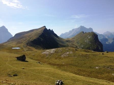
– si prosegue per il 436 in un magnifico anfiteatro di verdi prati e ruscelli, con il Mondeval sulla destra; si prosegue [possibile deviazione verso l’avvallamento alla sepoltura mesolitica ove è stato rinvenuto il c.d. “uomo di Mondeval”] verso la forcella Ambrizzola, costeggiando i Lastoi di Formin (45 min. / 1 h);
 -qui due possibilità che riprendono le gite sopra descritte:
1.si giunge con breve salita, alla Forcella Ambrizzola (m. 2.277 s.l.m. – 1 h), proprio sotto il Becco di Mezzodì;
 – da qui una discesa graduale costeggiando la Croda da Lago, si giunge al Rif. Palmieri (m. 2.046 s.l.m. – 45 min.);
– dal Palmieri si prende il sent. 434 che, dopo un tratto in piano, scende in modo piuttosto ripido, fino ad arrivare al trivio con il sent. 437 (e 435; vedi 2, sotto)
2. prima della forcella Ambrizzola, un bivio sulla sinistra fa prendere il sentiero 435 che sale (possibile deviazione a destra verso Forcella Rossa -m. 2.331 s.l.m.- che per tracce di sentiero riporta sul sentiero 434, e quindi al Palmieri) in modo ripido fino alla Forcella de Formin (m. 2.462 s.l.m. e 45 min./1 h) alla base dei Lastoi de Formin [alcune tracce di sentiero con ometti portano alla cima; m. 2.657 s.l.m.; per chi volesse bel panorama e scorci];
-il sentiero 435 poi prosegue in discesa costeggiando i Lastoi e su quello che forse u tempo era fondo marino (molti fossili per chi ha occhi esperti); via via il sentiero è più ripido -anche con alcuni passaggi in frana su sassaia – discende la Val de Formin e entra nel bosco fino a raggiungere il trivio con il sent. 434 (vedi 1, sopra) e 437 (1,5 h; m. 1.885 s.l.m.);
parte finale comune al trivio si prenda il sent. 434 che scende ancora nel bosco (180 m. di dislivello), per giungere in mezzora a Rio Curto (m. 1.703 s.l.m.), dove si era lasciata una macchina, e dunque alla fine della gita
Valutazioni: Una bellissima gita che dal Giau porta alla Croda da Lago, facendoci ammirare i Lastoni di Formin e il Becco di Mezzodì, con panorami suggestivi e magifici – La discesa su Rio Curto è molto ripida e se è piovuto, sdrucciolevole [effettuate: la variante 1 il 20.8.12; la variante 2 il 26.8.17].
path: – You leave a car in Bridge Ru Curto ( = Giau Pass Road at 1,703 m above sea level ) , and continue -with other macchine- to Passo Giau , where you park we head towards Croda da Lago sent. 436 ; – you reach the Forcella of Zonia and continue on to the Forcella Col Piombin (2,239 m); – you always follow the path 436, descending and descending into an amphitheater populated by marmots, on a steep final slope to the Forcella Giau (here 1 – 1.5 h); – continue on n. 436 in a magnificent amphitheater of green meadows and streams, with the Mondeval on the right; continue [possible deviation towards the descent to the mesolithic burial where the c.d. “Mondeval man”] towards the Ambrizzola fork, crossing the Lastoi de Formin (45 min / 1 h); -now two options that resume the tours described above: 1. arrive at a short climb to Forcella Ambrizzola (m. 2,277 s.l.m. – 1h) just below the Becco di Mezzodì; from here a gradual descent along the Croda da Lago, you reach the Rif. Palmieri (m. 2,046 s.l.m. – 45 min.); – takes the path 434 which, after a stretch of plan, goes down quite steeply, until it reaches the trivial with the sent. 437 (and 435; see 2, below); 2. before the fork of Ambrizzola, a junction on the left takes the path 435 which rises (possible deviation to the right towards Forcella Red – m. 2,331 m – trail marks on path 434, and then to Palmieri) steeply up to Forcella de Formin (2,462 m above sea level and 45 min./h) at the base of the Lastoi de Formin [some trails of path with stones -one over the other- lead to the top; m. 2,657 s.l.m .; for those who like beautiful panoramas and glimpses]; -the path 435 then goes downhill along the Lastoi and on what was perhaps the sea bottom (many fossils for those who have expert eyes); The path is steeper along the way – with a few landscaped passages on the slope – descends the Val de Formin and enters the forest until it reaches the trivial with the sent. 434 (see 1, above) and 437 (1.5 h; m. 1,885 s.l.m.); Final part common to the trivial take the sent. 434 which goes down into the woods (180 m slope), to reach halfway through Rio Curto (1,703 m), where he left a car, and at the end of the trip: A beautiful trip that leads to the Giau Croda da Lago, making us admire the Lastoni Formin and Beak of Mezzodì – The descent of Rio Curto should be slippery [carried n. 1 on 20.8 .12; n. 2 on 27.8.17 ] .
§ § §
Area: Croda da Lago – Becco d’Ajal [1/2 giornata – tre ore di cammino]")
Percorso:
-si giunge al lago d’Ajal m. 1.412 s.l.m. (o direttamente in automobile oppure a piedi parcheggiando sulla strada per Pocol e passando per la diga Ciou del Conte – vedi), dove si parcheggia e si prende il sent. 431 verso la Croda da Lago;
– superato il Cason del Macaron (m. 1.486 s.l.m.) 15 min., si prosegue nel bosco per sentiero ripido; a m. 1835 s.l.m. (Ra Forzela), dopo circa 1 ora di salita, si prenda deviazione verso destra per il Becco d’Ajal (“per esperti”);
-si arriva in vetta (m. 1.845 s.l.m. dopo altri 15/30 min. circa) per saliscendi per anticima e con salita finale per la vetta con un passaggio esposto cui prestare qualche attenzione; serve piede fermo e assenza di vertigini; ")
– subito sotto la cima, lasciando il sentiero dopo la parte esposta, con una deviazione di pochi metri sulla destra si giunge ad una breve galleria di guerra con due affacci strepitosi sulla valle e sulla Tofana di Rozes.
-il ritorno è per lo stesso sentiero (1,5 h).
-ma la Croda da lago consente varianti e collegamneti tra i vari sentieri; così le gite descritte possono tra loro collegarsi. E’ possibile ad esempio, alla Ra Fozela, proseguire per il sentiero n. 431 che sale al Rif. Palmeri; senza arrivarci si può anche scendere con tracce di sentiero ben visibili (anche attraverso le Crepo Ros) verso il sentiero n. 406 giungendo per altra strada al Cason del Macaron (2,5h) (effettuata il 26.8.25).
Valutazioni: L’ascesa, nella parte finale molto ripida, quasi un’arrampicata su sentiero esposto in un punto privo di corda e non frequentato – non bisogna avere vertigini e necessita passo fermo – non è per tutti – la cima, piccola, è interamente occupata da una fortificazione di circa 30 mq, nella quale si entra e sui cui muretti si può con attenzione salire– il panorama è però incredibile perché è a 360 gradi – Portare acqua e panini eventuali [Sarà stata l’ora, ma quando abbiamo effettuato la gita la prima volta non abbiamo incontrato nessuno; in realtà è sempre così, il luogo non è frequentato; la prima volta alla cima si è giunti poco prima delle 8,00 e all’alba, salendo, il gioco delle ombre nel bosco, ci ha fatto vivere situazioni magiche (un legno è apparso come un uccello dal becco dorato …) – di soddisfazione – merita – effettuata la prima volta il 8.8.02; la seconda volta è stata il 7.8.13; poi 24.8.16, giunto alla cima, a pochi metri sotto di noi, l’aquila volava attorno alla cima … magnifico; ancora il 23.8.17; 17.8.18]. Ultima variante effettuata il 26.8.25.
path: -you come by car to Ref . Ajal Lake , where you park and take the felt . 431 towards the Croda da Lago ; – Exceeded the Cason del Macaron ( 15 min . ) , Continue in the woods for steep ; about m . 1800 above sea level , after about 1 hour of climb , take detour to the right to the beak Ajal ( ” experts ” ) ; -you reach the summit ( after other 15/30 min.) with final climb slightly exposed passage with which to pay some attention- just below the top, leaving the path after the exposed part , with a deviation of a few meters you will reach a short war gallery with two sensational views over the valley and Tofana Rozes.il return is by the same route ( 1.5 h ) . But the Croda da Lago allows for variations and connections between the various paths; thus the excursions described can be linked together. For example, at Ra Fozela, it is possible to continue along path no. 431 that goes up to the Rif. Palmeri; without reaching it, you can also descend along clearly visible trail traces (even through the Crepo Ros) towards path no. 406, reaching the Cason del Macaron by another road (2,5h; 26.8.25).
Ratings: The rise , in the final part very steep , almost climbing on trail exposed in a point without rope and not attended – we should not have vertigo and needs firm step – is not for everyone – the top, small , is busy from a fortress into which you enter – but the view is amazing because it is 360 degrees – Bring water and sandwiches any [ it must have been the time , but when we made the trip the first time we have not met anyone; the top has indeed arrived just before 8.00 and at dawn , going up , the play of shadows in the woods , made us live situations magic ( a wood appeared as a bird -beaked golden … ) – satisfaction – deserves – carried out the first time on 08/08/02 ; the second time was the 7.8.13 reached the top, a few meters below us, the eagle was flying around the summit … magnificent; again on 23.8.17 e 17.8.18]
§ § §
Le Rocchette:
1- Socol – Val d’Ortiè: Cason de Vido e Cason de El Crojà – [per tutti – 2,5 h – 500 m. di dislivello – non ci sono rifugi]
Percorso: Arrivati a Socol (oltre Pian da Lago) si supera l’abitato e si giunge nei pressi di un’azienda agricola – spaccio di prodotti tipici; si può lasciare l’auto (m. 1096 s.l.m.). – si prende una carrareccia (Alta Via n. 3 e sentiero 437) che si lascia subito per una altra carrareccia verso destra; – il sentiero sale nei boschi ancora incontaminati e si giunge ad un primo pianoro su Col de Vido, ove c’è il Cason omonimo (circa m. 1450 s.l.m.);
Cason de Vido
edicola al Cason
– proseguendo il comodo sentiero si giunge ad un secondo pianoro ove è il Cason de El Croja (m. 1606 s.l.m.; 1 ora e mezza per salire);
dal Cason de El Crojà
rio d’Ortie
qui c’è fontana con acqua da bere; – quindi, attraversando il rio d’Ortiè e passando per il Pian de Ra Baita si raggiunge il sentiero 427 che scende rapidamente, superando nuovamente il rio d’Ortiè al ponte Alade (m. 1236 s.l.m.), si raggiunge il punto di partenza (45 min. per scendere).
Valutazioni: Bella passeggiata nei boschi poco conosciuti ed incontaminati alle pendici delle Roccchette, senza incontrare persone ed anzi accompagnati dal verso dei caprioli; bello scorcio sulle Rocchette una volta giunti ai Cason, e un bel panorama sul Sorapis, dall’altra parte della valle. Una gita da effettuare anche quando è appena piovuto, perché il sentiero è sempre praticabile (effettuato il 15.7.18)
panorama sul Sorapiss
Arrive in Socol (beyond Pian da Lago), pass the village and arrive near a farm – selling typical products; you can leave the car (m 1096 s.l.m.). – take a cart track (Alta Via n.3 and path 437) that you leave immediately for another cart to the right; – the path climbs into the uncontaminated woods and you reach a first plateau on Col de Vido, where there is the homonymous Cason (about 1450 m.; 1,5 hours); – continuing the comfortable path, you reach a second plateau where is the Cason de El Croja (m 1606 s.l.m.); – then, crossing the Rio d’Ortiè and passing through the Pian de Ra Baita; – reach the path 427 that descends rapidly, passing again the Rio d’Ortiè to the bridge Alade (1236 m.); reach the starting point (45 min.) Nice walk in the little known and uncontaminated woods on the slopes of the Roccchette, without meeting people and indeed accompanied by the direction of the roe “sound’s”; beautiful glimpse of the Rocchette once you reach the Cason, and a beautiful view of the Sorapis, on the other side of the valley. A trip that is possibile even when it has just rained, because the path is always feasible
§ § §
Le Rocchette:
2 – Malga Federa – Forcella Son Forcia – Rif. Palmieri – Malga Federa (quattro ore, per tutti; rifugio per l’acqua solo alla fine)
Percorso: Si raggiunge Malga Federa (m. 1.816 s.l.m.) per la strada che sale da loc. Campo verso il lago di Pianozes (m. 1181 s.l.m.); si lascia l’auto o al parcheggio del lago o in uno slargo che si raggiunge proseguendo la strada per la malga, pochi metri dopo aver superato il bivio per il lago. Alla Malga si giunge in auto solo fuori stagione (altrimenti in taxi-jeep);
nel bosco accanto al rio du Federa
Cason de Col Jarinei
-dalla Malga seguendo tracce di sentiero in direzione delle Rocchette, costeggiando il rio Federa si entra nel bosco e si sale fino ad una grande altopiano dove troneggia il Cason Col Javini (m. 1.915 s.l.m.) sovrastato dal Becco di Mezzodì.
Cason de le Rocchette
– si prosegue nella salita fino alla Forcella Son Forcia (m. 2.069 s.l.m.); quindi si scende un poco fino al Cason de Le Rocchette, in un bella valletta che guarda il Sorapiss e la val d’Ortie (descritta alla gita che precede)
-da dietro il Cason, una ripida salita porta alle propaggini delle Rocchette sulle cui anti cime si gusta un bel panorama delle cime più elavate tra Becco di Mezzodì e Croda da Lago (m. 2.192 s.l.m.);
-si scende poi nuovamente alla Forcella e da qui verso sinistra si entra nel bosco finalmente con un sentiero, il n. 457 che attraversa la vallata e giunge al rif. Palmieri (m. 2.046 s.l.m.), nei pressi del Lago da lago.
-infine in un quarto d’ora circa si giunge alla Malga Federa
Valutazioni: bella passeggiata effettuata in autunno senza incontrare nessuno nella prima parte (al rifugio invece c’era gente); natura incontaminata e paesaggio inusuale (effettuata il 20.10.18).
four hours, for everyone; refuge for water at the end – You reach Malga Federa (1,816 m above sea level) on the road that goes up from loc. Campo (possible to reach the malga by car, out of season) – from here following traces of the path in the direction of the Rocchette, you pass the wood and you reach the Cason Col Javini (1.915 m above sea level) dominated by the Bacchus of Mezzodì; then again you go up to the Forcella (2,047 m above sea level) up to the Cason de Le Rocchette, in a beautiful little valley that overlooks the Sorapiss and the Val d’Ortie (described in the previous trip) – a steep ascent leads to the outcrops of the Rocchette on whose peaks one can enjoy a beautiful view of the highest peaks between Becco di mezzodì and Croda da lago (2.192 m.l.m.); then go down again to the Forcella and from here to the left you enter the woods finally with a path, the n. 457 that crosses the valley and reaches the ref. Palmieri (2,046 m. Above sea level), near the lake by the lake. – from here in about fifteen minutes you reach the Malga Federa – Ratings: nice walk in the fall without meeting anyone in the first part (at the shelter there were people); uncontaminated nature and unusual landscape (carried out on 20.10.18).
§ § §
Le Rocchette:
3 – Malga Federa – Forcella Son Forcia – Rocchetta de la Ruoibes – Malga Federa [cinque ore; per camminatori esperti; rifugio per l’acqua all’inizio ed alla fine, nessun punto ristoro durante la gita].
La prima parte coincide con la gita che precede cui si rinvia; precisamente partenza da Malga Federa (1800 s.l.m.), fino alla Forcella Son Forcia (2069 s.l.m.) superando il Caso Col Javini (1915 s.l.m.) [circa 1 ora]. da qui la gita differisce da quella che precede.
Alla Forcella si sale ancora per tracce di sentiero verso destra (15 min), fino ad arrivare alle anticime delle Rocchette, in un altopiano incontaminato tra rododendri, genzianelle, genziane, nontiscordardime, … all’interno di amplissimo catino costituito dalla Croda da lago, dal Becco di Mezzodì e dalle quattro cime delle Rocchette. L’altipiano in leggera salita si attraversa in circa mezz’ora, fino a giungere (2336 s.l.m.) alle propaggini della Rocchetta de la Ruboibes. Branchi di camosci indisturbati notano la nostra presenza … splendidi esemplari che corrono lontano con grande agilità, fino a fermarsi sulla neve ancora presente
Da qui la salita ripida e sconnessa, sempre senza sentiero, fino alla cima (2496 s.l.m.), con splendido panorama sulle valli d’Ampezzo e Boite, ed a 360° dall’Antelao al Pelmo, fino dall’altra parte alla Croda del Becco … salita complessiva in due ore e mezza (circa 700 metri di dislivello)
Il ritorno piacevole per la stessa strada (più o meno…) in un paio d’ore.
Valutazioni: gita splendida per l’assenza di persone e per il luogo incontaminato. I camosci dimostrano e i fiori quanto poco l’uomo vi giunga. Bisogna sapersi muovere bene tra i monti poiché, pur senza difficoltà particolari, l’assenza del sentiero e la salita non agevole, necessitano di esperienza ed orientamento (effettuata il 27.6.20).
Le Rocchette: Malga Federa – Forcella Son Forcia – Rocchetta de la Ruoibes – Malga Federa [five hours; for expert walkers; refuge for the water at the beginning and at the end, no refreshment points during the trip].The first part, see the previous trip: departure from Malga Federa (1800 s.l.m.), up to Forcella Son Forcia (2069 s.l.m.) passing the Col Javini case (1915 s.l.m.) [about 1 hour].To the Forcella go up again along traces of the path to the right (15 min), until you reach the peaks of the Rocchette, in an uncontaminated plateau between rhododendrons, gentians, gentians, forget-me-nots, … inside a very large basin consisting of the Croda da lago, from Becco di Mezzodì and the four peaks of the Rocchette. The slightly uphill plateau can be crossed in about half an hour, until reaching (2336 m asl) the offshoots of the Rocchetta de la Ruboibes. Herds of undisturbed chamois notice our presence … splendid specimens that run far with great agility, until they stop on the snow still presentFrom here the steep and bumpy climb, always without a path, to the top (2496 asl), with a splendid panorama of the Ampezzo and Boite valleys, and 360 ° from Antelao to Pelmo, to the other side to the Croda del Becco … total climb in two and a half hours (about 700 meters in altitude)The pleasant return on the same road (more or less …) in a couple of hours.
Evaluations: splendid trip for the absence of people and for the uncontaminated place. Chamois and flowers show how little man gets there. You have to know how to move well in the mountains because, even without particular difficulties, the absence of the path and the difficult ascent require experience and orientation (carried out on 27.6.20).
§§§
Le Rocchette:
4 – Malga Federa – Rifugio Palmieri – Becco di Mezzodì – Rocchetta de Prendera – e ritorno Forcella Son Forcia – Malga Federa – Grotes de federa [sette ore; per camminatori esperti; rifugio per l’acqua all’inizio ed alla fine, nessun punto ristoro durante la gita].
Percorso: Si raggiunge Malga Federa (m. 1.816 s.l.m.) e quindi il Rifugio Palmieri (m. 2.046 s.l.m.), cfr. gite descritte in precedenza;
– quindi per il sentiero 434 si sale piuttosto dolcemente e gradualmente sino alla forcella Ambrizzola (m. 2277 s.l.m.) verso il Beco de Mezdì;
– il sentiero prosegue con tracce evidenti che aggirano -dal lato di Mondeval- il Becco de Mezdì, con un passaggio tra massi dopo una prima parte del sentiero piuttosto comoda; il Becco si aggira con un’ultima parte di sentiero in forte salita, fino ad una sella (m. 2417 s.l.m);
– da qui verso la cima della Rocchetta de Prendera (m. 2496 s.l.m.) in due ore dal Rifugio. Salita comoda su massi e sassi.
La discesa porta fino alla sella prima citata; e -prendendo a sinistra ed aggirando nuovamente il Beco- si può naturalmente tornare per lo stesso sentiero, giungendo al Rif. Palmieri.
In alternativa dalla sella si scende a destra seguendo tracce di sentiero, per sassi e prati (e facendo attenzione perchè più che con le tracce bisogna orientarsi, facendo attenzione a possibili piccoli “salti”), fino alla forcella Sonforcia (m. 2069 s.l.m.); quindi -sempre per tracce poco visibili- per Malga Federa attraverso il Cason de Col Jarinei (m. 1932 s.l.m.) (tratto meglio descritto alla gita sopra descritta: Malga Federa – Forcella Son Forcia – Rif. Palmieri – Malga Federa).
La gita ben può terminare qui, dove si può riprendere la jeep; oppure proseguire (come abbiamo fatto) per sentiero (oppure per diverse tracce di sentiero) fino al Ponte Federa (1603 slm). Qui invece di proseguire e giungere diretti al parcheggio, abbiamo preso (sulla destra) il percorso delle Grotes de Federa (che è diviso in due parti; questa è stata inaugurata nel 2020 ed è quella che dal Ponte scende a Pianozes; l’altra invece dal Ponte porta alla Malga ed è descritta sopra, in altra gita cfr. descrizione nella gita Pianozes – Malga Federa e Gores de Federa – prosecuzione per Croda da Lago) che -passando anche con un facile e divertente passaggio attrezzato sopra il rio impetuoso- attraverso alcune forre porta Pian del legname e ad Aga Benedetta (1387 slm).
Infine si riprende il sentiero 432 e si giunge al parcheggio.
Valutazioni: gita splendida, panoramicamente eccezionale e con pochissime persone nella parte centrale (sulla Rocchetta). Belle sensazioni. con vista sul branco di camosci stanziale che è sotto le Rocchette. Magnifico panorama a 360° sulle valli di Ampezzo, San Vito, Alleghe ed oltre. Da consigliare ma occorre avere esperienza per non perdere il sentiero, essere allenati e avere gambe per circa sette ore. La jeep in partenza per raggiungere i duemila metri del rifugio Palmieri è stata fondamentale (per me ultra cinquantenne) (effettuata il 21.8.20).
Route: You reach Malga Federa (1,816 m asl) and then the Palmieri Refuge (2,046 a.s.l.), cf. trips described above; – then along the path 434 you go up rather gently and gradually up to the Ambrizzola fork (m. 2277 a.s.l.); – the path continues with evident traces that bypass – from the Mondeval side – the Becco de Mezdì, with a passage between boulders after a rather easy first part of the path; the Becco goes around with a last part of the steeply uphill path, up to a saddle (2417 m asl); – from here to the top of Rocchetta de Prendera (2496 m a.s.l.) in two hours from the Refuge. Comfortable climbing on boulders. The descent leads to the saddle mentioned above; from here, always following traces of the path, through stones and meadows, up to the Sonforcia saddle (m. 2069 a.s.l.); then to Malga Federa through the Cason de Col Jarinei (m.1932 s.l.m.) and Malga federa.
The tour may well end here, where you can take the jeep back; or continue (as we have done) along the path (or for various traces of the path) to Ponte Federa (1603 asl). Here instead of continuing and reaching the parking lot, we took (on the right) the path of the Grotes de Federa (which is divided into two parts; this was inaugurated in 2020 and is the one that goes down from the bridge to Pianozes; the other instead from the bridge leads to the Malga and is described above, in another excursion) that – also passing with an easy and fun aided passage above the impetuous stream – through some gorges leads Pian del Legwood and Aga Benedetta (1387 asl).Finally, take path 432 again and reach the parking lot.Evaluations: splendid excursion, panoramically exceptional and with very few people in the central part (on the Rocchetta). Nice sensations. Recommended but you need to have experience in order not to lose the path, be trained and have legs for about seven hours. The jeep leaving to reach the two thousand meters of the Palmieri refuge was essential (for me over fifty years old); done 21.8.20