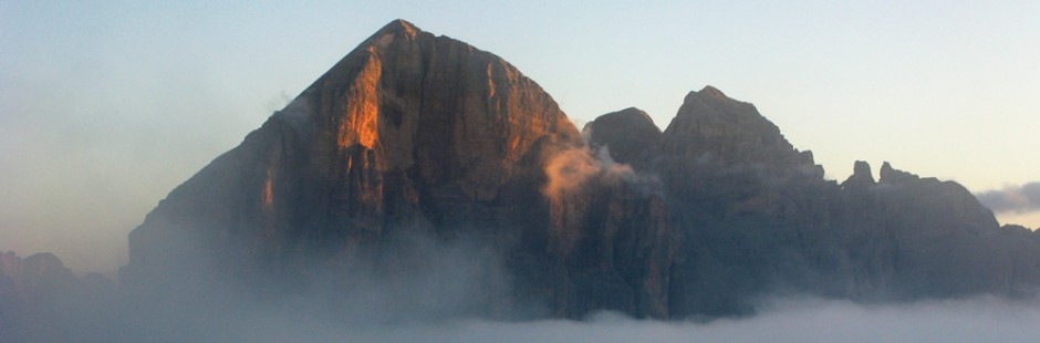
 La Val di Fanes, è una lunga e rasserenante valle, non troppo frequentata nella sua parte più alta, famosa per il suo “Regno” magico e mitologico degli elfi che popolavano le Dolomiti d’Ampezzo, percorsa dal Rio Fanes, che nella parte finale ha creato canyons e provoca cascate spettacolari – La valle è dominata dall’omonimo gruppo montuoso, da un lato, e dall’altro lato dal monte Castello che è a sua volta diviso dal gruppo delle Tofane dalla val Travenanzes, che sfocia anch’essa nella Val di Fanes – Sono possibili bellissime passeggiate ma anche vie ferrate spettacolari e non difficili.
The Val di Fanes, is a long and soothing valley, not too busy in its upper part, famous for his “Kingdom” magical and mythological elves who populated the Dolomiti d’Ampezzo, traveled by the Rio Fanes, that in the final part has created canyons and spectacular waterfalls causes – The valley is dominated by the homonymous mountain range, on the one hand, and on the other side of mount Castello which is in turn divided by the group Tofane from Travenanzes valley, which flows also in Val di Fanes – beautiful walks are possible and spectacular and not difficult climbing routes.
§ § §
Area: Fanes (1/2 giornata – bambinabile)
Percorso:
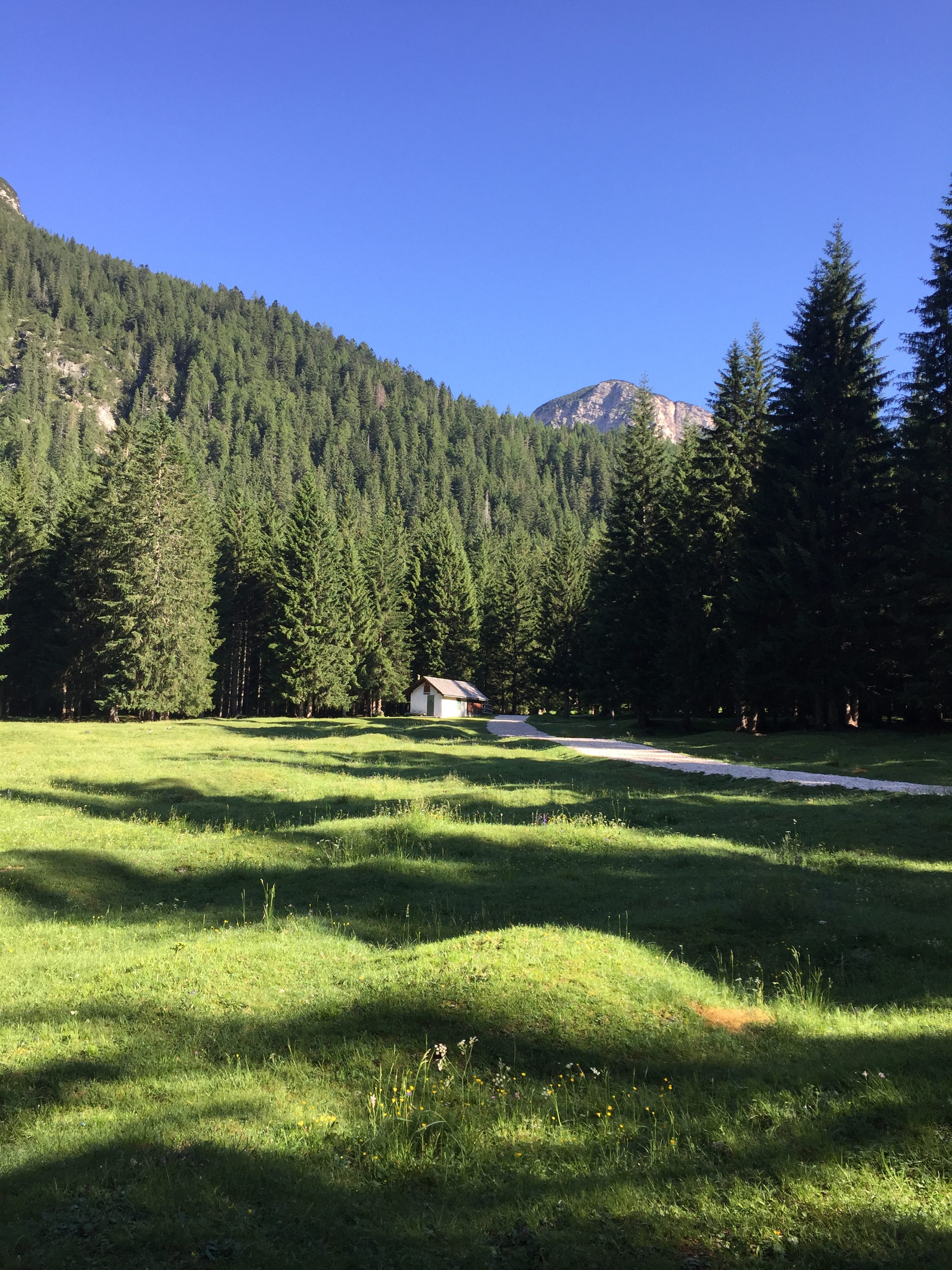
– Inizio della Val di Fanes (dal Centro visitatori), fino a Pian de Loa (sent. 401)
Valutazioni: Tranquilla passeggiatina nel bosco e sul fiume, anche per giocare con bimbi (45 min.) [effettuata 5.8.06]
Start of Val di Fanes (from the Visitor Center), up to Pian de Loa (sent. 401) – Ratings: quiet stroll in the woods and the river, even to play with kids ( 45 min . ) [performed 05/08/06] .
§ § §
Area: Fanes (intera giornata; occorre l’attrezzatura da ferrata)
Percorso:
Inizio della Val di Fanes (dal Centro visitatori; m. 1314 s.l.m.), a Pian del Loa (sent. 10/401; m. 1346 s.l.m.; dieci / quindici min.);
pian de loa
1) da Pian de Loa si percorre la carrareccia salendo alla sinistra del Rio Fanes per sent. 10/401 e si giunge a Ponte Alto (45 min.); da qui varie possibilità:
Beginning of the Val di Fanes (from the Visitor Center; m. 1314 s.l.m.), to Pian del Loa (sent. 10/401; m. 1346 s.l.m.; ten / fifteen min.); 1) from Pian de Loa go along the cart road going up to the left of Rio Fanes for sent. 10/401 and you reach Ponte Alto (45 min.); here various possibilities
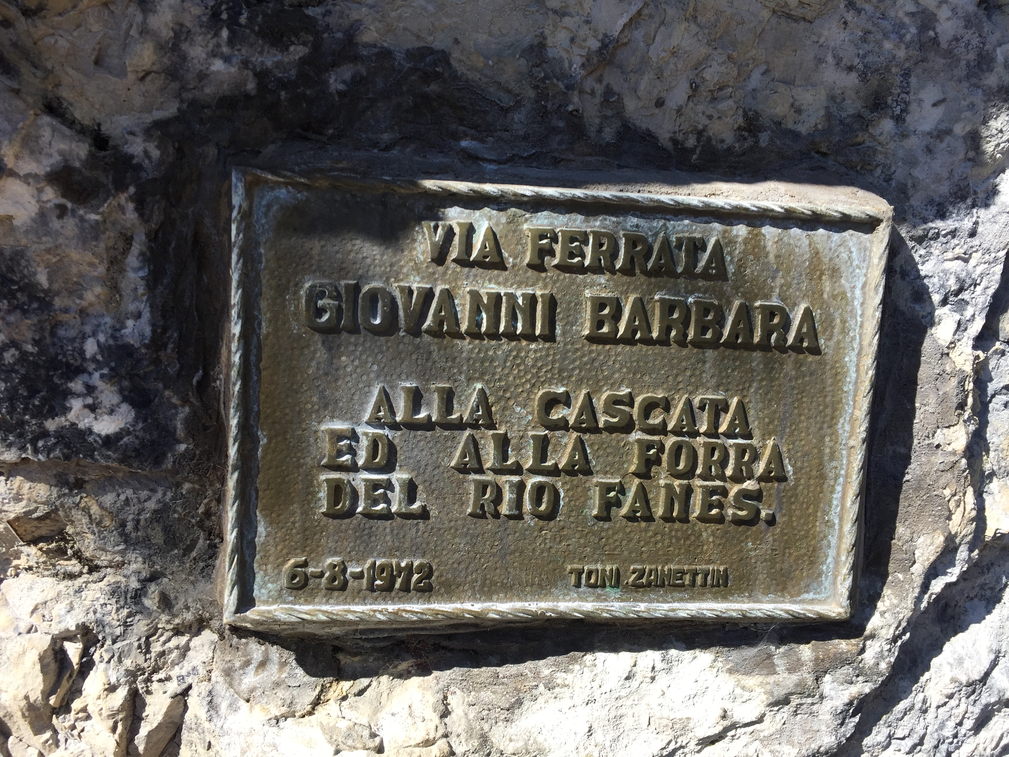

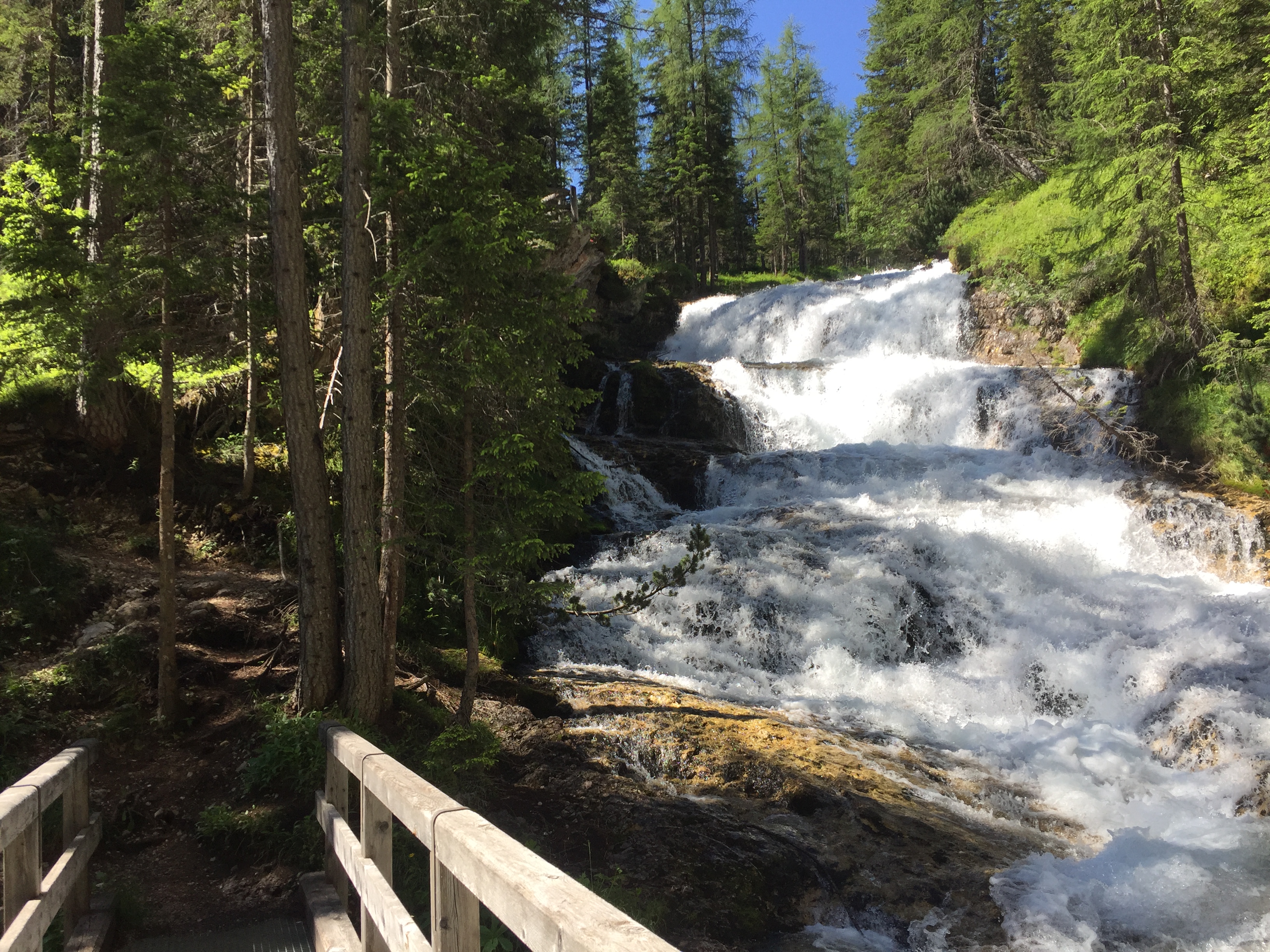
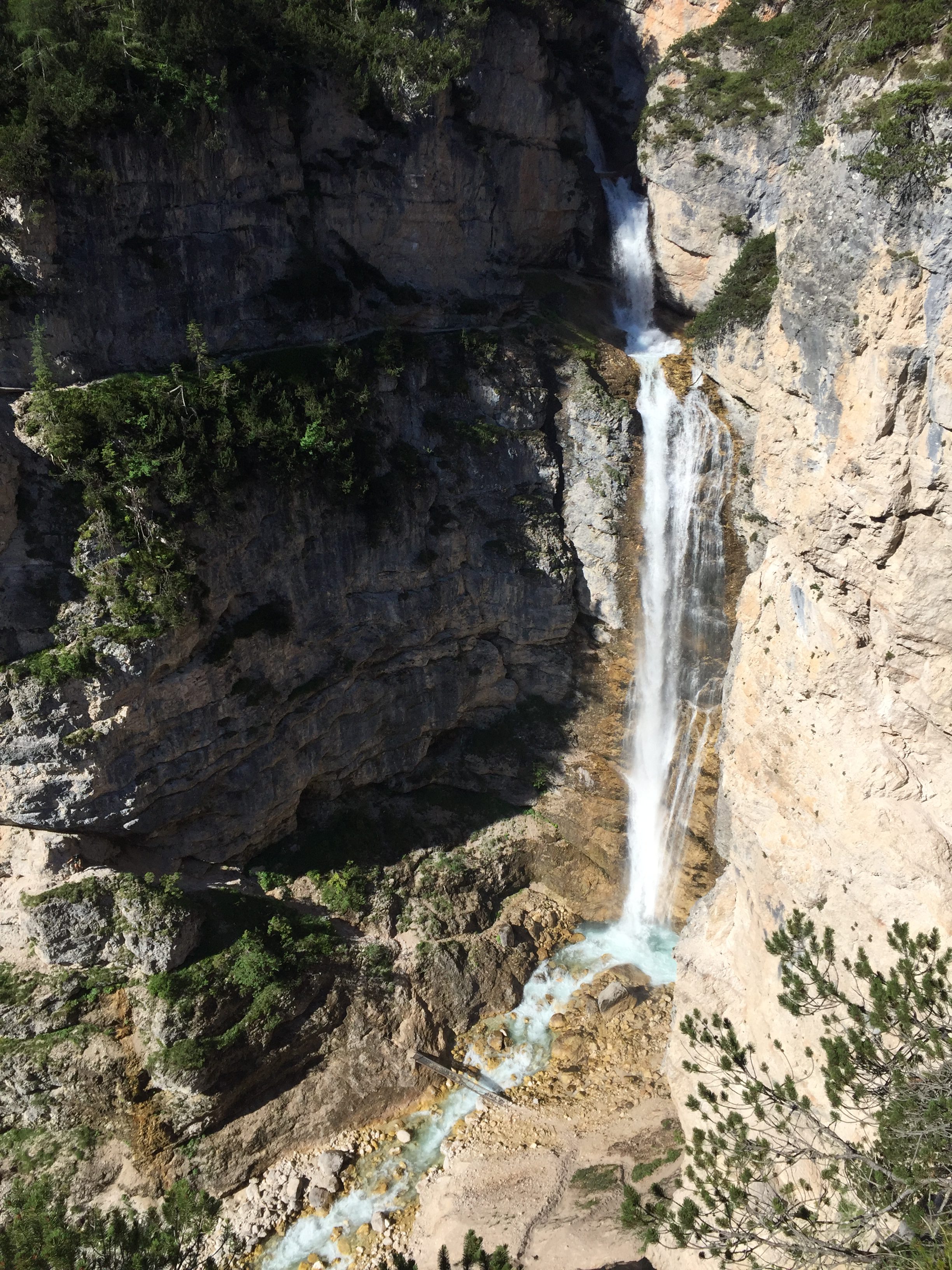
si lascia il sentiero e ci si addentra in una radura; poi con un sentiero si giunge in pochi metri alla ferrata Barbera alle “cascate di Fanes”; superato un sentierino con corda perché un po’ esposto, si passa sotto alla cascata 

(il tutto dura 5 min. e la gita può anche terminare qui; è emozionante passare sotto la grande cascata; una volta passati si può ritornare indietro per la stessa strada);
leave the path and enter a clearing; then with a path you reach in a few meters the Barbera via ferrata at the “Fanes waterfalls”; having passed a small path with a rope because it is slightly exposed, you pass under the waterfall; beautiful; 5 min.; pay attention; its possible to came back using the same path.
proseguendo oltre la cascata invece si scende fino al greto del torrente con alcuni scalini fissati alla roccia, alcune scalette ed un sentiero;
continuing beyond the waterfall, go down to the bed of the stream with some steps fixed to the rock, some steps and a path;
qui due opzioni:
i) o si prosegue il sentiero in discesa fino alla base della cascata e si attraversa il rio con un comodo ponte in ferro; a questo punto si risale la parete poco più a valle, utilizzando la ferrata Delai, ove prestare attenzione ma senza difficoltà particolari (ottima per iniziare le vie ferrate) per giungere nuovamente a Ponte Alto (1,15 h) – esposta e non bisogna soffrire di vertigini
i) either continue the downhill path to the base of the waterfall and cross the stream; at this point go up the wall a little further downstream, using the Delai ferrata (pay attention; a good way to try a via ferrata), to reach Ponte Alto again (1.15 h)

(Per l’intera gita vanno considerate complessive 2/2,5 ore; effettuata tra le altre, 18.8.03);

ii) o si sale sul versante opposto (salita molto scoscesa in un canalino, con gradoni) giungendo al “Belvedere” – si segue a questo punto il sentiero per Pian de Loa (1 h) – (Per l’intera gita vanno considerate complessive 2 ore)
a1); il percorso può essere fatto anche al contrario (si rinvia al n. 2 che segue); si necessita di panini
i) go up on the opposite side (very steep climb in a gully, with steps) reaching the “Belvedere” – follow the path for Pian de Loa (1 h) – (For the whole trip a total of 2 hours should be considered) a1); the path can also be done in reverse (refer to No. 2 below); sandwiches needed
b) Proseguendo da Ponte Alto per il sent. 10/401, e seguendo la carrareccia tenendo la destra (il sent. diviene il n. 10) si giunge (dopo 1 h; 250 m. di dislivello in salita) ad un bivio per la “cascata superiore dello Sbarco di Fanes” (m. 1758 s.l.m.)che si supera con la ferrata della Cengia Mattia che si sviluppa (per circa 30 m.) attraversando in sentiero una ulteriore cascata e, con pochi chiodi, superando una piccola parete un po’ esposta
b) Continuing from Ponte Alto for sent. 10/401, and following the cart-road keeping to the right (sent. N. 10) you reach (after 1 h; 250 m of elevation gain) at a junction for the “upper cascade of the Landing of Fanes” which pass through the Cengia Mattia ferrata which develops (for about 30 m.) crossing a further waterfall in the path and, with a few nails, passing a small wall a little exposed


– il sentiero prosegue poi in leggera salita per 10 min. accanto al torrente che viene nuovamente attraversato per tornare in pochi minuti sul sent. 10 – segue la discesa verso Ponte Alto e quindi fino a Pian de Loa (sent. 417; 1,5 h) – (Per l’intera gita vanno considerate complessive 4 ore; effettuata 23.9.06);
the path then continues slightly uphill for 10 min. next to the stream that is again crossed to return in a few minutes to the sent. 10 – follow the descent towards Ponte Alto and then up to Pian de Loa (sent. 417; 1.5 h)


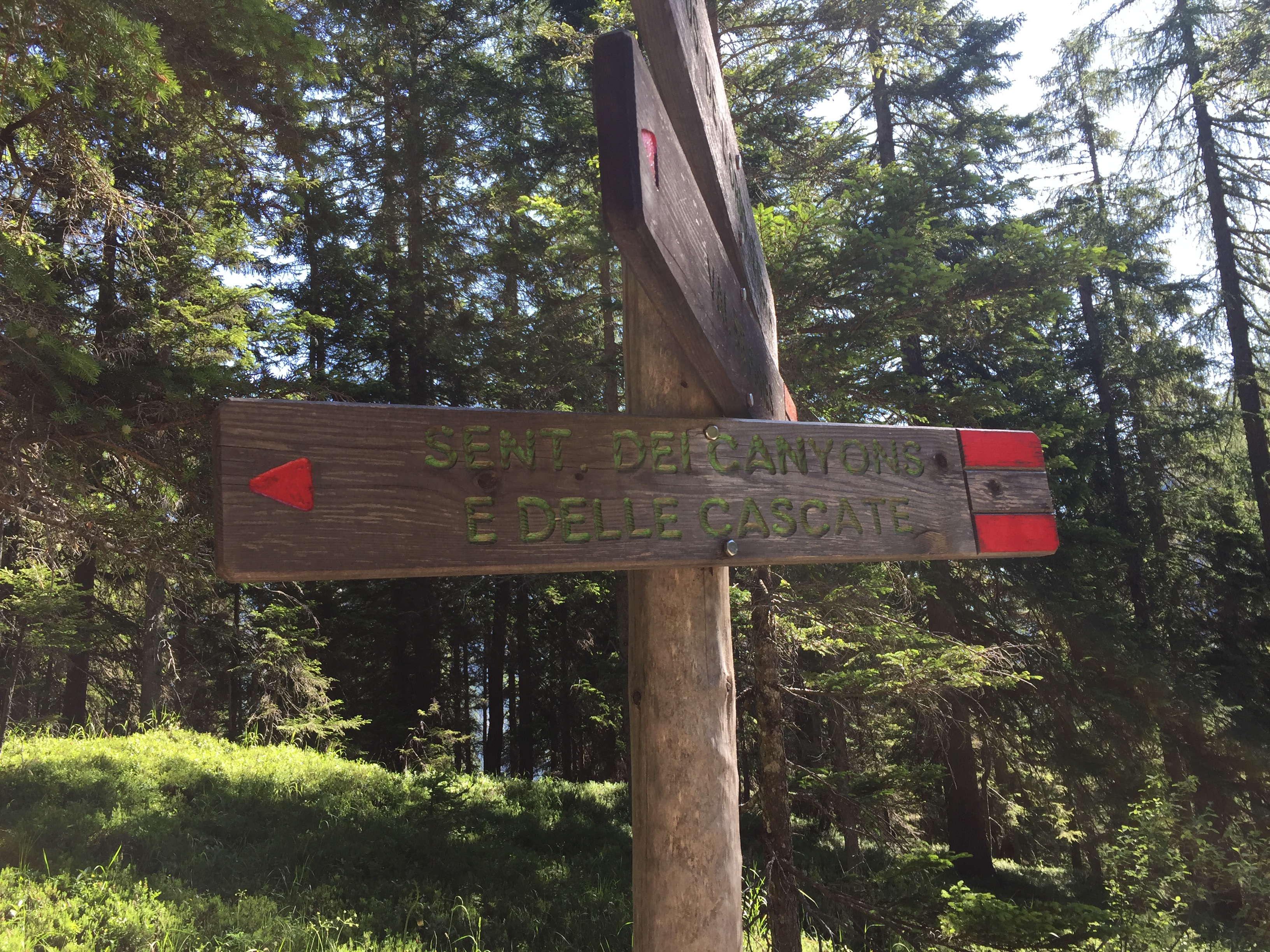
2) da Pian de Loa, anzichè seguire la strada si prende il sentiero dei Canyons e delle Cascate, che, attraverso il bosco sale verso il “Belvedere” (20/30 min.; 1.494 s.l.m.), dal lato opposto del torrente, dunque, rispetto al sentiero 10/401 che porta a Ponte Alto
– giunti al (andata e ritorno “Belvedere” si segue ancora il sentiero che scende per un canalino ripido (ci sono dei gradoni) fino al greto del Rio Fanes, alla base della cascata (effettuata fino a qui il 24.10.20 con ritorno stessa strada; 2 ore circa) – il percorso compie in salita quello descritto al punto 1, i) salendo con scalini fino alla cascata, passando sotto alla stessa, e facendo la breve ferrata Barbera (20/30 min.);
2) from Pian de Loa, instead of following the road, take the path of the Canyons and the Waterfalls, which, through the forest, goes up to the “Belvedere” (20/30 min., 1,494 m asl), on the opposite side of the stream, therefore , compared to the path 10/401 which leads to Ponte Alto – once you reach the “Belvedere”, follow the path that descends through a steep gully (there are some steps) up to the Rio Fanes riverbed, at the base of the waterfall – the path goes uphill to the one described in point 1, i) going up steps up to the waterfall, passing under it, and making the short ferrata Barbera (20/30 min.);
 quindi bisogna lasciare il sentiero 10 salendo nel bosco per sentiero non numerato, ma ben indicato. Dopo un tratto in salita si attraversa nuovamente il fiume ed il sentiero prosegue nel canyon, salendo sempre sullo stesso lato del torrente, superando dislivello anche grazie a comodi gradoni in ferro, a tratti ripidi ma molto spettacolari per la presenza di molte cascate – il sentiero poi diviene meno ripido, attraversa il torrente e, salendo nel bosco giunge al bivio (dopo circa 1,5 h) per la “cascata superiore allo sbarco di Fanes”. Da qui la gita diviene come quella sopra descritta alla lett. ii)
therefore you have to leave the path 10 going up into the woods along the path not numbered, but well indicated. After an uphill stretch, cross the river again and the path continues into the canyon, always climbing on the same side of the stream, overcoming the difference also thanks to comfortable iron steps, sometimes steep but very spectacular due to the presence of many waterfalls – the path then it becomes less steep, crosses the stream and, going up into the woods, reaches the crossroads (after about 1.5 hours) for the “upper waterfall to the landing of Fanes”. From here the trip becomes like the one described above at 1, lett. b)
(Per l’intera gita vanno considerate complessive 4/5 ore; effettuata il 28.8.11 e il 6.7.19; solo prima parte il 24.10.20).
 Valutazioni: Belle passeggiate nel bosco, sulle cascate e nei canyons relativi – Le ferrate sono buone per iniziare: molto suggestive sotto e sopra le cascate, con attraversamento del Rio Fanes in più punti e possibile “doccia”– Adatte a tutti, pur tenendo presente che un paio di passaggi, specie nella Delai e nella Cengia Mattia, necessitano di un minimo di tecnica e non bisogna soffrire di vertigini – Necessaria attrezzatura – Soddisfazione e una buona dose di fatica per il giro completo.
Ratings: Beautiful walks in the woods, waterfalls and canyons related – The railways are good to start: very suggestive below and above the falls, with crossing the Rio Fanes in several places and can ” shower ” – Suitable for all, while taking into account that a couple of steps, especially in Ferrata Delai e Cengia Mattia, require a minimum of technical and should not suffer from vertigo – Necessary equipment – Approval and a good deal of effort for the full tour


§ § §
Area: Fanes – Passo Posporcora (intera giornata – per tutti – gita di circa quattro ore)
Percorso:
– Inizio della Val di Fanes (dal Centro visitatori), a Pian del Loa (sent. 10/401);
– da Pian de Loa si percorrere la carrareccia salendo alla sinistra del Rio Fanes per sent. 10/401 e si giunge a Ponte Alto (45 min.);
– da qui, volendo, la gita prosegue con quella indicata con la lett. a) della gita precedente;
– da Ponte Alto si prosegue per il sent. 10/401; poco dopo (5 min.) si giunge ad un bivio; si prende il sent. 401 a sin.;
– quindi (15 min.), al successivo bivio, si prende a sin. il sent. 408 per il Passo Posporcora con salita nei boschi (300 m. di dislivello da Ponte Alto)
– superato il Passo, alla cui sinistra c’è il Col Rosà, si segue ancora il sentiero 408 fino al Boite e, prendendo il sent. 417 si giunge in piano al Camping Olimpia.
Valutazioni: Bella passeggiata nel bosco, poco frequentata nella seconda te – Va notato che la partenza è diversa dall’arrivo (pur se di pochi chilometri) [effettuata 14.8.84]
Area: Fanes – Passo Posporcora (full day – for all – day trip of about four hours) path: – Start of Val di Fanes ( from the Visitor Center ) , at Pian del Loa (sent. 10/401 ) ; – From Pian de Loa will take the dirt track going up to the left of the Rio Fanes to sent. 10/401 and you get to Ponte Alto (45 min); – Hence , if desired, the trip continues with that indicated by the letter a) the previous outing; – From Ponte Alto, continue to the felt n. 10/401; shortly after ( 5 min . ) you arrive to a junction; you take the felt n. 401 to the left; – Then (15 min), at the next junction, turn right the felt n. 408 for Passo Posporcora with climb in the woods (300 m in altitude from Ponte Alto) – Exceeded the spending to which the left is the Col Rosà , you follow the path up to 408 Boite and taking the felt n. 417 is reached in plan at Camping Olympia. Ratings: Nice walk in the woods, little-used in the second part – It should be noted that the departure is different from the arrival ( although a few kilometers ) [ performed 08/14/84]
§ § §
Area: Fanes – Val di Fanes – Via della Pace – Val Travenanzes (intera giornata – gita di circa nove ore; occorre l’attrezzatura da ferrata)
Percorso:
– Inizio della Val di Fanes (dal Centro visitatori), a Pian del Loa (sent. 10/401);
 – da Pian de Loa si percorrere la carrareccia salendo alla sinistra del Rio Fanes per sent. 10/401 e si giunge a Ponte Alto (45 min.);
– da Ponte Alto si prosegue per il sent. 10/401; poco dopo (5 min.), superato il bivio si tiene la destra e si prosegue per la carrareccia con il sent. 10 della Val di Fanes
– si sale nella magica valle superando il lago di Fanes fino al bivio per la Malga Grande di Fanes (da Ponte Alto si è nel frattempo saliti di circa 700 m. di dislivello);
")
– dalla Malga si sale (sent. 10 e poi 17) verso la Via della Pace che sale nell’anfiteatro della Furcia Rossa;
")
")
prosegue in cresta –come sentiero attrezzato
– tra baraccamenti fino al Monte Castello ed al Bivacco della Pace (saliti di altri 600 m. di dislivello);
")

– si attraversa poi la vicina forcella Ciase e per il ripido ghiaione (il sent. è sempre il 17) si scende (700 m. di dislivello) in Val Travenanzes sul sent. 401 poco più a monte della Malga Travenanzes;
– il sent. 401 va quindi seguito per tutta la val Travenanzes – verso Ponte Alto fino a Pian de Loa.
Valutazioni una gita tanto magnifica quanto lunga e impegnativa fisicamente – ha in realtà tutto: il panorama e l’ambiente poiché la Val di Fanes e la Val Travenanzes sono tra le più belle valli dell’area; il dislivello; il ghiaione; la parte attrezzata della via della pace (per questo serve preparazione fisica, attrezzatura, la conoscenza di saper affrontare con una certa disinvoltura un ghiaione) [effettuata il 19.8.85].
(full day – trip of about nine hours – set da ferrata) path: – Start of Val di Fanes (from the Visitor Center), at Pian del Loa (sent. 10/401 ); from Pian de Loa will take the dirt track going up to the left of the Rio Fanes to sent. 10/401 and you get to Ponte Alto (45 min); – continue to the felt n. 10/401; shortly after (5 min), after the fork , keep right and continue along the dirt track with path . 10 Val di Fanes – You go up in the magical valley past the Lake Fanes to the junction for Malga Fanes Grande (from Ponte Alto has meanwhile risen to about 700 m . in altitude) ; from Malga climb (sent. 10 and then 17 ) to the Way of Peace that rises in the amphitheater of the Red Furcia proceeds on the crest -like equipped path – From barracks to Monte Castello and the bivouac of Peace (rose by another 600 m. in altitude); – Then you cross the nearby fork Ciase and the steep scree (path n. is always 17 ) descend (700 m. Altitude) in the Val Travenanzes sent. 401 little further upstream of Malga Travenanzes the felt . 401 must be followed throughout the Travenanzes valley – towards Ponte Alto to Pian de Loa – Ratings: a trip so magnificent as long and demanding physically – actually has it all: the landscape and the environment as the Val di Fanes and Val Travenanzes are among the most beautiful valleys in the area; the difference in height ; scree ; the equipped the way of peace ( this requires physical preparation, equipment, knowledge of knowing how to deal with a certain ease a scree ) [performed on 19.08.85]