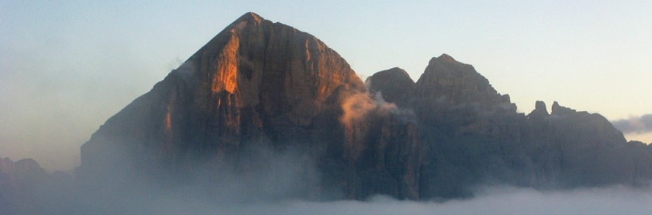
 Crans Montana, famosa località sciistica, anche in estate presenta delle belle passeggiate, tutte tranquille e per tutti. La particolarità sono le bisse, canalini artificiali con cui gli antichi abitanti del vallese portavano l’acqua dalla montagna alla valle, realizzandole anche in punti esposti, prolungandoli per chilometri.

Ai piedi di Crans Montana c’è Sion, capoluogo del Vallese e carina cittadina, collegata alla parte più occidentale del Paese da una autostrada che porta a Martigny (e prosegue poi per Ginevra) e che consente di salire al Passo del San Bernardo.
La zona di Verbi er, valle che si diparte da Martigny verso l’Italia, è altrettanto amena e piacevole, ed è caratterizzata da alcuni paesini walser, antica popolazione divisa tra Svizzera ed Italia su quelle alte e belle montagne.
Crans Montana , the famous ski resort , even in summer has some lovely walks , all quiet and for all . The special feature is the Bisse , artificial grooves with which the ancient inhabitants of the Valais brought water from the mountain to the valley , realizing them in places exposed , prolungandoli for chilometri
Near (under) Crans Montana is Sion, capital of the Valais and pretty town , connected the westernmost part of the country by a highway leading to Martigny ( and continues to Geneva ) and that allows you to go up to the St. Bernard.
Verbier is in a valley that branches off from Martigny to Italy , is just as pleasant and enjoyable , and is characterized by some Walser villages , ancient population divided between Switzerland and Italy on the highest and most beautiful mountains
§ § §
Area: Montana: Bisse du Tsittoret cioè le “chemin de transumance” [intera giornata – per tutti – quattro ore di cammino].
Percorso:
-si giunge in auto a Cave de la Colombiere; 
-da qui sempre seguendo la Bisse che affianca il sent. n. 4 e poi il sent. n. 8, si sale fino a Tiche (dislivello da m. 1.835 s.l.m. a m. 1.971 s.l.m.);
")

-si giunge su un altipiano, con un grande prato attraversato da un torrente;
-si prosegue quindi verso la Montagne du plan, fino alla base della grande cascata (si sale fino a m. 2.196 s.l.m.);
-il ritorno è per lo stesso sentiero.
Valutazioni: Gita bella e non particolarmente faticosa, con un bel ristoro sotto la cascata. La Bisse è dolce e rasserenante; panorama bellissimo sulle Alpi[effettuata 12.8.09].
is reached by car in Cave de la Colombiere ; -from here again following the Bisse that supports the felt . n . 4 and then sent. n . 8 , you climb up to Tyche (difference from m . Above sea level to 1,835 m . Above sea level 1971 ) ; -it comes on a plateau , with a large lawn crossed by a stream ; -you then continues towards the Montagne du plan , up to the base of the large waterfall ( you climb up to m . 2196 above sea level) ; -the return is along the same path . Ratings: beautiful and not particularly strenuous , with a nice refreshment under the waterfall . The Bisse is sweet and soothing ; beautiful panorama of the Alps [ carried 12/08/09 ]
° ° °
Area: Montana: Bisse du Roh e le beverage de Tseuzier [intera giornata – sei ore di cammino].
Percorso:
-si giunge a Plan Moyen e qui comincia la passeggiata, prendendo subito la bisse;
-la bisse (cioè il sent. n. 3) prosegue piuttosto esposta, sul costone della montagna, ed è caratterizzata da ponticelli e corde;
-la parte della bisse termina dopo circa 1,30 h, e permette di giungere su un sentiero più comodo, in parte anche carrabile, che sale tra pascoli e mucche;
-si raggiunge una diga panoramica, con un grande lago artificiale (2 h);
-il ritorno è sul medesimo sentiero (2 h, dal lago alla bisse; 1,5 h per rifare la bisse)
 Valutazioni: Gita bellissima nella prima parte ove non bisogna soffrire di vertigini; meno bella la seconda parte. Visto anche un picchio … [effettuata 13.8.09].
you reach Plan Moyen and here begins the walk , taking immediately Bisse ; -the Bisse ( ie sent. n . 3 ) goes on quite exposed , on the ridge of the mountain , and is characterized by small bridges and ropes ; -the part of the Bisse ends after about 1.30 h , and would not lead to a more comfortable path , partly driveway , flanked pastures and cows ; -you reaches a dam panoramic , with a large artificial lake ( 2 h -the return is on the same path ( 2 h , from the lake to the Bisse ; 1.5 h to redo the Bisse ) Ratings: beautiful in the first part where we must not suffer from vertigo ; less beautiful the second part . Also saw a woodpecker … [ carried 13/08/09 ]
§ § §
Area: Verbier: Ghiacciao di Arolla [da Crans tre ore di automobile – due ore di cammino].
Percorso:
-si parte da Crans, si supera Sion e si percorre la Val d’Herens, fino ad Hevolene, paese walser;
-si passano anche i “pinnacoli di terra”; 
 -si giunge così ad Arolla e si prende una carrareccia verso il ghiacciaio, dove si arriva dopo circa un’ora di cammino non faticoso.
-il ritorno è sul medesimo sentiero.
Valutazioni: il tragitto in macchina consente di passare per il bel paese walser, caratteristico di quella antica popolazione, e di vedere alcuni pinnacoli di terra, altissimi, caratteristici per una grande sasso sul loro apice, frutto di corrosione dell’acqua e del vento, anch’essi altrettanto particolari – la passeggiata sui limiti del ghiacciaio (a parte una pericolosa divagazione sui seracchi) è piacevole ed avventurosa, con una imponenza montana impressionante [effettuata 18.8.09].
-it starts from Crans , past Sion and take the Val d’ Herens , until Hevolene , country Walser ; -you also pass the ” pinnacles of the earth” ; -you thus comes to Arolla and you take a track towards the glacier , where you arrive after about an hour’s walk is not strenuous. -the return is on the same path . Ratings: ride the car allows you to switch to the beautiful country Walser , characteristic of the ancient population , and to see some pinnacles of land , high , characteristic for a big stone on their peak , the result of corrosion of water and wind , also equally special – the walk on the limits of the glacier (apart from a dangerous digression on seracs ) is enjoyable and adventurous , with an impressive mountain grandeur [ carried 18/08/09 ]
° ° °
Area: Martigny: Gole del Trient [mezz’ora di cammino]
Percorso:
-dopo Sion e Matigny, poco prima della bella Abbazia di St. Maurice, sulla sinistra della strada si può parcheggiare per accedere alle gole, dove un percorso attrezzato con ponticelli e parapetti, consente di godere un bello spettacolo naturale [effettuata 19.8.09]
after Sion and Matigny , just before the beautiful Abbey of St. Maurice , on the left of the road you can park to access the gorge , where a trail equipped with bridges and rails , allowing you to enjoy a good show natural [ carried 08/19/09]